(BIVN) – Kīlauea is not erupting, and the USGS Volcano Alert Level remains at ADVISORY.
No changes have been detected at the Kīlauea summit, lower East Rift Zone, or Southwest Rift Zone. Weak steaming continues to be occasionally visible on the inactive lava flow field within Nāpau Crater on the middle East Rift Zone, where the most recent eruption occurred from September 15th to September 20th.
Scientists with the USGS Hawaiian Volcano Observatory reported shallow earthquake counts were slightly elevated in the middle and upper East Rift Zone. 67 earthquakes were recorded over the past day. Data continue to show that magma is moving at a low rate from the summit to the middle East Rift Zone, which means “future intrusive episodes and eruptions could occur” in the area.
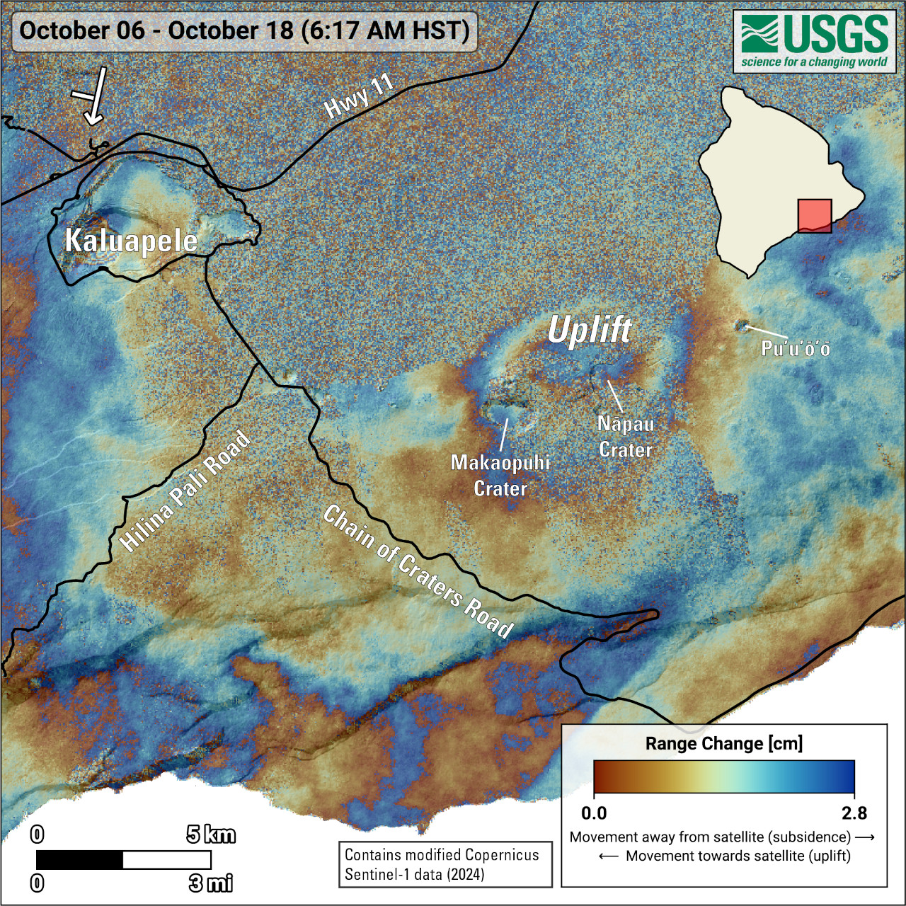
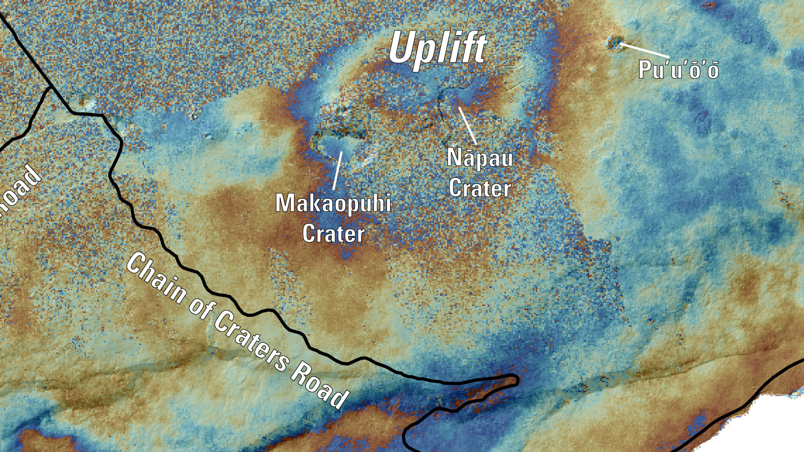
The USGS HVO on Wednesday released a new map, produced using data acquired by the European Space Agency’s Sentinel-1 satellites. The map shows deformation at Kīlauea over the timeframe of October 6th to 18th.

USGS: “Colored fringes denote areas of ground deformation, with more fringes indicating more deformation. Each color cycle represents 2.8 cm (1.1 in) of ground motion. The symbol in the upper left indicates the satellite’s orbit direction (arrow) and look direction (bar). The round feature north of Nāpau and Makaopuhi Craters on the middle East Rift Zone indicates ground surface inflation over this time period as magma accumulates underground near the recent September 15–20, 2024, eruption site. Fringes at Kaluapele are due to new topography created by past lava flows, that has not yet been incorporated into our digital elevation model (DEM).”
From the Wednesday, October 23 update from the USGS HVO:
Rift Zone Observations: The middle East Rift Zone (MERZ) eruption near Nāpau Crater stopped around 10 a.m. HST on the morning of September 20. Only occasional weak steaming from the eruption site has been seen in webcam imagery since that time. No SO2 from the eruption site was detected on September 23 during measurements on Chain of Craters Road, indicating that the MERZ SO2 emissions are negligible.
Shallow earthquake counts were slightly elevated over the past day with 67 earthquakes in the middle and upper East Rift Zone, and no tremor being recorded on seismometers near the recent eruption site. Tiltmeters in the MERZ show modest deflation and GPS instruments show low rates of deformation.
All recent activity was confined to the MERZ between Makaopuhi Crater and Puʻuʻōʻō and there are no indications of any changes downrift in the lower East Rift Zone.
Analysis: Kīlauea erupted briefly in and near Nāpau Crater from September 15–20, 2024. Lava flows from this eruption covered more than 880,000 square meters (217 acres) of Nāpau Crater and areas to the west. A webpage with eruption-related resources is available (here) and a summary of the eruption is available in this “Volcano Watch” article.
While the middle East Rift Zone eruption has ended, unrest continues at low levels in this region of Kīlauea. Rates of seismicity and ground deformation have greatly decreased since the eruption, but data shows that magma is continuing to move at a low rate from the summit to the middle East Rift Zone. Future intrusive episodes and eruptions could occur with continued magma supply.


by Big Island Video News6:21 pm
on at
STORY SUMMARY
HAWAIʻI VOLCANOES NATIONAL PARK - Shallow earthquake counts were slightly elevated over the past day in the middle and upper East Rift Zone, scientists report.