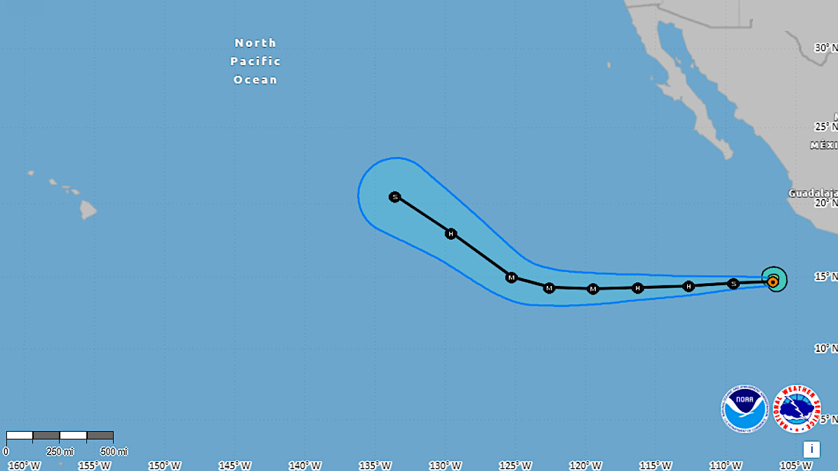
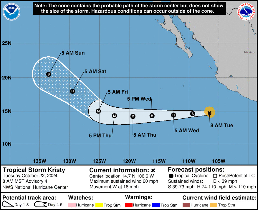
(BIVN) – There is a new tropical storm in the Eastern Pacific that is expected to strengthen into a hurricane, serving as a reminder that the hurricane season in the Pacific continues until November 30th.
Tropical Storm Kristy is not expected to have an impact on the Hawaiian islands. The storm is currently 470 miles west-southwest of Acapulco, Mexico and moving west at 16 mph.
Forecasters say Kristy could rapidly intensify, and the storm is expected to become a major hurricane in the coming days. The forecast track shows Kristy will veer to the northwest, and weaken, before reaching the Central Pacific.
Here is the discussion on Kristy from the National Hurricane Center on Tuesday morning:
Kristy still appears to be on an intensification trend this morning. The storm’s structure on satellite imagery is quite well organized, with a large curved band on its western side, and a smaller central dense overcast that suggests a formative inner core may be developing. There has not been much passive microwave imagery for a more in-depth look at the convective structure since the prior advisory, but based on a blend of the subjective Dvorak intensity estimates (T3.0/45 kt from TAFB and T3.5/55 kt from SAB), the initial intensity is being increased to 50 kt for this advisory.
The tropical storm is moving a little north of due west this morning, with the motion estimated at 280/15 kt. A well-established subtropical mid-level ridge should continue to steer the tropical cyclone westward, with some of the guidance even showing a little farther south of due west over the next 48-60 h. By this weekend, the ridge becomes eroded towards its western edge by a mid- to upper-level trough that should allow Kristy to begin gaining latitude on Friday into the weekend. The track forecast this cycle is nearly on top of the previous NHC track forecast for the first 48 h, and is a little to the south and west thereafter, blending the consensus aids TCVE and HCCA with the prior track at the end of the forecast period.
As alluded to in previous discussions, the environment appears quite favorable for intensification, with low shear, warm sea-surface temperatures, and a moist surrounding environment. In fact, rapid intensification is becoming a distinct possibility as the storm forms an inner core. Indeed, the latest ECMWF-SHIPS guidance is giving Kristy a 43 percent chance of a 45-kt increase in intensity over the next 36 h. The latest NHC intensity forecast thus was increased over the next couple of days, and now peaks Kristy as a 110 kt category 3 hurricane in 60-72 h. It is worth noting that the hurricane-regional model guidance mean is still a little above that peak intensity. After 72 h, the same upper-level trough eroding the subtropical ridge should also contribute to a rapid increase in southwesterly vertical wind shear over Kristy as it also moves over increasingly cool ocean waters. Thus, a fast rate of weakening is likely to begin by this weekend, in good agreement with the IVCN and HCCA consensus aids.


by Big Island Video News7:13 am
on at
STORY SUMMARY
HONOLULU - Tropical Storm Kristy is expected to intensify into a major hurricane as it moves west, far to the east of Hawaiʻi.