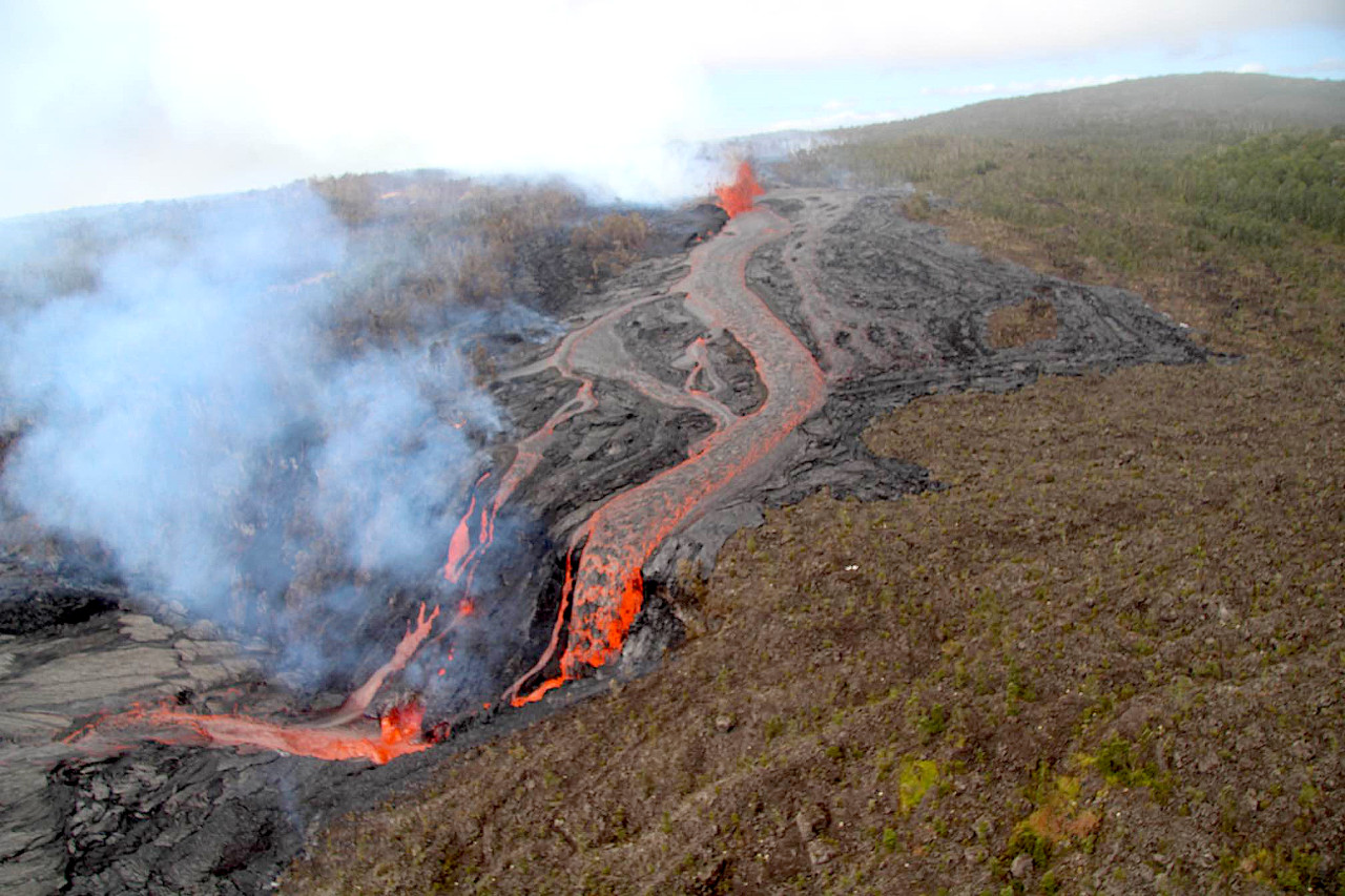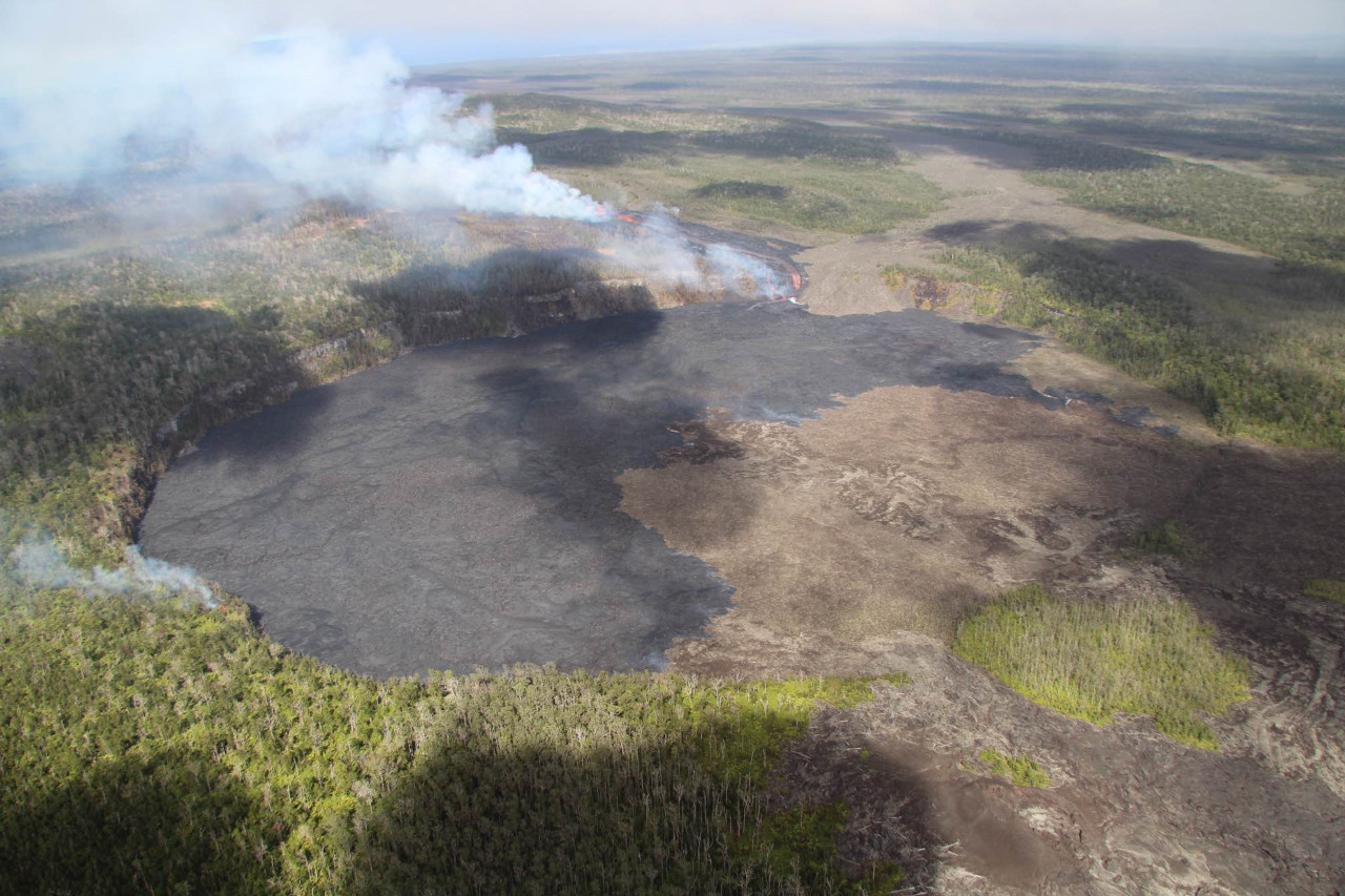
USGS: “USGS Hawaiian Volcano Observatory geologists conducted a reconnaissance overflight of the eruption near Nāpau Crater on the middle East Rift Zone of Kīlauea. They observed lava cascading over the rim of the crater from a channel more than 50 meters (about 164 feet) wide. Lava is contained within Nāpau Crater and now covers about two thirds of the crater floor.” (USGS photo by M. Zoeller)
(BIVN) – Kīlauea continues to erupt on the middle East Rift Zone within a remote area of Hawaiʻi Volcanoes National Park, and the latest phase of the event is the most voluminous of the eruption to date.
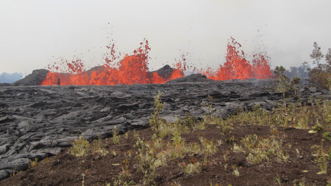
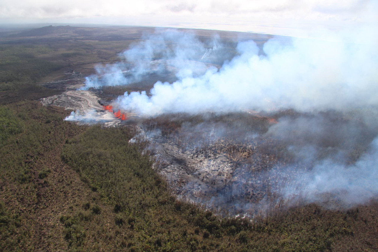
This fourth phase began at around 3:15 p.m. on Wednesday afternoon, when a new fissure vent opened just west of Nāpau Crater, sending cascades of lava pouring over the western cliffs and rapidly covering the crater floor.
As of the most recent information from the USGS Hawaiian Volcano observatory around noon on Thursday, new lava now covers about two thirds of the crater floor.
The USGS Volcano Alert Level remains at WATCH. Officials say there is no immediate threat to life or infrastructure, although “residents of nearby subdivisions may experience volcanic gas emissions related to this activity which may increase and decrease over the coming hours and days,” the USGS HVO said.
From the Thursday activity update from the USGS HVO:
Summit Observations: Only 1 small, shallow earthquake was detected beneath the Kīlauea summit region over the past 24 hours. The summit tiltmeter at Sandhill continues to record strong deflation, while weaker deflation is being recorded by the tiltmeter at Uēkahuna. This pattern indicates that the summit magma body continues to supply magma to the middle East Rift Zone. The most recent measurement of SO2 emission rate at the summit was 60 tonnes per day on September 17, 2024.

USGS: “New lava from fissure eruptions over the past several days now covers about two thirds of the crater floor.” (USGS photo by M. Zoeller)
Rift Zone Observations: The eruptive fissure west of Nāpau Crater remained active overnight and continues to feed lava cascades into the crater that have covered approximately 250,000 square meters (300,000 square yards) or a third of the crater floor since the new eruption began yesterday afternoon. The rate of coverage indicates lava is erupting at roughly 5-15 cubic meters per second (6-16 cubic yards). At the time of this notice, fountaining remained strong as observed on the S2cam (see link below). In total, approximately two thirds of Nāpau Crater floor (500,000 square meters or about 125 acres) has been covered during this eruption since Sunday night.
Shallow earthquakes remain very low in the MERZ with about 20 in the past 24 hours. Most of these were to the west and northwest of Nāpau Crater. Tremor remains strong on the MERZ seismometers close to the eruption site and increased significantly with the onset of the new vent yesterday.
Tiltmeters in the MERZ continue to show no significant changes. Recent position solutions from GPS instruments have shown displacements of over 20 cm (8 inches) for several stations in the MERZ. The largest displacement is for station MKAI, just downslope of Makaopuhi Crater, which has experienced 54 cm (1.8 feet) of south-southwest motion since September 14. The combination of large GPS displacements and modest tilt rates suggests that much of the deformation is the result of magma entering a storage region several kilometers (1-2 miles) below the surface.
Sulfur Dioxide (SO2) emission rates measured yesterday, September 18, were 10,000 tonnes per day for the new vent that opened in the afternoon.
All activity is currently confined to the middle East Rift Zone between Makaopuhi Crater and Puʻuʻōʻō and there are no indications of any changes further downrift in the MERZ or in the LERZ.
Analysis: The ongoing MERZ eruption is currently in its fourth phase of vent opening and lava production. Each eruption has increased in volume with the current eruption being the largest to date. Multi-day fissure eruptions are not unusual and current eruptive activity appears to be linked to supply of magma from the summit.
Chain of Craters Road in Hawaiʻi Volcanoes National Park remains open. Maunaulu Trail and parking area, Nāpau Trail and Nāulu Trail remain closed. Escape road is open from Highway 11 to the Maunaulu access road closure.


by Big Island Video News1:05 pm
on at
STORY SUMMARY
HAWAIʻI VOLCANOES NATIONAL PARK - Lava has covered about a two thirds of the Nāpau crater floor since the latest phase of the new eruption began Wednesday afternoon.