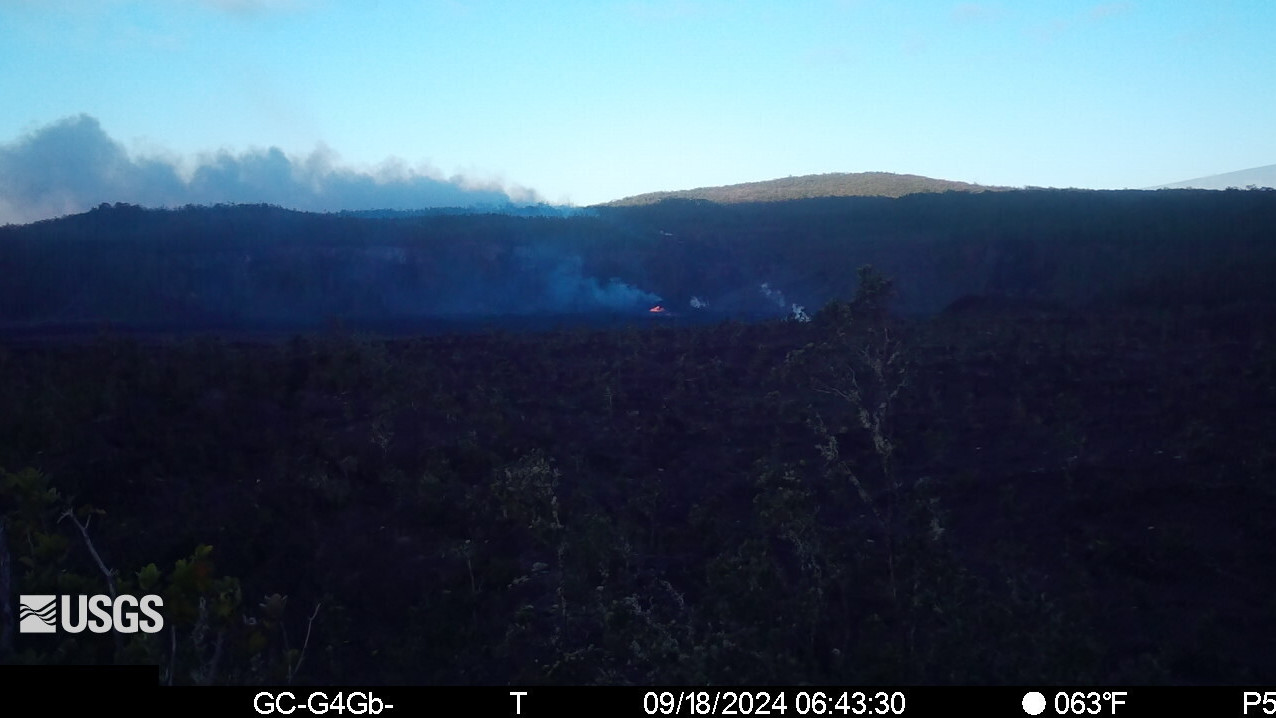
The eruption continues, and can be seen in this new USGS webcam showing a view of Nāpau Crater on the East Rift Zone of Kīlauea.
(BIVN) – The eruption of Kīlauea volcano on the middle East Rift Zone continued Wednesday morning.
The USGS Volcano Alert Level remains at WATCH. As of the most recent updated posted by the USGS Hawaiian Volcano Observatory, no changes have been detected in the lower East Rift Zone or Southwest Rift Zone.
The eruption is occurring within a closed and remote area of Hawaiʻi Volcanoes National Park. There is no immediate threat to life or infrastructure.
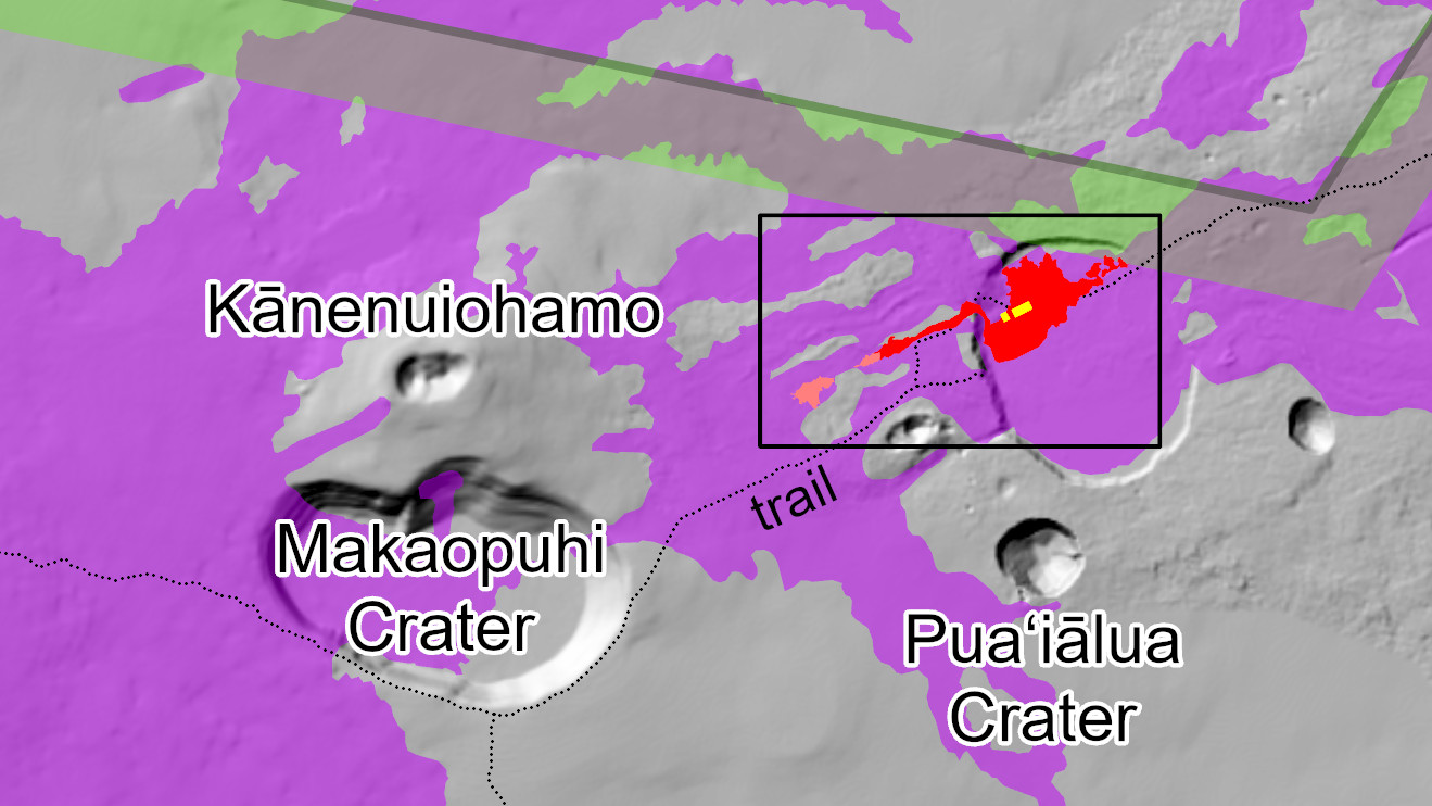
On Tuesday evening, the USGS published a new map showing the location of the activity on the middle East Rift Zone.
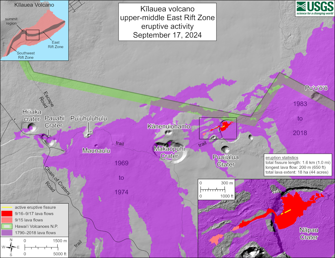
USGS: “This reference map depicts fissures and lava flows from the Kīlauea middle East Rift Zone eruption on Tuesday, September 17, 2024. The presented data are current as of the final Hawaiian Volcano Observatory helicopter overflight of the day, which occurred at approximately 10:30 a.m. Areas in bright red represent new lava flows from the evening of September 16 and morning of September 17, when activity was focused on the floor of Nāpau Crater. In total, the fissure system has stretched over 1.6 kilometers (1.0 miles) of the East Rift Zone, with lava flows now covering 18 hectares (44 acres).”
Chain of Craters Road remains closed in Hawaiʻi Volcanoes National Park. Escape Road is also closed south of Nāhuku lava tube.

by Big Island Video News
on at
STORY SUMMARY
HAWAIʻI VOLCANOES NATIONAL PARK - Lava continued to erupt at Nāpau Crater on the middle East Rift Zone overnight and into Wednesday morning.