(BIVN) – The heavy rainfall produced by passing Hurricane Hone at the end of August improved drought conditions across Hawaiʻi island.
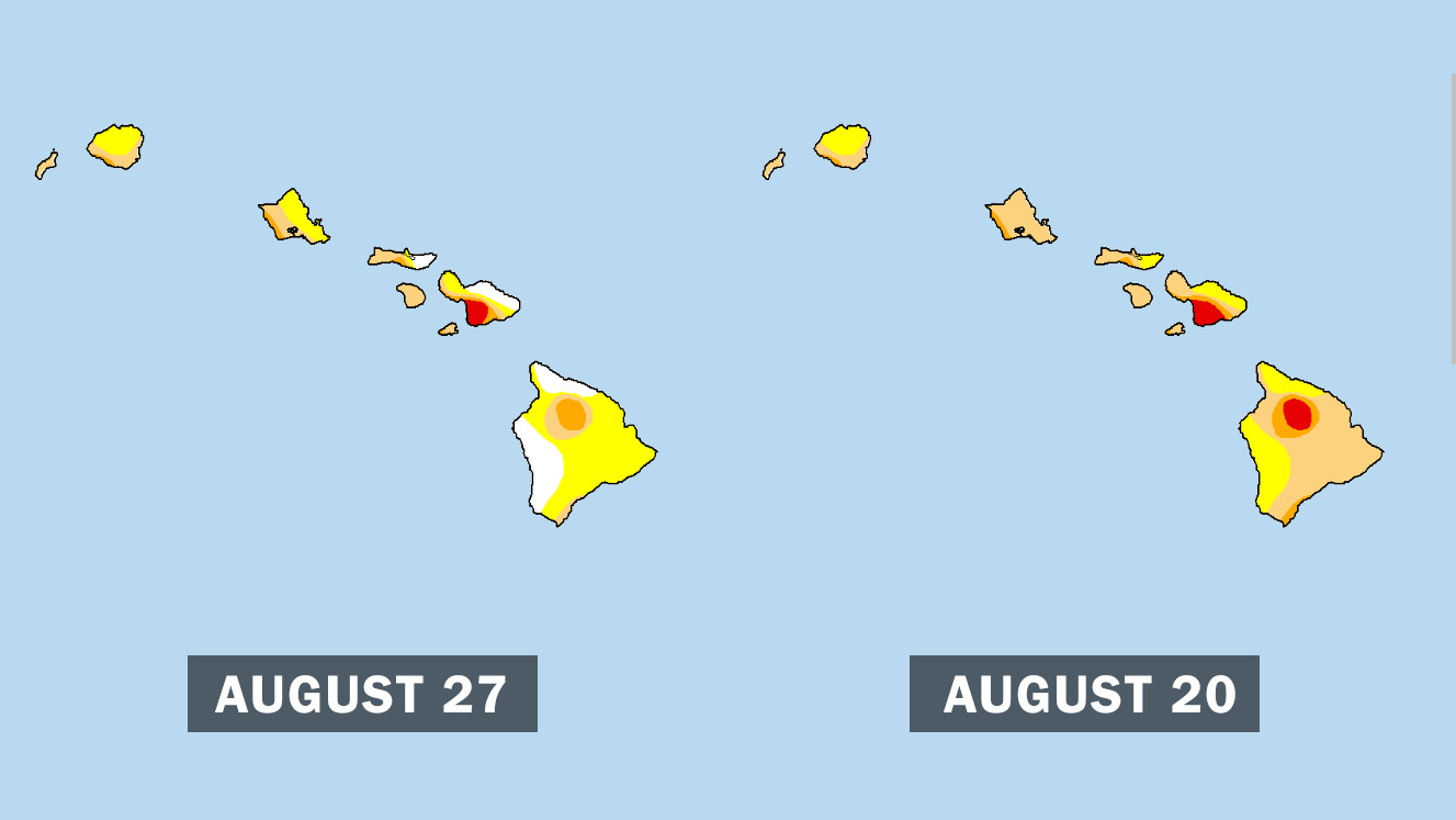
The Big Island was experiencing widespread D1 Moderate Drought and D0 Abnormally Dry conditions, as well as a patch of D3 Extreme Drought, before Hurricane Hone skirted the island within 50 miles of South Point on August 25th.
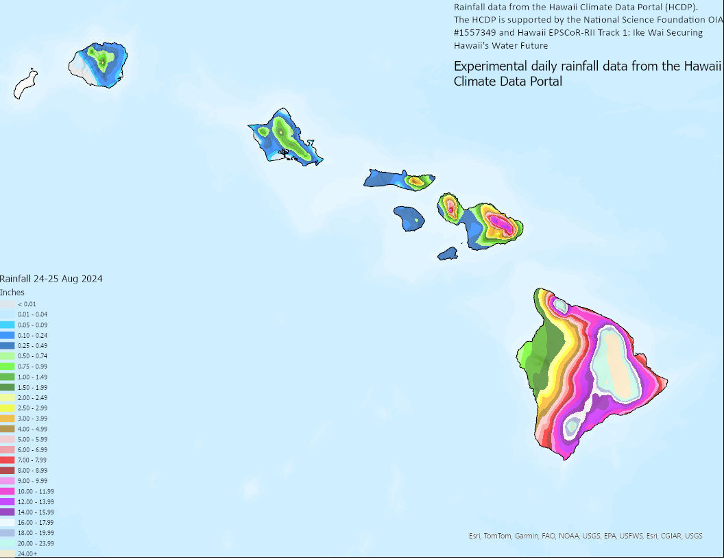
The National Weather Service says several rain gages along the windward and southeast facing slopes of Hawaiʻi island reported 2-day rainfall totals greater than 20 inches.
On the latest U.S. Drought Monitor map, D3 Extreme Drought conditions have been erased, and the D1 Moderate Drought conditions in windward areas have reverted to D0 Abnormally Dry conditions.
From the U.S. Drought Monitor:
Hurricane Hone spread heavy rains across parts of Hawaii this week. Rainfall totals of 4+ inches were widespread on the windward side of the Big Island with over a foot of rain reported in favored upslope areas. Hone’s rains reached as far west as Oʻahu. The Big Island experienced a 1-category improvement in drought conditions and abnormal dryness and drought contracted on Maui, Molokai, and Oʻahu.

Above image via NWS Honolulu shows the two-day total rainfall for August 24-25, 2024 from the Hawaii Climate Data Portal.
“Fortunately, rain rates were mostly below an inch per hour, which mitigated more serious flooding beyond road closures in low-lying areas,” the National Weather Service wrote in a post tropical cyclone report. The most significant impacts occurred in Kaʻū.


by Big Island Video News7:20 am
on at
STORY SUMMARY
HAWAIʻI ISLAND - The latest U.S. Drought Monitor map shows the Big Island experienced an improvement in drought conditions and abnormal dryness.