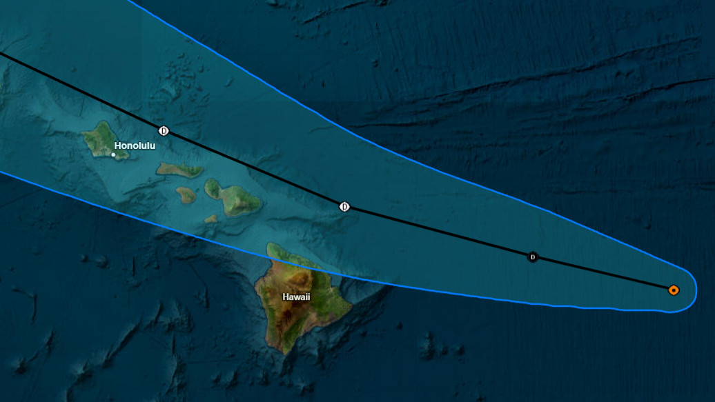
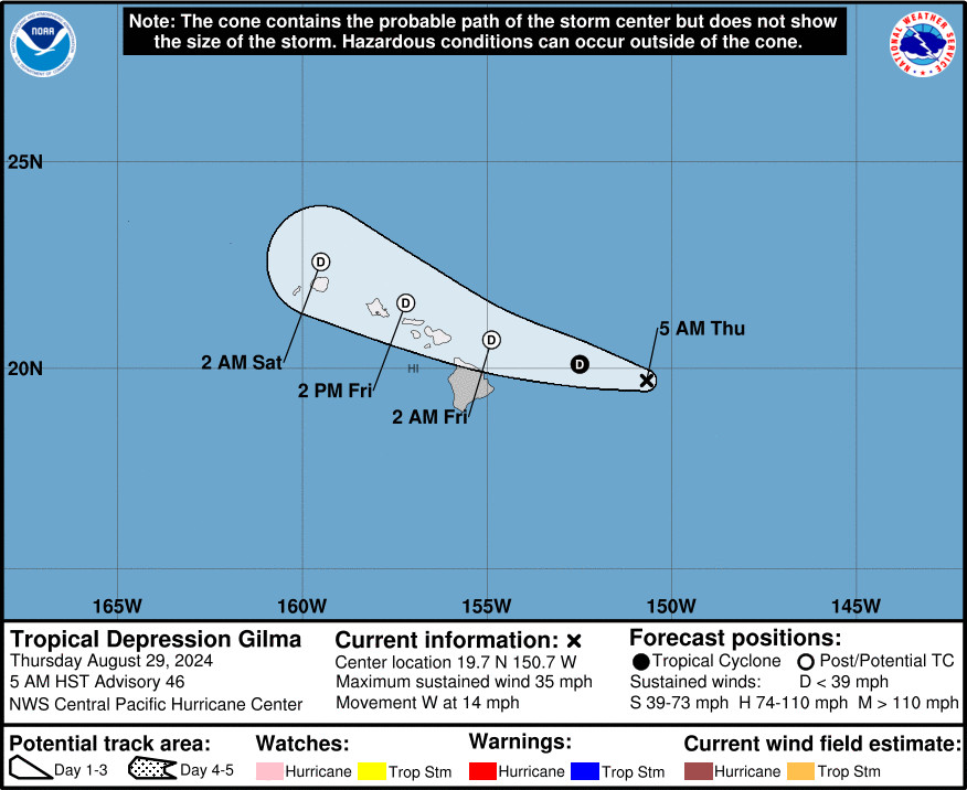
(BIVN) – Gilma is now a tropical depression, and continues to weaken, 285 miles east of Hilo, Hawaiʻi.
“A continued motion toward slightly north of due west will continue today, followed by a turn toward the west-northwest on Friday as the remnant low of Gilma passes near the Hawaiian Islands,” the Central Pacific Hurricane Center reported at 5 a.m. HST. “Gilma is expected to dissipate near Kauai on Saturday.”
Tropical storm Hector, approaching from the east behind Gilma, has weakened to a remnant low.
Forecasters say the “main impacts from these weak systems as the pass near or over the state is enhanced rainfall that can begin as early as tonight and persist into the weekend.”
From a National Weather Service discussion posted at 4:03 a.m. HST:
Timing of the heaviest rainfall is looking like it will be Thursday night into Friday for the Big Island and Maui. As the remnants continue a northwest track, chances of heavy rainfall will then focus near Oʻahu and Kauai Friday night into Saturday. Current rainfall totals range between the 1 to 3 inches. Even though widespread flooding is not expected, localized flooding could be possible. Have also added isolated thunderstorms to the forecast during this time as the environment becomes increasingly unstable. Dewpoint temperatures are currently in the low 70s and will continue to rise to the mid 70s as the remnants of Gilma skirts just east of the state. This combination of high dewpoints and lighter winds will make the air feel warmer than usual.
With all of this said, slight variations in the track would bring noticeable differences in the forecast. A slight shift in forecast track to the north would mean less rainfall for the islands, and a slight shift to the south would bring higher rainfall totals across the state. Stay tuned for forecast updates.
Remnants of Tropical Storm Hector will follow closely behind Gilma as a weak surface trough with a diffuse moisture plume sometime Saturday night into Sunday. This will bring a slight uptick in shower activity during this period. Dewpoint temperatures will continue to fluctuate between the low to mid 70s. Moderate to locally fresh trades will gradually return, first for the eastern half of the state then to the western half of the state Sunday. No significant impacts are expected from remnants of Hector at this time.


by Big Island Video News6:50 am
on at
STORY SUMMARY
HAWAIʻI - The remnant low of Gilma will pass near the Hawaiian Islands on Friday, and dissipate near Kauai on Saturday, forecasters say.