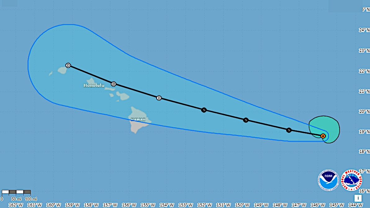
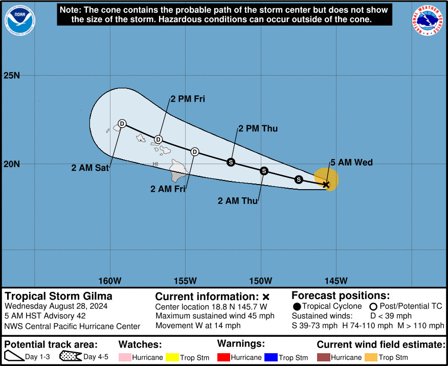
(BIVN) – Two tropical cyclones are approaching Hawaiʻi from the east: Tropical Storm Gilma and Tropical Storm Hector. Both storms are on a westward track, and forecasters expect significant weakening over the next few days.
Weather impacts from these systems are favoring additional periods of wet weather for the islands from Friday through Sunday, the National Weather Service says.
Tropical Storm Gilma was 615 miles east of Hilo as of 5 a.m. on Wednesday. At the same time, Tropical Storm Hector was 1,450 miles east of Hilo.
From the National Weather Service discussion posted at 3:51 a.m. on Wednesday:
According to the latest forecasts from the hurricane center both tropical cyclones Gilma and Hector continue to weaken as they approach, which means the main impacts to the islands will more likely from rain, not wind. That said, there remains some uncertainty in how long these systems can hold together, which plays a role in forecasting rainfall totals for each island. The good news for the Big Island is the rainfall totals from each of these systems will probably feel more like a wet trade wind weather with a only a slight risk for flash flooding. More or less rain will fall based on slight deviations in the track of these post-tropical low centers. A slight shift in forecast track to the north will mean less rainfall for the islands, and a slight shift to the south will bring higher rainfall totals across the state. Stay tuned for more wet weather details as rainfall impacts evolve over time.
There are no weather watches or warnings in effect for Hawaiʻi at this time.


by Big Island Video News7:09 am
on at
STORY SUMMARY
HAWAIʻI - Both Tropical Storm Gilma and Hector will weaken as they approach the state, in part due to increasing westerly wind shear aloft, forecasters say.