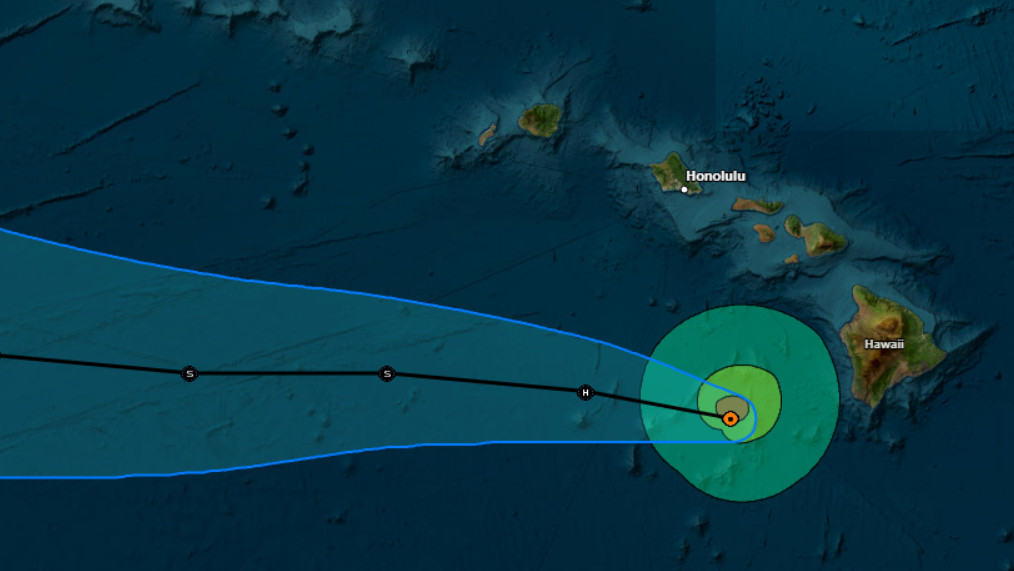
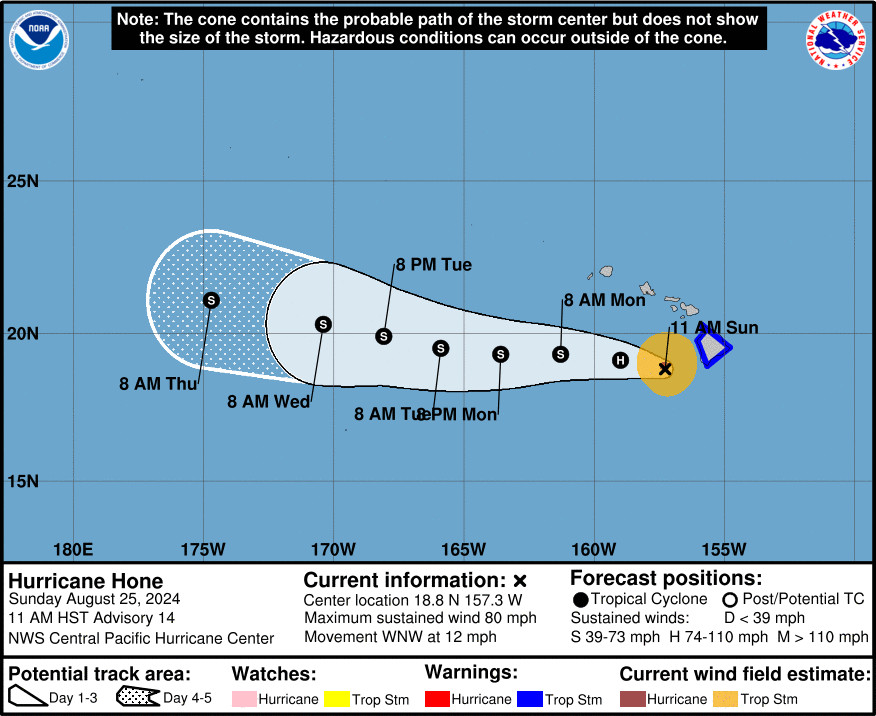
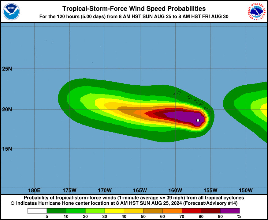
(BIVN) – Hurricane Hone was 105 miles west of South Point on Hawaiʻi island as of 11 a.m. on Sunday morning. The storm is gradually moving away from the Big Island, but forecasters say tropical storm conditions continue to impact parts of the island.
Hurricane Hone is generating maximum sustained winds of 80 mph with higher gusts.
A Flash Flood Warning continues for most of the Big Island, and a Tropical Storm Warning remains in place for the entire island.
As of 11:30 a.m., according to Hawaiian Electric, there were about 18,150 impacted customers without power across the state. Of those, approximately 14,000 customers without power are on Hawaiʻi island, the majority of which are on the east and south sides of the island.
“Hundreds of Hawaiian Electric employees are working to restore electric service to customers impacted by Hurricane Hone as it moves across the state,” the utility company said. “These outages were caused by impacts from the storm and were NOT related to the company’s Public Safety Power Shutoff (PSPS) program.”
“Paʻauʻau gulch stream gauge is showing another spike in stream flow as of 10 a.m.,” said the National Weather Service. “In the Kaʻū District, Highway 11 remains closed at Kawa Flats, and Wood Valley Road and Cane Haul Road remain closed near Pahala. Heavy rainfall will continue through the rest of the morning hours as Hurricane Hone moves westward to the southwest of the Big Island.”
From the Central Pacific Hurricane Center at 11 a.m. HST:
Data from a U.S. Air Force Reserve Hurricane Hunter aircraft confirm what can be deduced from latest satellite images, that Hone has weakened since undergoing a period of intensification last night. The pressure has been rising slowly over the course of this morning’s mission, and the highest flight-level winds thus far have been 67 kt. The initial intensity estimate for this advisory has been lowered, perhaps conservatively, to 70 kt.
The initial motion estimate is 290/12kt, as Hone’s forward speed has increased somewhat since the previous advisory. Recent jogs in the observed track may have been related to the high terrain of the Big Island, but as it continues to move away, Hone’s general westward motion will be imparted by a low- to mid-level ridge to the north. The updated forecast track is close to the previous, after accounting for a northwesterly jog as Hone passed south of the Big Island, and most closely follows the dynamical consensus models.
Water vapor and infrared satellite images show that Hone lies in a col between upper-level ridges centered to the distant east-northeast and west. This pattern has been providing enhanced outflow aloft over the last 12-18 hours, likely aiding in the observed intensification to a hurricane. The forecast track will take Hone north of the upper-level ridge axis to its west, and into an area of increased westerly vertical wind shear, especially after Tuesday. Despite steadily increasing SSTs along the forecast track, the forecast anticipates that Hone will weaken due to the shear. The intensity forecast generally follows the trends presented by the intensity consensus, and anticipates that Hone will dissipate before exiting the central Pacific basin.
KEY MESSAGES:
1. Tropical Storm conditions will continue on the Big Island into the early afternoon, with gradually diminishing wind and rainfall through the evening. Winds will strongest downslope of higher terrain, over headlands, and through passes.
2. Hone will continue to deliver persistent and locally widespread rainfall to portions of the Hawaiian islands.
3. Swells generated by Hone are affecting portions of the Hawaiian islands, producing life-threatening surf and rip current conditions.


by Big Island Video News12:06 pm
on at
STORY SUMMARY
HAWAIʻI ISLAND - 14,000 customers are without power are on Hawaiʻi island, the majority of which are on the east and south sides of the island.