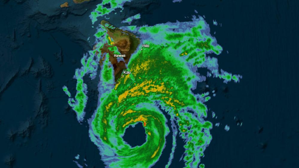
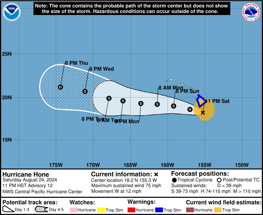
(BIVN) – Hone has become a hurricane. The storm, now with maximum sustained winds near 75 mph, was 105 miles south of Hilo as of 11 p.m. Saturday evening, moving west at 12 mph. Heavy rain and strong winds are impacting areas of East Hawaiʻi and parts of Kohala.
Hurricane-force winds extend outward up to 15 miles from the center of Hone, and tropical-storm-force winds extend outward up to 125 miles, the Central Pacific Hurricane Center says.
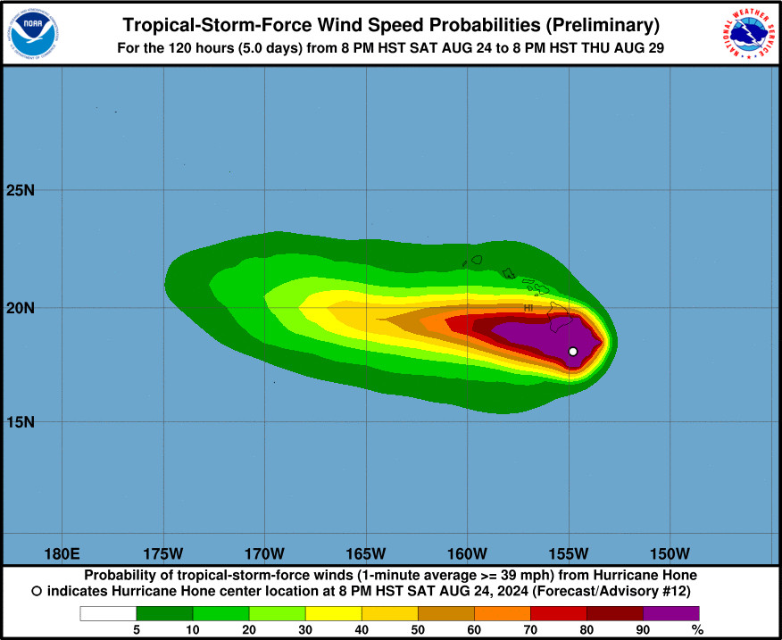
A Tropical Storm Warning remains in effect for Hawaiʻi County, and a Flood Advisory has been issued for various locations. Tropical Storm conditions are expected on the Big Island through early Sunday, officials say. Winds are expected to be strongest downslope of higher terrain, over headlands, and through passes.
Officials report Kohala Mountain Road (Highway 250) is closed due to a downed tree at the 17 Mile Marker. Also, a large tree fell “and is completely obscuring traffic” just above the Mana Road on the Maunakea Access road.
The Hawaiʻi County Civil Defense website is also reporting the closures of the following roads in Puna – North Kulani Road in Mountain View, 39th and Pohaku Street in Orchidland, 40th Street in Orchidland, and Koloa Maoli Road (C Road) in Hawaiian Acres – all due to “water on roadway”.
Ochiro Camp Road in Laupahoehoe was also closed due to flooding.
Forecasters expect 6 to 12 inches of rain “over mainly windward and southeast facing slopes of the Big Island, with locally higher amounts possible.”
From the Central Pacific Hurricane Center discusson posted at 11 p.m. HST:
Hone is passing by around 50 nautical miles south of South Point on the Big Island of Hawaii this evening, where it is within radar range. Combined radar and data from the Air Force Reserve reconnaissance aircraft support raising the intensity to 65 knots, making Hone a Category 1 Hurricane. Despite recent subjective Dvorak estimates suggesting a slightly lower intensity, the satellite presentation has evolved markedly from this afternoon, with cold cloud tops near -80 C reinforcing the aircraft-based intensity. Additionally, a dropsonde report measured a central pressure of 991 mb, depicting a significant decrease from this afternoon. The initial intensity is raised to 65 kt for this advisory.
The initial motion of Hone is set at 280/10, consistent with the previous forecast cycle. This slightly north of due west trajectory is expected to persist over the coming days, influenced by the subtropical ridge to the north. However, as Hone passes near the Big Island overnight into Sunday, the mountainous terrain could influence local steering currents, potentially leading to localized and short-term deviations in the storm’s motion and intensity. A gradual slowing in forward speed is anticipated Sunday into Monday as the ridge weakens slightly. As we move into the early to mid portion of the week, Hone is projected to encounter increasing vertical wind shear, which is expected to weaken the storm and make it more shallow. This change in conditions will allow the low-level trade wind flow to steer the system toward the west-southwest. The official forecast track remains nearly identical to the previous advisory and is closely aligned with the tightly clustered consensus guidance.
Environmental conditions affecting Hone will remain steady over the next 24 h, with sea surface temperatures between 26 C and 27 C, light to moderate vertical wind shear, and sufficient mid-level moisture. This supports maintaining a steady trend through Sunday. Although sea surface temperatures are forecast to rise to around 27 C Sunday night and beyond as Hone continues westward, increasing vertical wind shear will gradually weaken the storm Sunday night through the middle of next week. The intensity forecast closely follows dynamical consensus guidance.


by Big Island Video News11:13 pm
on at
STORY SUMMARY
HAWAIʻI ISLAND - The Tropical Storm Warning for the Big Island continues, as heavy rains fall across East Hawaiʻi and parts of Kohala.