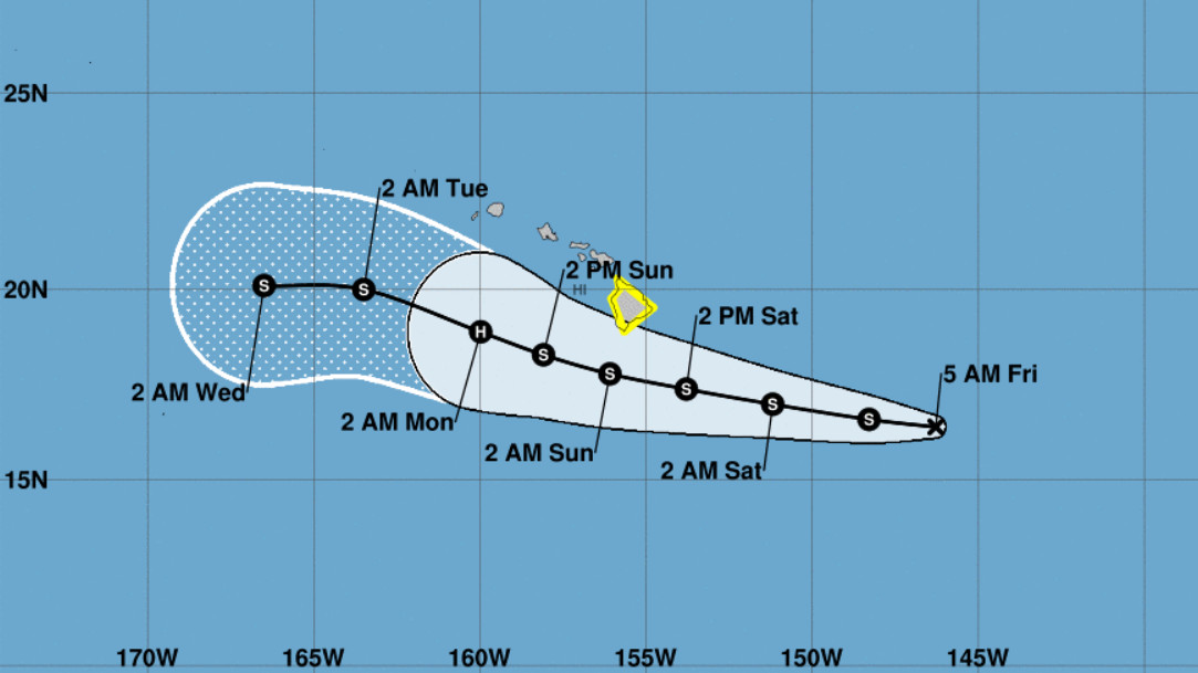
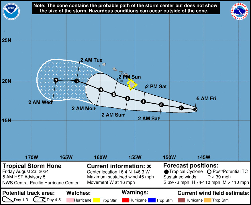
(BIVN) – A Tropical Storm Watch remains in effect for Hawaiʻi island, with Tropical Storm Hone located 620 miles east-southeast of Hilo as of 5 a.m. Friday morning.
Tropical Storm Hone, with maximum sustained winds of 45 mph, is moving west towards Hawaiʻi at 16 mph. The storm is expected to gradually strengthen and continue moving toward the west over the next couple of days.
“The latest forecast track brings the center of Hone near or south of the Big Island from Saturday night into Sunday morning as a strong tropical storm,” the National Weather Service in Honolulu wrote at 5:20 a.m. HST. “Hone will then strengthen to a Hurricane late Sunday into Monday as it passes south of Kauai and Oʻahu.”
Forecasters provided this situation overview on Friday morning:
Winds associated with Hone will increase over the Big Island on Saturday and may become locally damaging by nightfall. Tropical storm conditions, with sustained winds over 39 mph, are possible Saturday night into Sunday. Winds will be the strongest where they blow over island mountains, through passes, and downslope from higher terrain. This includes areas like the Humuʻula Saddle, the Waimea Saddle, leeward Kohala, and South Point.
Persistent rainbands within the deep tropical moisture on the north side of Hone may bring excessive rainfall and flash flooding to portions of the Big Island starting Saturday afternoon through Sunday. The Hamakua, Hilo, Puna, and Kaʻu Districts appear to have the highest risk for flash flooding. A few heavy showers and thunderstorms may persist over leeward and upslope portions of the Big Island lasting into Monday.
Swells associated with Hone are expected to bring high surf and strong rip currents along east and southeast facing shores of the Big Island from late Saturday through Sunday. Listen for later High Surf Advisories or Warnings that may be needed for further information.
The Central Pacific Hurricane Center says Hone “is expected to produce storm total rainfall of 4 to 8 inches over mainly windward and southeast facing slopes of the Big Island, with locally higher amounts.”
The forecasters say a U.S. Air Force Hurricane Hunter Aircraft is on it’s way to sample Hone, in order to gather “valuable information on the intensity, structure, and size of the tropical cyclone”.
The Central Pacific Hurricane Center also provided this information in its 5 a.m. discussion:
Environmental conditions will change little during the next couple of days. Hone will remain in an environment characterized by low to moderate vertical wind shear, marginal sea surface temperatures around 26-27C, and marginally sufficient deep layer moisture. As a result, only slow and gradual strengthening of the system is forecast during the next couple of days as it moves steadily west to west-northwestward. It appears that there remains a window for further intensification Sunday and Monday as the system tracks south of the Hawaiian Islands. Hone will be moving into an area with slightly warmer sea surface temperatures around 27C and higher ocean heat content, while the westerly vertical wind shear remains at light to moderate levels. This could allow Hone to reach Hurricane strength and the current official forecast continues to reflect this. Beyond day 3, westerly vertical wind shear increases sharply to 30 to 40 knots, and some drier mid-level air appears to begin entraining into the system. This should result in steady weakening for days 4 and 5. The intensity forecast is close to the intensity consensus during the next couple days, and is roughly a blend of the consensus and dynamical intensity guidance from days 3 through 5.


by Big Island Video News6:45 am
on at
STORY SUMMARY
HAWAIʻI - A Tropical Storm Watch is in effect for the entire island of Hawaiʻi, with excessive rainfall and flash flooding possible starting later Saturday.