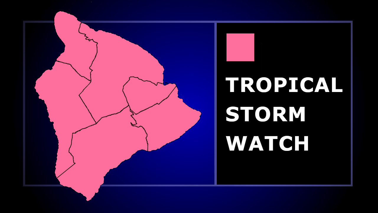
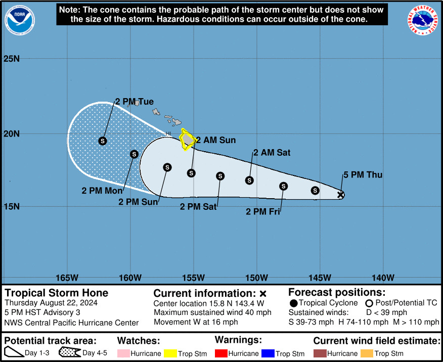
(BIVN) – A Tropical Storm Watch has been issued for Hawaiʻi island, as well as a Flood Watch, as Tropical Storm Hone churns in the Central Pacific, 800 miles east southeast of Hilo.
The National Weather Service says the latest forecast track “brings the center of Hone south of, or possibly near, the Big Island Saturday night into Sunday morning as a strong tropical storm.”
According to a statement published by the National Weather Service at 5:43 p.m. HST on Thursday:
Winds associated with Hone will increase over the Big Island on Saturday and may become locally damaging by nightfall. Tropical storm conditions, with sustained winds over 39 mph, are possible Saturday night into Sunday. Winds will be the strongest where they blow downslope from higher terrain, over headlands, and through passes. This includes areas like the Humʻuula Saddle, the Waimea Saddle, leeward Kohala, and South Point.
Persistent rainbands on the north side of Hone may bring excessive rainfall and flash flooding to portions of the Big Island starting Saturday afternoon and continuing through the remainder of the weekend. The Hamakua, Hilo, Puna, and Kaʻu Districts appear to have the highest risk for flash flooding. A few lingering heavy thundershowers may persist over portions of the Big Island into Monday, especially over leeward and upslope areas.
Swells associated with Hone are expected to bring high surf and strong rip currents to east and southeast facing shores of the Big Island, starting later Saturday and persisting through the remainder of the weekend. Listen for later High Surf Advisories or Warnings that may be needed for further information.
The Hawaiʻi County Civil Defense said residents should review their emergency plans and prepare an emergency kit. Residents should also prepare their property for heavy rains and flooding conditions.


by Big Island Video News7:22 pm
on at
STORY SUMMARY
HAWAIʻI - Tropical Storm Hone will pass south of the Big Island this weekend, and is likely to impact local weather conditions.