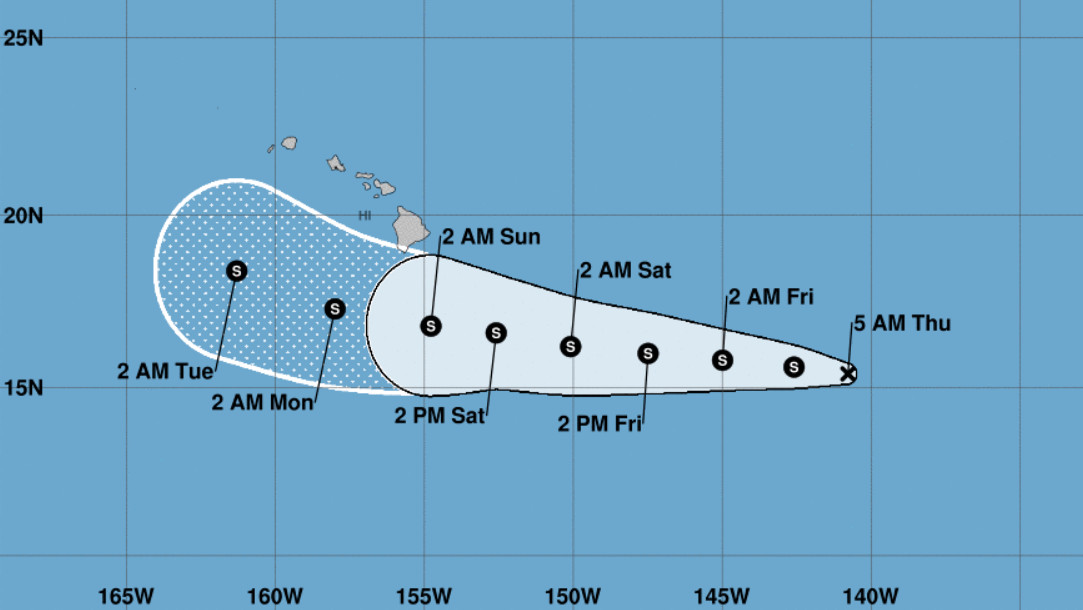
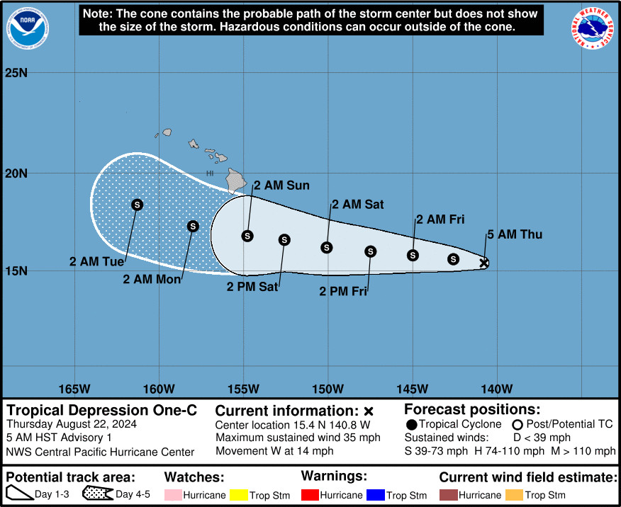
(BIVN) – A tropical depression has formed in the Central Pacific, as forecasters anticipated, about 980 miles east southeast of Hilo.
The storm is moving to the west near 14 mph, and is expected to strengthen into a tropical storm later today.
“Tropical Depression One is forecast to approach the Hawaiian Islands during the next few days, bringing the potential for heavy rainfall, along with dangerous surf and rip currents,” the Central Pacific Hurricane Center said at 5 a.m. HST. “A Tropical Storm Watch could be required for portions of the main Hawaiian Islands tonight or Friday.”
“A wet and windy period is expected, potentially beginning as early as Friday night into Saturday over the eastern part of the state, then statewide later Saturday through early next week,” the National Weather Service in Honolulu said.
From the Central Pacific Hurricane Center discussion posted at 5 a.m. HST:
The area of low pressure well east-southeast of the Hawaiian Islands has become better organized overnight, with persistent deep convection now over the low-level circulation center. As a result, the first Tropical Depression of the season has formed in the Central Pacific basin. Subjective Dvorak intensity estimates came in at 2.5 PHFO and 1.5 SAB. Taking a blend of these estimates, the initial intensity will be set at 30 knots.
The initial motion of Tropical Depression One is set at 270/12 knots. This general motion is expected to continue during the next several days as the system is steered by a large subtropical ridge to the north. A decrease in forward speed and a slight turn toward the west- northwest is forecast by days 4 and 5 as a weakness develops in the subtropical ridge to the north. The track forecast is closely aligned with the consensus guidance.
Tropical Depression One is forecast to remain in a low to moderate vertical wind shear environment, with warm sea surface temperatures of 27 to 28C, and adequate deep layer moisture during the next several days. This should result in gradual strengthening of the system as it tracks steadily westward, and a tropical storm will likely form later today. By late in the weekend into early next week, the tropical cyclone will begin to see an increase in westerly vertical wind shear and the potential for some entrainment of drier mid-level air. This should lead to a gradual weakening of the system. The intensity forecast is close to the intensity consensus during the next several days, bringing the system up close to hurricane strength over the weekend, then is slightly lower than the consensus guidance by days 4 and 5.
Behind Tropical Depression One-C, Hurricane Gilma is about 2,000 miles east of Hilo.
Gilma is now a major hurricane and continues to intensify over open waters in the Eastern Pacific. “As the storm treads further west, cooler water is likely to increase weakening of the system through the weekend into early next week,” the National Hurricane Center reported.


by Big Island Video News7:05 am
on at
STORY SUMMARY
HAWAIʻI - Tropical Depression One-C is expected to gradually strengthen, likely forming a tropical storm later today as it moves west.