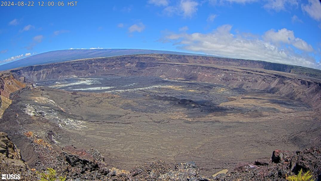
(BIVN) – Kīlauea is not erupting and the USGS Volcano Alert Level remains at ADVISORY.
Scientists with the USGS Hawaiian Volcano Observatory say the magnitude-4.7 earthquake that occurred at 12:52 a.m. on Kīlauea volcano’s south flank had no apparent impact on either Mauna Loa or Kīlauea.
Increased earthquake activity and ground deformation continues on Kīlauea’s upper East Rift Zone, but at a decreased rate compared to the uptick that was observed on August 20th.
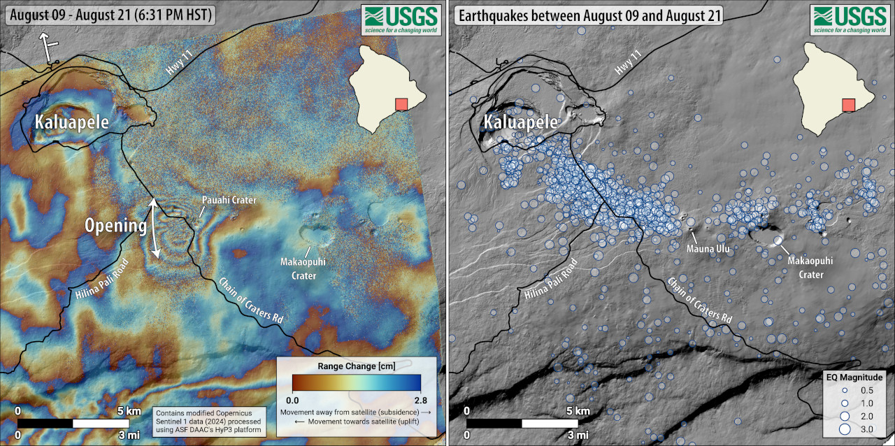
The USGS Hawaiian Volcano Observatory released a new image illustrating the activity on Kīlauea’s upper and middle East Rift Zone (above), and explained the image with this lengthy caption:
The map on the left shows recent deformation at Kīlauea over the timeframe of August 9–21, 2024. Data were acquired by the European Space Agency’s Sentinel-1A satellite. Colored fringes denote areas of ground deformation, with more fringes indicating more deformation. Each color cycle represents 2.8 cm (1.1 in) of ground motion.
The symbol in the upper left indicates the satellite’s orbit direction (arrow) and look direction (bar). The butterfly-shaped feature near Pauahi Crater on the upper East Rift Zone indicates ground surface motion over this time period as magma intruded underground.
The map on the right shows earthquakes over the same timeframe, August 9–21, 2024. The intrusion of magma likely occurred the night of August 19–20, when there were more than 200 earthquakes beneath Kīlauea’s upper East Rift Zone, extending from near Puhimau Crater southeast to Maunaulu. Most earthquakes were smaller than M2.0, though there were 6 events larger than M3.0 and the largest was M3.7. Earthquakes remained at depths of 1–3 km (0.6–1.8 miles) beneath the surface and were accompanied by elevated rates and changing patterns of ground deformation.
Cracks in Chain of Craters Road—which formed between Hilina Pali Road intersection and the Maunaulu parking lot during a similar intrusive episode from July 22–25—widened during the recent unrest, prompting Hawaiʻi Volcanoes National Park to close Chain of Craters Road.
On Thursday, the USGS HVO provided this Kīlauea activity update:
Summit Observations: Approximately 21 earthquakes were detected beneath Kaluapele (Kīlauea’s summit caldera) over the past 24 hours at depths of 1–3 km (0.6–1.9 mi) below the ground surface with magnitudes of less than M2.0. Rates of deformation at the summit remained relatively low with minor local deflation, likely in response to unrest in the upper East Rift Zone (UERZ). An overall gradual inflationary trend continues to be seen on GPS instruments around the summit region. The most recent measurement of the summit’s SO2 emission rate was approximately 75 tonnes per day on August 20, 2024.
Rift Zone Observations: Over the past 24 hours, there have been approximately 65 earthquakes beneath Kīlauea’s UERZ region, extending from Puhimau Crater southeast to Maunaulu. Most earthquakes have been smaller than M2.0, though there was 1 event larger than M3.0. Events have remained at depths of 1–3 km (0.6–1.8 miles) beneath the surface. Most earthquakes have been too small to feel, but several were reported felt in Hawaiʻi Volcanoes National Park and surrounding communities.
Earthquake activity was accompanied by elevated rates and changing patterns of ground deformation recorded by the ESC tiltmeter northeast of Pauahi Crater in Kīlauea’s UERZ on Tuesday (8/19). Deformation as of Thursday morning is relatively level (flat).
Activity in the middle East Rift Zone (MERZ) remains low. Earthquake locations are scattered around Makaopuhi crater within Hawaiʻi Volcanoes National Park. Depths range from 1–3 km (0.6–1.9 mi) below the ground surface with magnitudes less than M2.0. There has been no significant change in deformation at the POC tiltmeter overnight. GPS instruments continue to record inflation in the region.
Measurements from continuous gas monitoring stations downwind of Puʻuʻōʻō in the middle East Rift Zone—the site of 1983–2018 eruptive activity—remain below detection limits for SO2, indicating that SO2 emissions from this area are negligible.
At this time, there is no evidence of seismicity or ground deformation beneath the lower East Rift Zone, and Southwest Rift Zone activity remains low. Current activity is restricted to the summit and upper East Rift Zone region.


by Big Island Video News12:29 pm
on at
STORY SUMMARY
HAWAIʻI VOLCANOES NATIONAL PARK - Scientists on Thursday morning posted the first update on Kīlauea following the magnitude-4.7 earthquake that occurred after midnight.