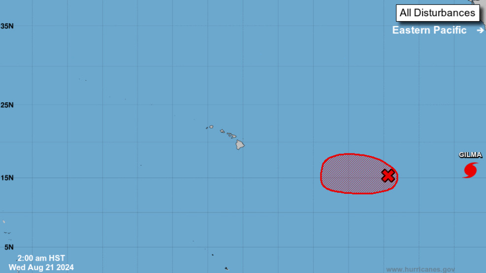
(BIVN) – Forecasters say there is increased consensus that a weather disturbance located east-southeast of the Hawaiian islands will develop into a tropical cyclone today, and could approach the islands over the weekend.
“From late Friday through the weekend, confidence in forecast details remains on the lower end of the spectrum, but models are coming to an increased consensus on some of the larger scale features,” the National Weather Service in Honolulu wrote on Wednesday morning. “A tropical cyclone (TC) is likely to form about 1350 miles ESE of the islands today, and head generally westward while intensifying the next couple of days, potentially passing dangerously close to the islands over the weekend.”
“It is too early for forecast specifics with respect to potential impacts in the islands, but the triple threat that a TC could bring includes strong and damaging winds, heavy and potentially flooding rainfall, as well as high surf and storm surge,” the forecasters wrote.
The potential tropical cyclone will likely cross into the Central Pacific tonight, which means the Central Pacific Hurricane Center in Honolulu will assume the forecast responsibility for the storm from the National Hurricane Center in Miami.
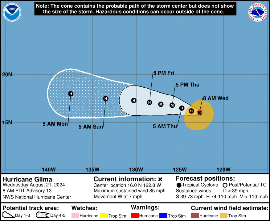
The forecasters in Miami are currently tracking Hurricane Gilma, located farther out in the Eastern Pacific (2,130 miles east-southeast of Hilo) and the storm is intensifying. Gilma is now expected to become a major hurricane as it continues a slow westward to west-northwestward motion over the next few days.
From the National Hurricane Center discussion posted Wednesday morning:
With the improvement of Gilma’s inner core structure this morning, the hurricane may be poised to intensify more over the next day or two. This scenario is shown by the recent hurricane-regional model guidance, which shows more intensification than the prior cycle. Given the reduction in vertical wind shear noted in the recent SHIPS guidance and as Gilma remains over 27-28 C sea-surface temperatures for the next 48 h, the NHC intensity forecast now shows intensification into a Category 3 hurricane over this time period. This intensity forecast is higher than the previous one, but is in good agreement with the latest HCCA consensus aid. However there remain some hurricane-regional models that show even more intensification (e.g., HAFS-A). After 48 h, sea-surface temperatures begin to gradually decrease, and slow weakening is expected to begin thereafter, though less than the previous advisory due to the further south track over warmer ocean waters.
“It is the peak of hurricane season here in Hawaii, and now is a good time to make sure that you and your family are prepared,” the National Weather Service added. “For more information, visit weather.gov/safety/hurricane-plan.”


by Big Island Video News7:08 am
on at
STORY SUMMARY
HAWAIʻI - A tropical cyclone is likely to form east southeast of the islands today, and potentially pass dangerously close to Hawaiʻi over the weekend.