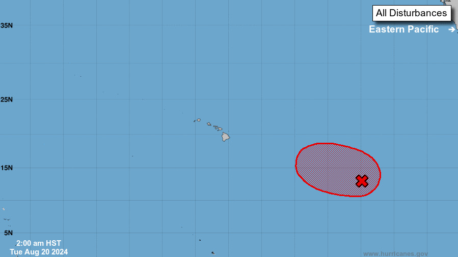
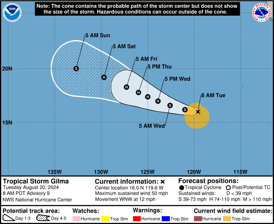
(BIVN) – Forecasters continue to track weather disturbances in the Eastern Pacific that could merge and develop into a tropical depression in the next few days, as well as Tropical Storm Gilma farther out in the Eastern Pacific.
At 3:55 a.m. HST, the National Weather Service in Honolulu wrote:
Our attention is focused on the potential track and evolution of two tropical disturbances near 10N latitude and 135W to 140W longitude; these systems are currently more than 1,000 miles east- southeast of the Hawaiian Islands. The interplay between these disturbances is key to the current model solutions which remains highly uncertain given that an organized tropical system has yet to emerge from this rather broad area of interest. Therefore, we expect some fluctuation in modeling outcomes as the system evolves over the next few days. The potential does exist for conditions to be quite windy by this weekend in addition to the potential for heavy rain. These impacts will be entirely driven by the intensity and track of any developed tropical cyclone. The Central Pacific Hurricane Center is closely monitoring the Central Pacific basin, so stay tuned for frequent updates over the next several days at www.hurricanes.gov.
The National Hurricane Center says it expects the two systems to merge later today and then gradually develop into a tropical depression. The disturbance is forecast to move west-northwestward into the Central Pacific basin Wednesday night or early Thursday.
Meanwhile, Tropical Storm Gilma – about 790 miles southwest of the southern tip of Baja California – is expected to become a hurricane by Wednesday night.
“The ongoing northeasterly vertical wind shear is expected to decrease and become fairly low during the next few days,” the National Hurricane Center wrote. “This more conducive upper-level wind pattern combined with warm SSTs and high moisture should allow Gilma to steadily strengthen through the rest of the week. Gilma is forecast to reach hurricane strength by Wednesday night and could reach its peak intensity a day later.”
“By the end of the week, the cyclone is expected to track over cooler waters and into a more stable airmass, which should induce a weakening trend,” the forecasters said.


by Big Island Video News6:33 am
on at
STORY SUMMARY
HAWAIʻI - Two disturbances over the western portion of the East Pacific basin are expected to merge and develop into a tropical depression in the coming days, potentially nearing Hawaiʻi.