(BIVN) – A magnitude 4.1 earthquake occurred on the south flank of Kīlauea volcano on Hawaiʻi island on Saturday evening.
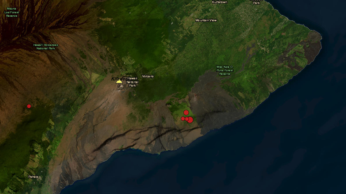
The quake shook the Big Island at 8:47 p.m., and was centered within Hawaiʻi Volcanoes National Park, about 9 miles south of Fern Forest in Puna. The event was measured at a depth of about 4.4 miles.
Over 270 people reported feeling the earthquake within the first hour of the event. Most of the reports were from East Hawaiʻi, although some said they felt the earthquake as far away as North Kohala and the island of Maui.
The earthquake, which was initially reported as a magnitude 4.4 by the Pacific Tsunami Warning Center, did not generate a tsunami. “However… some areas may have experienced shaking,” the PTWC stated.
UPDATE – (9:47 p.m.) – “As in all earthquakes, be aware of the possibility of after-shocks,” stated the Hawaiʻi County Civil Defense in a message following the event. “If the earthquake was strongly felt in your area, please check for any damages, including but not limited to structural and gas, water, and electrical utilities.”
In the minutes following the first earthquake, at least three more quakes – likely aftershocks – were recorded in the same area.
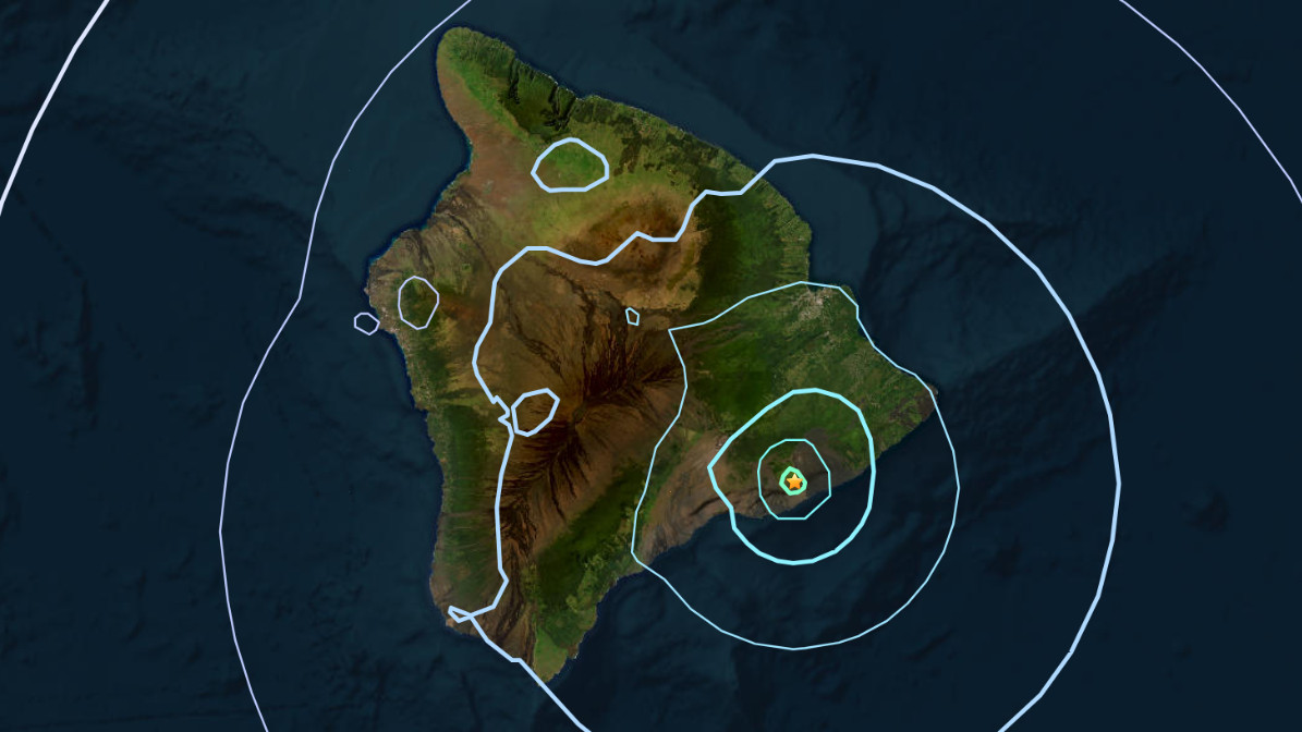
interactive map by the USGS shows the location of the earthquakes on Saturday evening
UPDATE – (9:45 p.m.) – The USGS Hawaiian Volcano Observatory provided this information:
On Saturday, July 6, 8:47 p.m. HST, a magnitude-4.1 earthquake occurred 9 mi (14 km) south of Fern Forest on the Island of Hawaiʻi at a depth of 4 mi (7 km) below sea level. It was followed by three aftershocks in a similar area within 10 minutes: a M2.0, M2.6 and one M3.3; other aftershocks are possible. The earthquake had no apparent impact on either Mauna Loa or Kīlauea volcanoes. Most earthquakes in this region are caused by abrupt motion of Kīlauea volcano’s south flank, which moves to the southeast over the oceanic crust. The location, depth, and waveforms recorded as part of today’s earthquake are consistent with slip along faults related to the south flank detachment fault.
The USGS noted that no damage to buildings or infrastructure was expected based on the earthquake intensity.

by Big Island Video News
on at
STORY SUMMARY
ISLAND OF HAWAIʻI - The earthquake was felt across the island of Hawaiʻi on Saturday night, but was not strong enough to generate a tsunami.