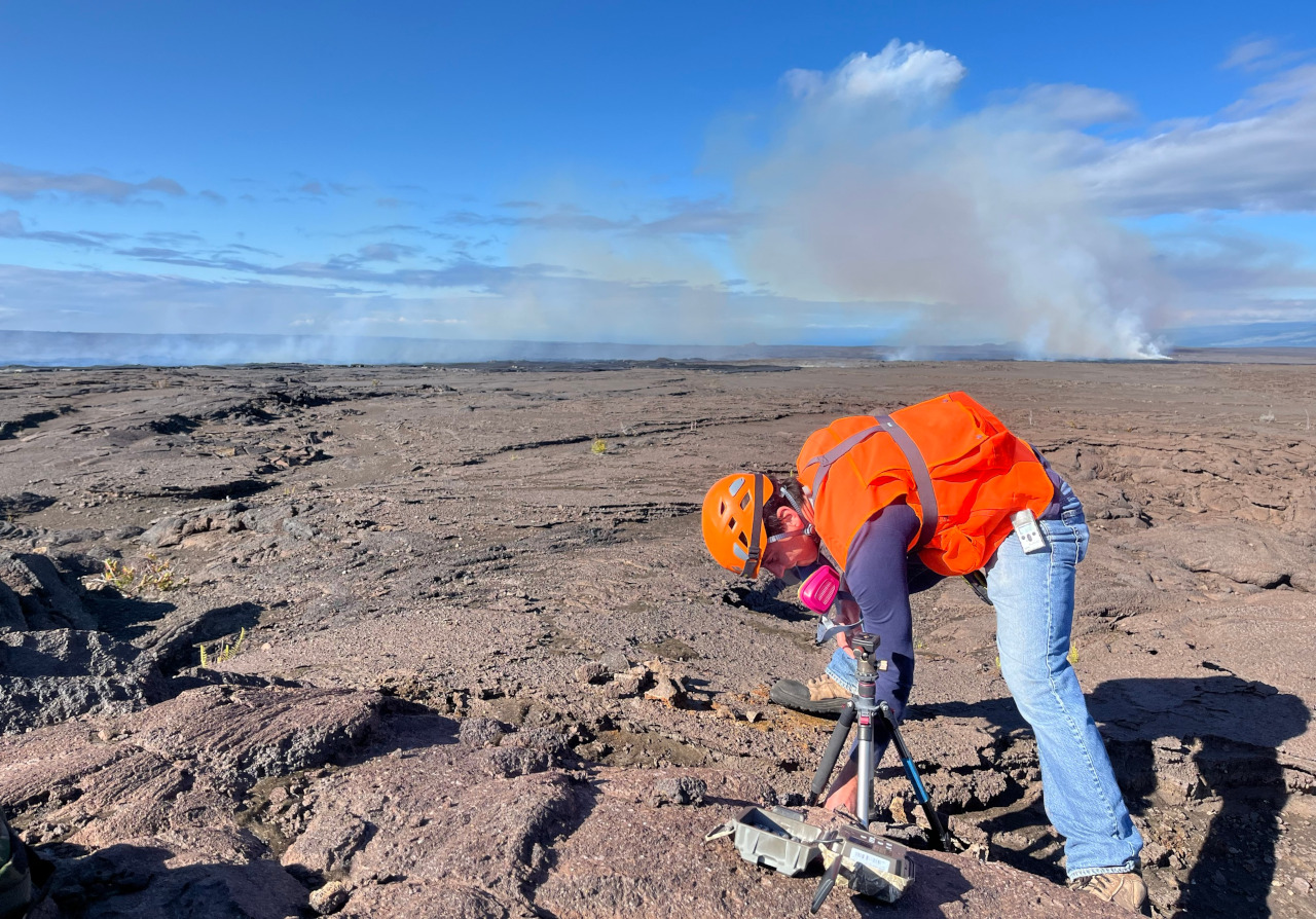
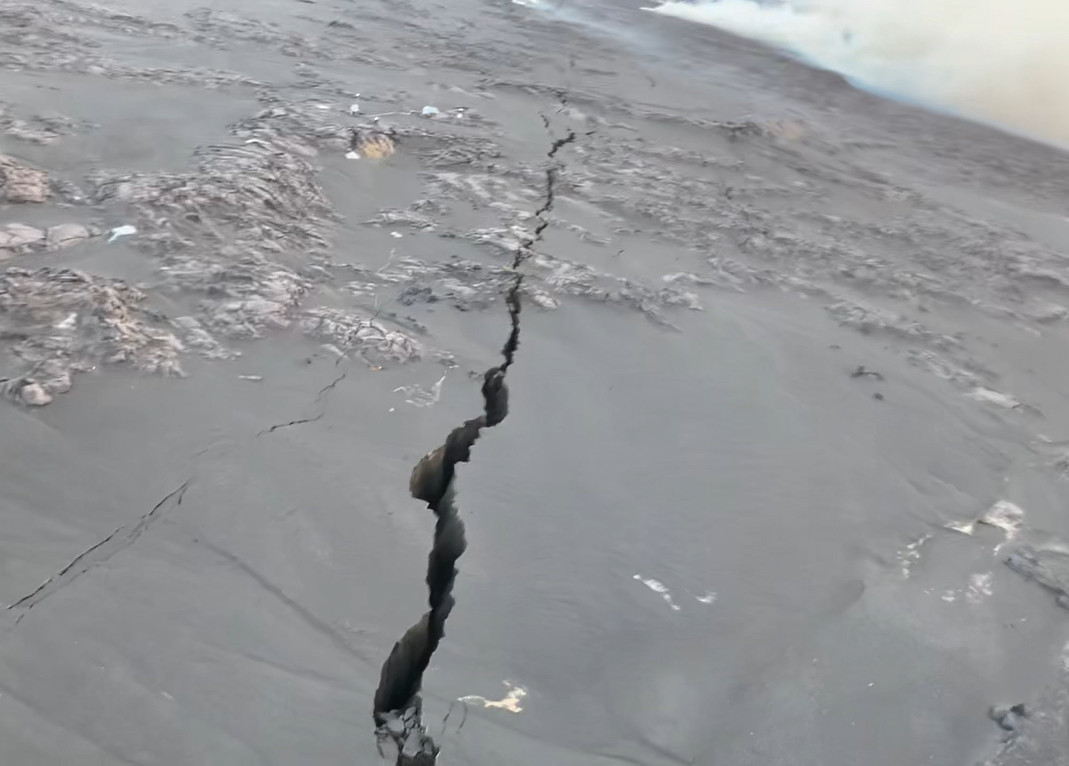
USGS: “USGS Hawaiian Volcano Observatory geologists visited the young lava flows formed within the past 9 hours on the upper Southwest Rift Zone of Kīlauea volcano. At the eruption site, geologists documented lava flow margins, collected samples, and deployed a new webcam to monitor the eruption. USGS image taken the morning of June 3, 2024.” (USGS image by N. Deligne)
(BIVN) – The new eruption of Kīlauea volcano that began just after midnight on Monday continues in a remote location of Hawaiʻi Volcanoes National Park.
Officials say the eruption, taking place on the Southwest Rift Zone about 2.5 miles southwest of Kaluapele, is low in eruptive volume, and does not pose an immediate threat to human life or critical infrastructure.
Due to the nature of the eruption, the USGS Hawaiian Volcano Observatory lowered the Volcano Alert Level for ground-based hazards from WARNING to WATCH, and the Aviation Color Code from RED to ORANGE.
The following temporary closures are in place at Hawaiʻi Volcanoes National Park:
- Hilina Pali Road from Chain of Craters Road intersection
- Kulanaokuaiki Campground
- Pepeiao Cabin
- Kaʻaha Trail and campground
- Kaʻū Desert Trail and pullout on Highway 11
- Maunaiki Trail
The USGS HVO provided these details in a 9:38 a.m. update:
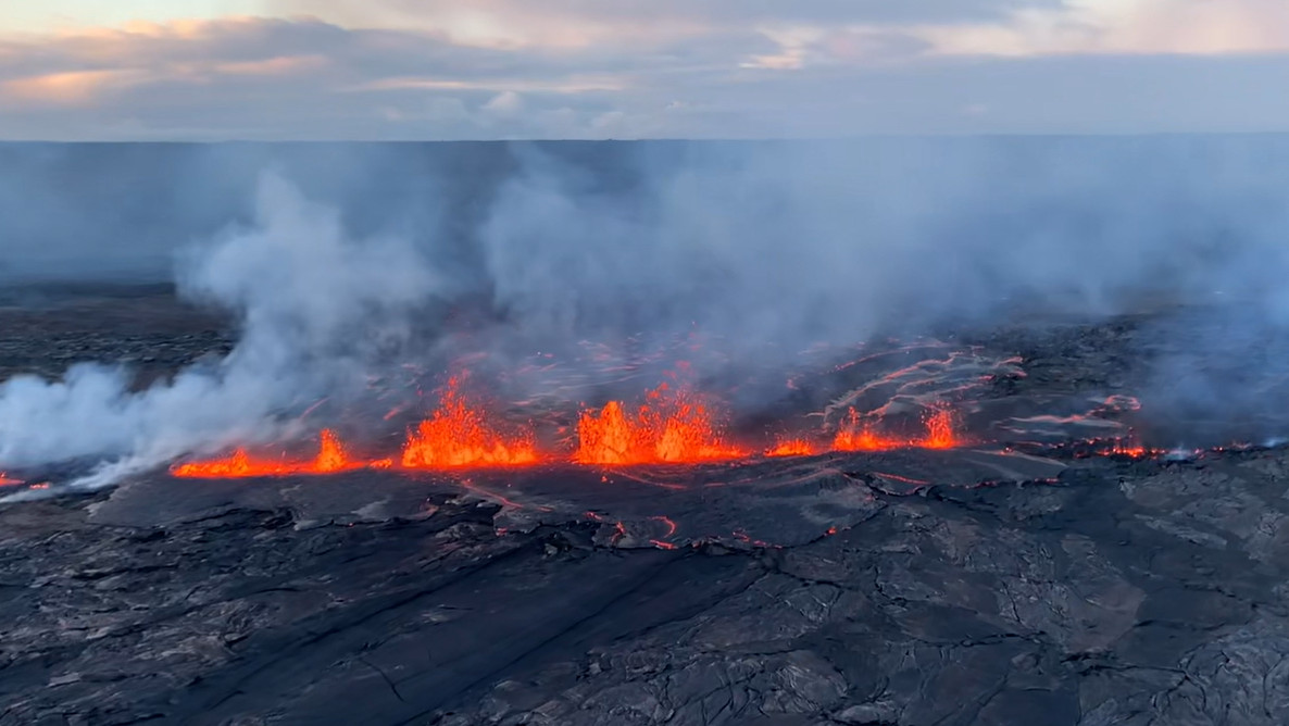
Eruption Site Observations: Lava is currently erupting from a fissure system extending approximately 1 km (0.6 miles) in length. One fissure is currently active; three additional fissures were active last night but are no longer active this morning. Lava flows are thin and have only traveled a few hundred meters (yards) from the fissures. The total area covered by new lava is currently estimated at a few thousand square meters (yards). Numerous large ground cracks have formed in the vicinity of the eruption.
This eruption is occurring in the same approximate location as the December 1974 eruption. Fissures from this eruption have the same orientation as fissures from the December 1974 eruption. The December 1974 eruption lasted about 6 hours but was far more voluminous and covered a much larger area. At this time, it is not possible to say how long the current eruption will last.
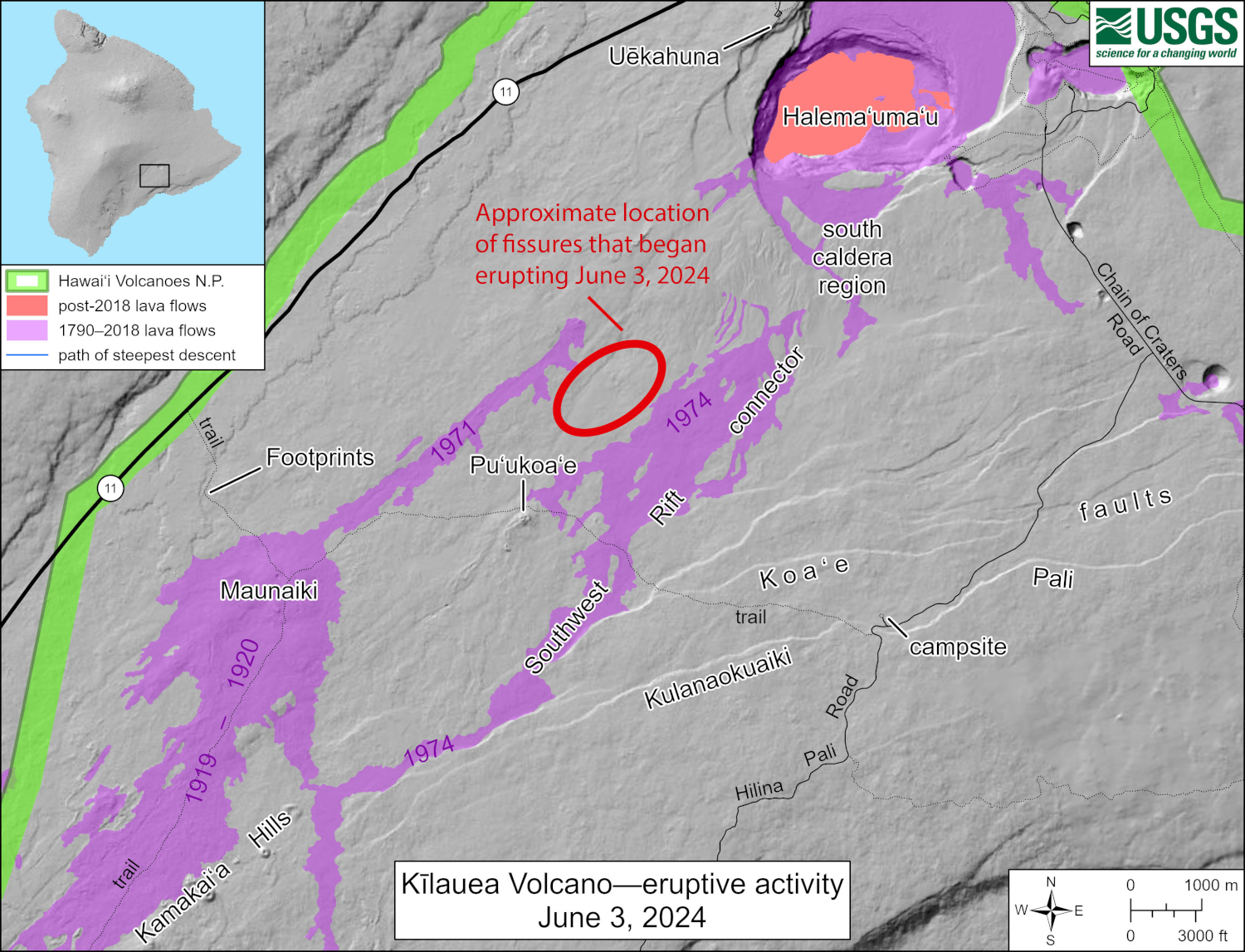
USGS: “This reference map depicts the approximate location of fissure vents that began erupting from Kīlauea Southwest Rift Zone at approximately 12:30 a.m. HST on June 3, 2024. The most recent eruption in this region was during December 1974, which lasted only about 6 hours. At this time, it is not possible to say how long the eruption will last.”
Due to the remote location of this eruption, the primary hazards at this time are airborne hazards related to gas emissions and tephra being blown down wind of the eruption.
Volcanic gases and steam are being emitted from the eruptive fissure system and from nearby ground cracks. Emissions data are being collected and analyzed at the time of this report and results will be included in future updates.
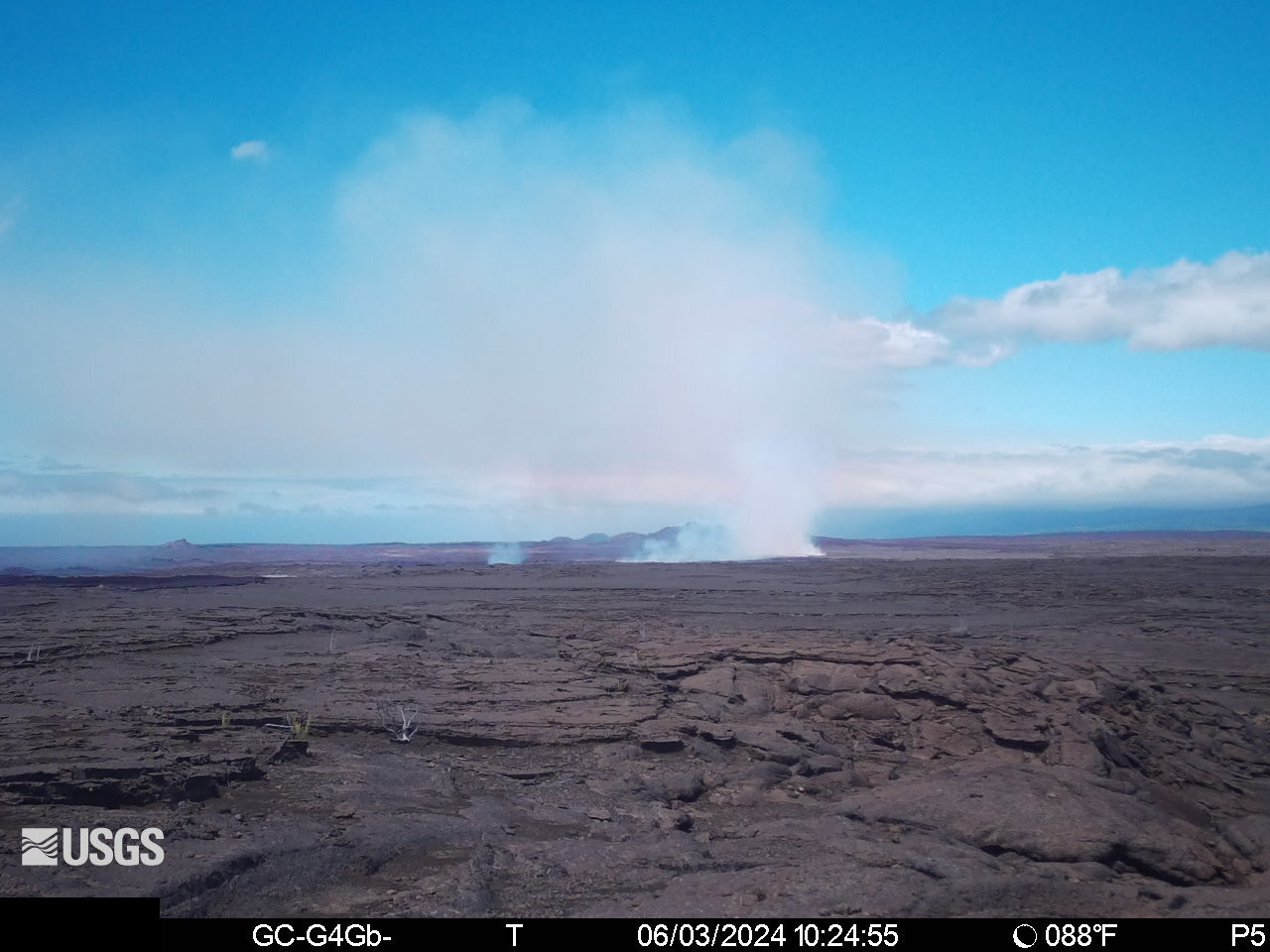
USGS: View of the upper Southwest Rift Zone of Kīlauea from a temporary webcam showing the site of the eruption that started on June 3, 2024 [S1cam].
Summit and Upper Rift Zone Observations: Heightened unrest beneath the summit, upper East Rift Zone, and upper Southwest Rift Zone continues although rates of seismicity and ground deformation have decreased since shortly before the eruption began.
More than 400 earthquakes occurred over the past 24 hours, with most of them occurring between noon yesterday and midnight last night, when rates exceeded 35 earthquakes per hour. The largest earthquakes included a magnitude-4.1 (M4.1) event at 9:12 p.m. and a M4.0 event at 7:07 p.m. last night. Earthquakes were widely felt in Hawaiʻi Volcanoes National Park and surrounding communities and triggered many rockfalls. Approximately 50 earthquakes have occurred beneath the summit, upper East Rift Zone, and upper Southwest Rift Zone over the past 8 hours, as rates have decreased to less than 10 earthquakes per hour. Earthquake depths continue to average 1–3 km (0.6–1.9 miles) beneath the surface.
Tiltmeters recorded significantly increased rates and changes in direction of ground deformation as well as coseismic offsets over the past 24 hours. The Uēkahuna tiltmeter northwest of the summit recorded a total of approximately 14 microradians of deflation over the past day as magma traveled to the southwest toward the area where the eruption eventually occurred. The Uēkahuna tiltmeter northwest of the summit recorded approximately 6 microradians of deflation over the past 8 hours. The Sand Hill tiltmeter southwest of the summit recorded a total of approximately 50 microradians of inflation between 8:00 a.m. yesterday morning and 8:00 p.m. last night as magma moved to the southwest, followed by approximately 35 microradians of deflation between 8:00 p.m. and this morning as magma moved away from the station and erupted onto the surface. The Sand Hill tiltmeter southwest of the summit has recorded approximately 12 microradians of deflation over the past 8 hours.
An SO2 emission rate of approximately 61 tonnes per day was recorded west of Kaluapele on May 21, prior to the current eruption. Sulfur dioxide (SO2) gas emission rates are currently elevated in the eruption area; measurements will be reported in future updates.
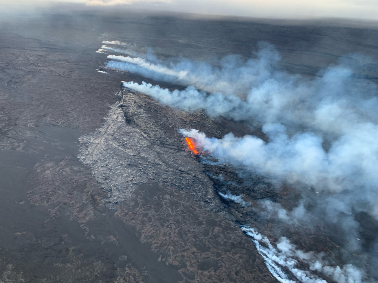
USGS: “Aerial image of the Southwest Rift Zone eruption of Kīlauea, viewed during an overflight at approximately 6 a.m. on June 3, 2024.” (USGS image)
Lower Rift Zone Observations: Rates of seismicity and ground deformation beneath the middle and lower East Rift Zone and lower Southwest Rift Zone are low. Eruptive activity and unrest is restricted to the summit and upper rift zone regions. Measurements from continuous gas monitoring stations downwind of Puʻuʻōʻō in the middle East Rift Zone remain below detection limits for SO2, indicating that SO2 emissions from Puʻuʻōʻō are negligible.
Analysis: Magma has been pressurizing the system beneath Halemaʻumaʻu and the south caldera region, activating seismicity in the upper East Rift Zone, and in the caldera south of Halemaʻumaʻu, since April. Renewed seismicity and deformation began to increase rapidly, beginning at approximately 12:00 p.m. HST on June 2, 2024. The style of seismicity and the coupled inflation at Sand Hill and deflation at Uēkahuna Bluff indicated that magma was moving below the surface during the early stages of dike formation.
Rates of seismicity and deformation increased greatly after 5:00 p.m. on June 2, prompting the USGS Hawaiian Volcano Observatory to raise Kīlauea’s alert level/aviation color code from ADVISORY/YELLOW to WATCH/ORANGE as both strong seismicity and increased inflation indicated a dike was being emplaced and magma could reach the surface at anytime. The Sand Hill tiltmeter recorded the onset of rapid deflation at approximately 8:00 p.m. HST and continued until about 9:30 p.m. HST. A drop of nearly 20 microradians was recorded and seismicity decreased during this period. No additional seismicity was identified, and it was likely that magma moved aseismically (without creating earthquakes) into the dike that formed just to the southwest of the current eruption in late January and early February 2024.
Both seismicity and tilt decreased after this event repressurized the January-February dike system. The increased pressurization presumably allowed the older magma stored near the surface to slowly move upward until the eruption was triggered at approximately 12:30 a.m. on June 3, 2024. Tremor, created by degassing when a dike nears or breaks the surface, began prior to lava reaching the surface, documenting the slow opening of the fissure system. To date, only a small volume of lava has erupted from the four fissure segments that follow the track of the December 1974 eruption. Due to the presence of stored lava, this eruption could end without producing much lava or it could continue to develop over the coming days and weeks into a bigger event if the new magma is erupted.
Due to the remote location of this eruption, the primary hazards at this time are airborne hazards related to gas emissions and tephra being blown down wind of the eruption. HVO will continue to closely monitor for changes, but does not anticipate any threat to communities or infrastructure due to the location of the vents.

by Big Island Video News11:08 am
on at
STORY SUMMARY
HAWAIʻI VOLCANOES NATIONAL PARK - The new eruption is ongoing in a remote location, is low in eruptive volume, and does not pose an immediate threat to human life or critical infrastructure.