UPDATE – (April 29) – The dramatic increase in seismicity beneath the upper East Rift Zone and caldera south of Halemaʻumaʻu continued into Sunday night and Monday morning. We expect to have a detailed update from the USGS Hawaiian Volcano Observatory today.
(BIVN) – Kīlauea volcano is not erupting, but there has been a significant increase in seismicity beneath the upper East Rift Zone and caldera south of Halemaʻumaʻu. The number of earthquakes increased early Saturday and was continuing with little change as of Sunday morning.
For now, scientists have maintained the USGS Volcano Alert Level for Kīlauea at ADVISORY, which means they believe an eruption is not yet imminent. Still, an eruption – either in Kīlauea’s summit region or beneath the upper East Rift Zone – is a potential outcome of the current activity.
As a precaution, Hawaiʻi Volcanoes National Park has closed Hilina Pali Road from the Chain of Craters intersection. The National Park Service says overnight use of the coastal backcountry, Nāpau and Pepeiao Cabin is also temporarily closed.
From the USGS Hawaiian Volcano Observatory at 10:08 a.m. HST:
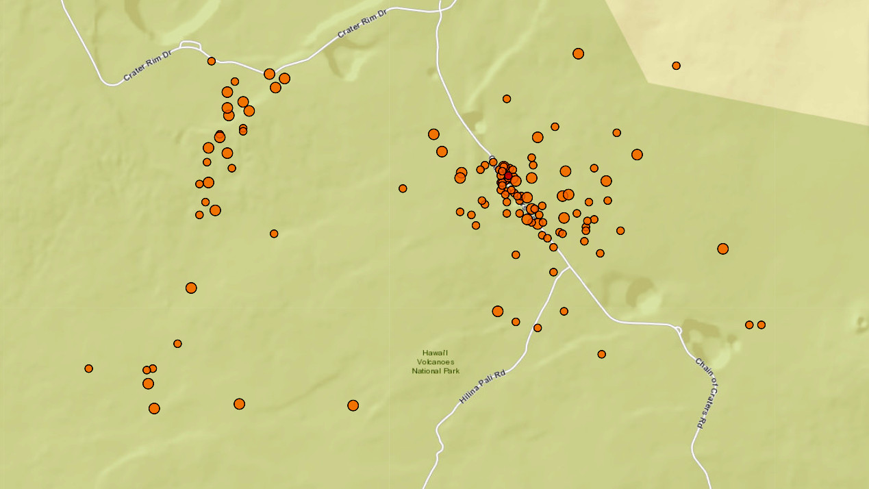
Summit and upper East Rift Zone Observations: Earthquake activity increased sharply just after midnight on April 27 beneath the upper East Rift Zone (between Puhimau Crater and Hilina Pali road) and beneath Kīlauea caldera south of Halemaʻumaʻu. Earthquakes are occurring at depths of 1.5-2.5 km (1-1.5 miles) beneath the surface. Earthquakes are occurring at rates of 10-15 per hour, compared to 2-5 per hour before April 27. Over the past 24 hours there were over 250 earthquakes beneath the upper East Rift Zone and about 50 earthquakes beneath the southern end of Kīlauea caldera. The largest earthquakes were between magnitudes 2 and 3, but most earthquakes were smaller than magnitude-2. Deeper earthquakes that were occurring 5-10 km (3-6 miles) directly beneath Kīlauea caldera over the past few weeks have ceased. Kīlaueaʻs summit remains inflated. Overall ground deformation rates remain low, with ongoing inflation of the summit and uplift south of the caldera. Tiltmeters near Uēkahuna and Sand Hill showed decreased rates of inflation and uplift overnight with the onset of a deflation-inflation (DI) event. Sulfur dioxide (SO2) gas emission rates remain low. An SO2 emission rate of approximately 52 tonnes per day was recorded on April 23.

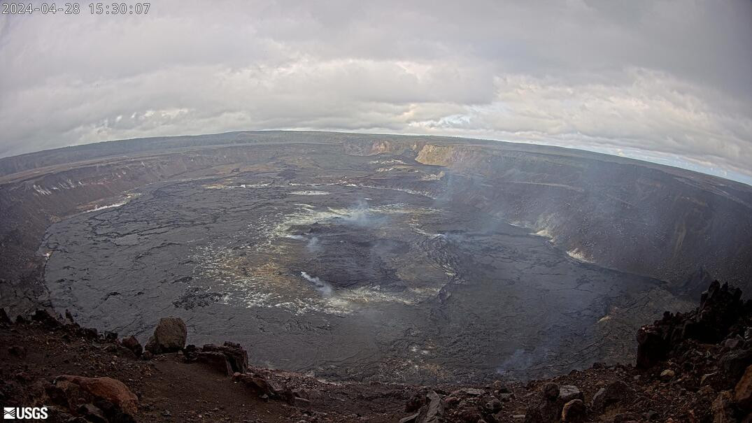
USGS webcam showing Halemaʻumaʻu and the down-dropped caldera floor from the west rim of the summit caldera.
Rift Zone Observations: All seismic activity on the East Rift Zone is confined to the upper East Rift Zone, with no significant earthquakes or deformation occurring past the Mauna Ulu region. Seismicity in Kīlauea’s Southwest Rift Zone remains low overall. Measurements from continuous gas monitoring stations downwind of Puʻuʻōʻō in the middle East Rift Zone—the site of 1983–2018 eruptive activity—continue to be below detection limits for SO2, indicating that SO2 emissions Puʻuʻōʻō are negligible.
The USGS Hawaiian Volcano Observatory says it will continue to provide daily updates while Kīlauea is at a heightened state of unrest. Should volcanic activity change significantly, a Volcanic Activity Notice will be issued.


by Big Island Video News3:39 pm
on at
STORY SUMMARY
HAWAIʻI VOLCANOES NATIONAL PARK - Hilina Pali Road is closed on the Upper East Rift Zone, where 250 earthquakes have occurred in the past 24 hours.