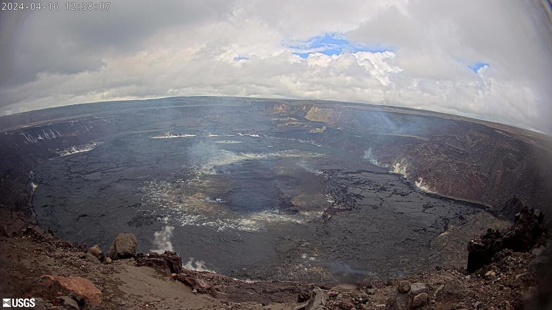
(BIVN) – Kīlauea volcano on the Island of Hawaiʻi is not erupting and the USGS Alert Level remains at ADVISORY.
Scientists with the USGS Hawaiian Volcano Observatory posted their weekly Kilauea update on Tuesday, reporting rates of seismic activity increased beneath the summit over the past week.
“Seismicity coupled with low rates of deformation indicate some magma continues to accumulate beneath the summit and south caldera region and also beneath the lower Southwest Rift Zone,” the USGS HVO wrote. “There are currently no signs of imminent eruption, but HVO continues to monitor activity at Kilauea volcano closely.”

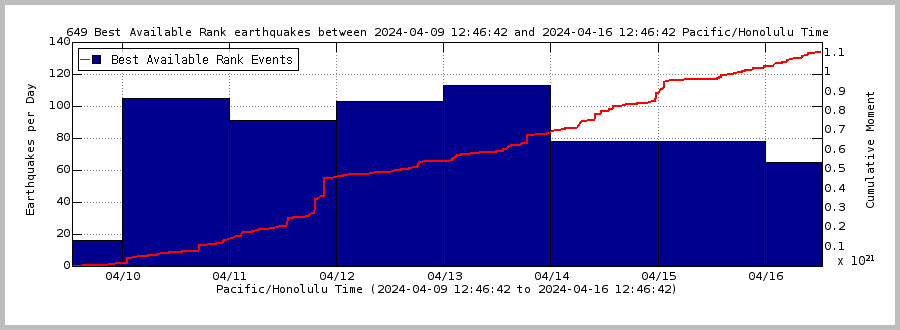
USGS graph shows earthquakes per day during the past week (blue bars). The red line is the cumulative moment (energy) release.
From this week’s USGS HVO update, published on Tuesday, April 16th:
Summit Observations: Rates of seismic activity beneath Kīlauea summit doubled over the past week. While the total number of detected events remains relatively low, brief sequences of elevated activity have occurred several times over the past week. Regions of elevated activity beneath Kīlauea summit include a sequence of deeper earthquakes (~8 mi below surface) beneath Kīlauea’s summit, and shallow earthquake activity (~1.5 mi below surface) within the volcano’s south caldera region. Magnitudes for these events are typically low (at or below M1+, sometimes too small to detect). Ground deformation continues to indicate low rates of long-term inflation across Kīlauea’s summit.
Sulfur dioxide (SO2) gas emissions have remained at low, noneruptive levels since October 2023. An SO2 emission rate of approximately 96 tonnes per day was recorded on April 8.
Rift Zone Observations: Low levels of seismicity continue beneath Koa’e fault zone and into the lower Southwest Rift Zone. Ground deformation, recorded by GPS instruments, shows on-going deformation across this region, a sign that magma continues to migrate downrift. No unusual activity has been noted along the East Rift Zone. We continue to closely monitor both rift zones.
Measurements from continuous gas monitoring stations downwind of Puʻuʻōʻō in the middle East Rift Zone—the site of 1983–2018 eruptive activity—remain below detection limits for SO2, indicating that SO2 emissions Puʻuʻōʻō are negligible.
Prognosis: Kīlauea’s magma system continues to recharge following the intrusion in late January and early February. The number of earthquakes beneath Kīlauea’s summit has slowly increased over the past month over intermittently elevated periods, some of which consist of earthquakes too small to detect or long-period events typical of fluid movement. While the number of earthquakes along the Koaʻe fault system and Southwest Rift Zone remains low, ground deformation patterns indicate that magma continues to be supplied to this region in the vicinity of the recent intrusion (more information on that event can be found here). Currently, this activity as a whole remains relatively low and HVO will continue to issue weekly updates on Tuesdays for Kīlauea. If activity continues to increase more consistently, HVO will begin issuing daily updates for Kīlauea.


by Big Island Video News1:35 pm
on at
STORY SUMMARY
HAWAIʻI VOLCANOES NATIONAL PARK - Magma continues to accumulate beneath the Kīlauea summit, south caldera region, and lower Southwest Rift Zone.