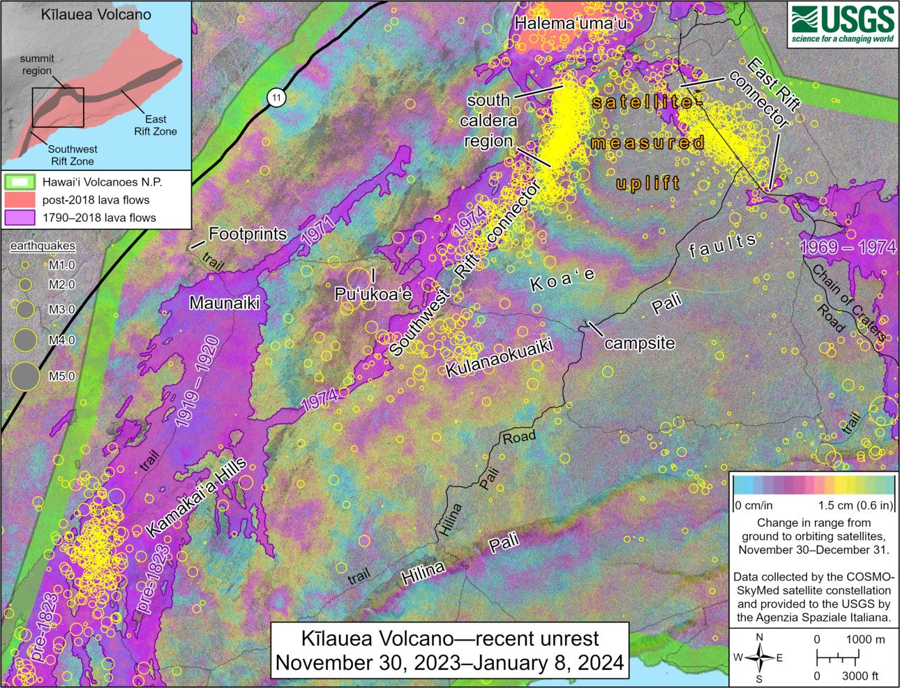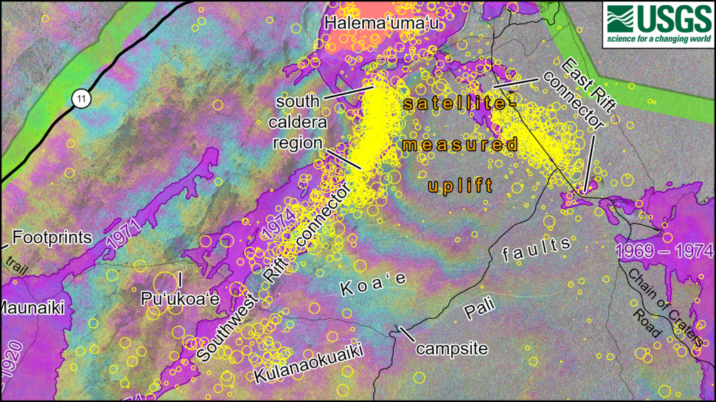
USGS: This map shows recent unrest at Kīlauea volcano. Yellow circles mark earthquake locations from November 30, 2023 through January 8, 2024, as recorded by HVO seismometers. Seismicity has been focused in several different regions of the volcano: the south caldera, the East Rift connector, the Southwest Rift connector (though at lower rates here than previous months), and near the Kamakaia Hills in the middle Southwest Rift Zone. Colored fringes in the map indicate areas of ground deformation from November 30–December 31, 2023, as measured by satellite radar. Each color cycle represents 1.5 cm (0.6 in) of ground motion toward the satellite, indicating uplift associated with magma accumulation.
(BIVN) – A new map published by the U.S. Geological Survey illustrates the signs of unrest at Kīlauea volcano over the last month.
The map summarizes earthquake locations and ground deformation around the Kīlauea summit, upper East Rift Zone, and Southwest Rift Zone from the period of November 30, 2023 through January 8, 2024.
Kīlauea is not erupting and has been relativley quiet over the past week. Seismicity has been low in the summit region, upper East Rift Zone, and Southwest Rift Zone.
From the USGS Hawaiian Volcano Observatory on Wednesday, January 10th:
Summit Observations: Over the past 24 hours, seismicity has remained low in Kīlauea’s summit region with approximately 8 small-magnitude earthquakes (less than M2) recorded beneath the caldera. The region south and southwest of the caldera remains quiet. Periods of increased shallow seismicity can be expected to continue during repressurization of the summit magma reservoir, which has been ongoing since the end of the September 2023 eruption. Seismicity has not reached the levels that immediately preceded recent summit eruptions at Kīlauea.
Kīlauea’s summit region remains at a high level of inflation; relative tilt is above the level reached prior to the most recent eruption in September 2023, and it is higher than at any time since the 2018 eruption. Summit tiltmeter stations switched to inflation yesterday morning, January 9, and that signal persists as of this morning.
Sulfur dioxide (SO2) gas emission rates remain low. Field measurements indicated an SO2 emission rate of approximately 80 tonnes per day on December 28, which was similar to measurements in October, November, and early December.
The swarm of earthquakes and rapid inflation that occurred south of the caldera on December 29 and 30 indicated that magma was being intruded at relatively shallow depths. Previous summit eruptions have been marked by similar swarms of earthquakes caused by magma moving towards the surface 1–2 hours before the appearance of lava. This type of earthquake activity is not being detected at this time and there are currently no signs of an imminent eruption at Kīlauea, however the volcano’s summit region remains at a state of heightened unrest.


by Big Island Video News2:56 pm
on at
STORY SUMMARY
HAWAIʻI VOLCANOES NATIONAL PARK - The new map summarizes ground deformation over the last month associated with periods of unrest at Kīlauea.