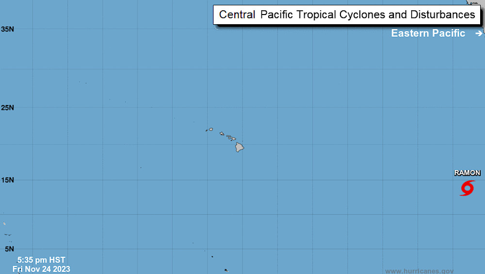
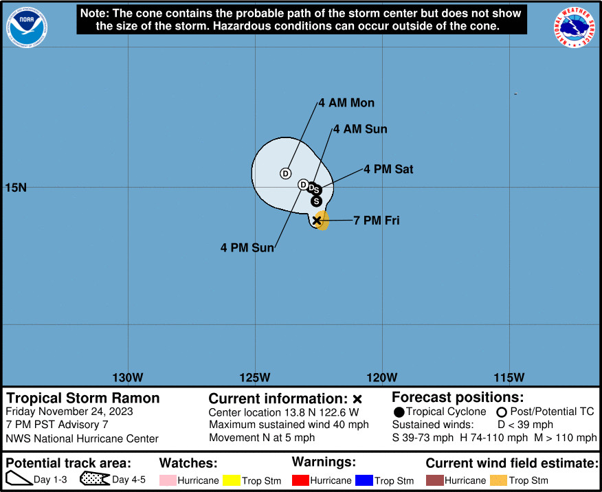
(BIVN) – Tropical Storm Ramon has formed in the Eastern Pacific, and was 2,185 miles east southeast of Hilo as of Saturday evening.
Ramon is not expected to last very long, and is not forecast to be a threat to Hawaiʻi. Forecasters say Ramon should briefly intensify overnight, and then weaken by Saturday night. The storm is likely to become a remnant low by Sunday.
From the National Hurricane Center:
Since the prior advisory, the tropical cyclone has become markedly better organized. A small central dense overcast has formed near the low-level center, with some modest evidence of banding along its northern and eastern semicircle. Subjective Dvorak estimates form both TAFB and SAB have been oscillating between 30-35 kt, with other objective intensity measures ranging from 33 kt from ADT, up to 39 kt from SATCON. Since the system does look better organized than earlier today, the intensity has been increased to 35 kt, upgrading Tropical Depression Twenty-E to Tropical Storm Ramon.
There might be a brief window for the storm to intensify a bit more overnight, with a shortwave trough riding along a subtropical jet north of Ramon resulting in a short-term boost in upper-level divergence over the cyclone. The divergence will also coincide with the nighttime diurnal convective maximum, which has been quite prominent the last few nights with this cyclone. However, the same shortwave trough is also progressive, and will soon lead to substantial increase in upper-level flow over of Ramon, resulting in a sharp increase in westerly vertical wind shear. Thus, after a brief period of intensification overnight, weakening is expected to begin tomorrow, with the system still forecast to become a remnant low on Sunday with dissipation shortly thereafter. This intensity forecast is shifted a bit closer to the the HCCA consensus aid, which favors the hurricane-regional model solutions more than the lower SHIPS/LGEM guidance.
The center of Ramon may have reformed closer to the deep convection earlier today, and its motion is a somewhat uncertain north drift at 360/4 kt. A mid-level ridge centered to the east of Ramon should lead to the cyclone moving slowly northward in the short term. However, as the storm encounters the very hostile upper-level environment, it should become vertically shallow, leaving the low-level center to be steered slowly west-northwestward by a weak low-level ridge by the end of the weekend. The latest track forecast shows a bit more of a northward motion early on, but falls back close to the previous track, just a bit east of the simple and corrected track aids.


by Big Island Video News6:26 pm
on at
STORY SUMMARY
HAWAIʻI - Ramon is forecast to intensify for a short time, and then weaken by tomorrow night, likely becoming a remnant low by Sunday.