(BIVN) – The volcanic unrest at Kīlauea volcano persists with moderate levels of seismicity, and no signs of an imminent eruption. The volcano alert level remains at ADVISORY.
A summit tiltmeter, located northwest of the caldera, has indicated a minor deflation episode over the past 2 days. Overall inflation still remains high, and is above the level reached prior to the most recent eruption in September.
The number of earthquakes also appears to be down compared to the day before, suggesting the recent swarm located immediately south of Kīlauea’s caldera which began on November 10th, may be about to enter another waning phase.
Scientists expect the unrest will continue to wax and wane with changes to the input of magma into the area. The USGS Hawaiian Volcano Observatory continues to say eruptive activity could occur in the near future with little or no warning.
From the USGS HVO on Thursday, Nov. 16:
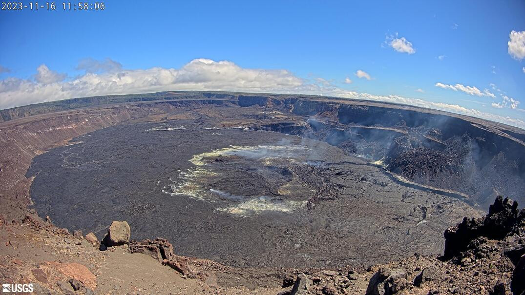
Summit Observations: Moderate levels of seismicity continue after a swarm started on Friday, November 10th. Activity is primarily occurring within and immediately south of Kīlauea’s caldera and extending towards the southwest. HVO continues to monitor this activity.
The Uēkahuna summit tiltmeter, located northwest of the caldera, has indicated a minor deflation episode at the summit over the past 2 days. However, overall, the summit of Kīlauea remains at a high level of inflation, above the level reached prior to the most recent eruption in September 2023.
Sulfur dioxide (SO2) emission rates remain low and were measured at a rate of about 100 tonnes per day on October 19, 2023.
There is currently no sign of an imminent eruption, but eruptive activity is possible in the coming weeks or months. Increased inflation and earthquake activity (heightened unrest) are expected to precede an eruption. The onsets of previous summit eruptions have been marked by strong swarms of earthquakes caused by the emplacement of a dike 1-2 hours before eruptions.
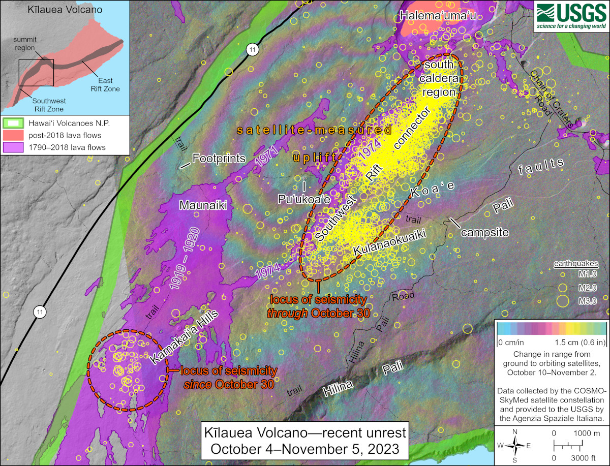
USGS: “This map shows recent unrest at Kīlauea’s summit and Southwest Rift Zone. Yellow circles denote earthquake locations from October 4–November 5, 2023, as recorded by HVO seismometers. Through October 30, most of these events were occurring closer to the summit in an area known as the Southwest Rift connector, but since October 30 there has been a slight increase in seismicity below the Kamakaiʻa Hills in the middle Southwest Rift Zone. Colored fringes denote areas of ground deformation from October 10–November 2, as measured by satellite radar. Each color cycle represents 1.5 cm (0.6 in) of ground motion toward the satellite, indicating uplift associated with a magmatic intrusion.”
Rift Zone Observations: Over the past week, a small cluster of several dozen earthquakes has occurred along the Southwest Rift Zone. Most events have been smaller than magnitude-2 and have located in the middle of the Southwest Rift Zone, at depths of 1-3 miles (1-5 km) below sea level. We continue to closely monitor this area. There have been several minor episodes of seismicity in the Upper East Rift zone in the past month, but no unusual activity has been noted along the rest of the East Rift Zone. Measurements from continuous gas monitoring stations downwind of Puʻuʻōʻō in the middle East Rift Zone have been below detection limits for SO2, indicating that SO2 emissions from Puʻuʻōʻō are negligible.

by Big Island Video News
on at
STORY SUMMARY
HAWAIʻI VOLCANOES NATIONAL PARK - Kilauea volcano on Hawaiʻi island is not erupting, and the USGS Alert Level remains at ADVISORY.