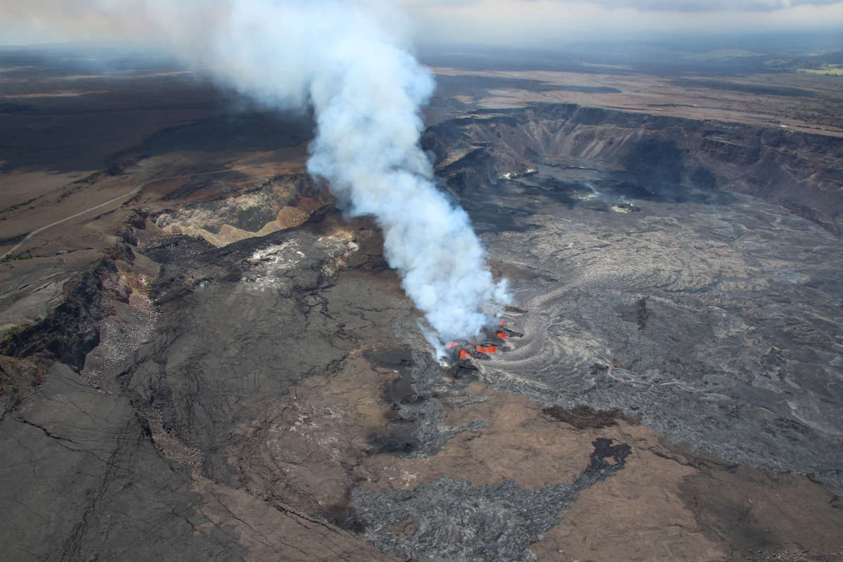
USGS: “An aerial view of the eruption at the summit of Kīlauea at approximately 12:30 p.m. H.S.T. on September 12, 2023. Multiple minor fountains remain active on the downdropped block within Kīlauea’s summit caldera. Lava flows emplaced since September 10, 2023, have surrounded older fissures from the April 1982 eruption, visible as darker brown vents in the center right of the photo.” (USGS photo by N. Deligne)
(BIVN) – The eruption of Kīlauea continues, with all activity confined to the summit caldera in Hawaiʻi Volcanoes National Park. The USGS Volcano Alert Level remains at WATCH.
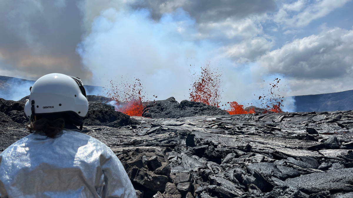
New photos posted to the Hawaiian Volcano Observatory website show recent views of the lava emerging from the east portion of Halemaʻumaʻu crater and on the downdropped block which formed during the 2018 summit collapse.
On September 12, as they were conducting a helicopter overflight, HVO scientists found a safe location to land on the downdropped block in order to retrieve “seismic nodes, which had been deployed during the Kīlauea Seismic Imaging Project earlier this year”, the USGS reported. They also collected samples of tephra from the now-inactive easternmost fissures of the new eruption. Scientists say these samples will be analyzed to better understand how and why the new eruption occurred.
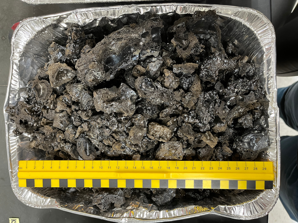
USGS: “Tephra created within approximately the first 18 hours of the eruption that began in Kīlauea caldera the afternoon of Sunday, September 10, were collected on September 12, 2023, and dried in the lab overnight.” (USGS photo by K. Lynn)
The samples “will be processed for various analyses to determine what the lava composition is and what minerals it might contain, such as olivine”, HVO wrote.
USGS reported on Wednesday that summit seismic activity “is dominated by eruptive tremor (a signal associated with fluid movement) with very few volcano tectonic earthquakes.” The most recent sulfur dioxide (SO2) emission rate measurement, taken on the morning of September 10th, was 30,000 tonnes per day.
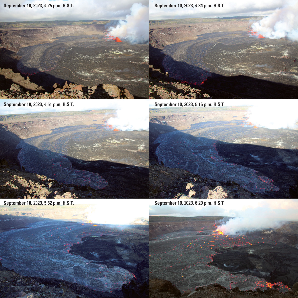
USGS: “Kīlauea started erupting on September 10, 2023, at approximately 3:15 p.m. H.S.T., from fissures which extended from the eastern margin of Halema‘uma‘u crater and onto the down-dropped block to the east within Kīlauea’s summit caldera. A large proportion of the erupted lava flowed northward until it encountered cliffs around Halema‘uma‘u crater and the summit caldera. This series of photos, taken from the western rim of Halema‘uma‘u looking east, shows lava flow advancing counterclockwise along the north (left) and then northwest (bottom) margin of Halema‘uma‘u. The first photo (top left) is from approximately 1 hour and 10 minutes after the eruption started, and the last photo (bottom right) is from approximately 3 hours and 5 minutes after the eruption started.” (USGS image by N. Deligne)

by Big Island Video News
on at
STORY SUMMARY
HAWAIʻI VOLCANOES NATIONAL PARK - Scientists were again at the summit caldera, collecting samples that will be analyzed to better understand how and why the new eruption occurred.