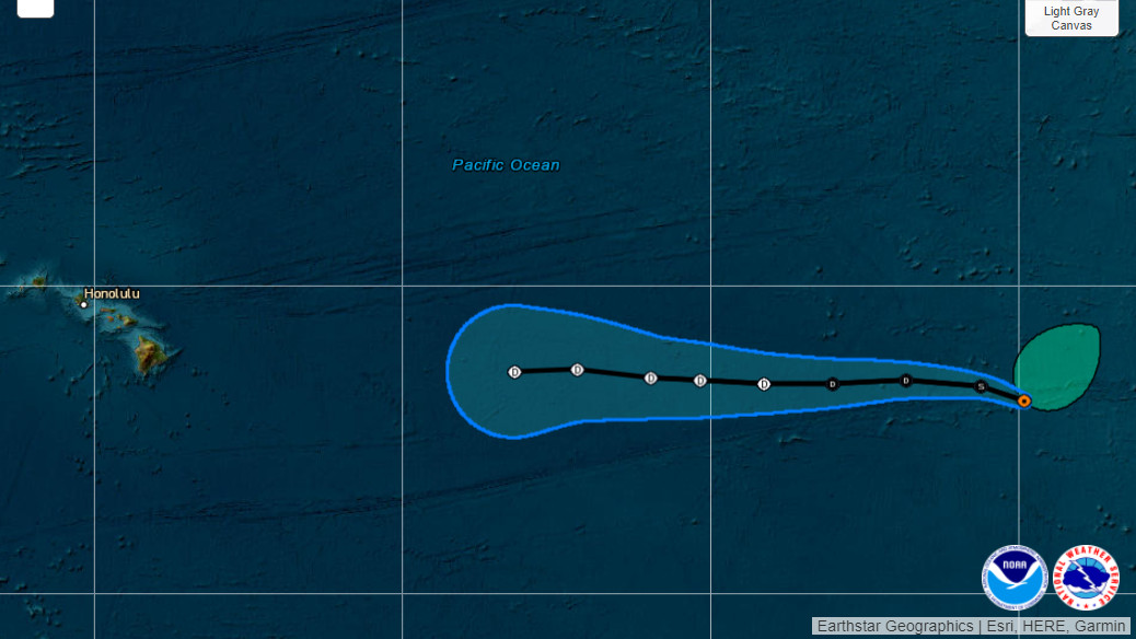
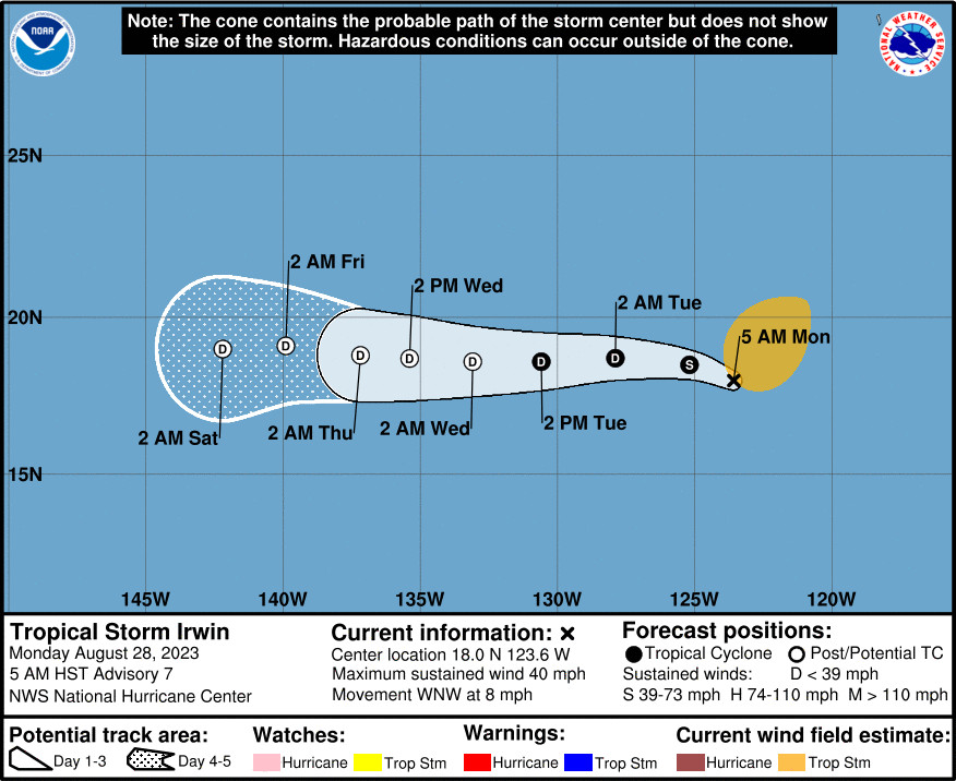
(BIVN) – There is a new tropical storm in the Eastern Pacific.
As of 5 a.m., Tropical Storm Irwin was 2,060 miles east of Hilo. The storm is moving west-northwest at 8 mph, with maximum sustained winds of 40 mph. Irwin is a large storm, with tropical-storm-force winds extending outward up to 255 miles from the center.
Irwin is expected to gradually weaken, and is forecast to become a remnant low by Wednesday, if not sooner.
From the National Hurricane Center:
Irwin continues to be a disheveled tropical cyclone. Infrared satellite imagery has shown a recent burst of convection just north of the estimated center and data from a microwave satellite pass at 0927 UTC indicates there is a curved band around the eastern portion of the semicircle. Objective and subjective satellite estimates range from 32-39 kt and the initial intensity is held at 35 kt as a blend of these measurements.
The tropical storm is moving west-northwestward at 7 kt. The cyclone is expected to turn westward in the low-level flow shortly and continue in this direction with an increase in forward speed for the next several days. The most recent forecast has shifted slightly north of the previous prediction and lies near the various consensus aids.
Irwin is crossing over a cooling gradient of sea surface temperatures and into a dry and stable environment. Simulated satellite imagery from global models suggests that the cyclone should be devoid of convection within 48 hours. Only minor adjustments have been made to the intensity forecast and it now shows Irwin becoming a remnant low in a couple of days.


by Big Island Video News6:56 am
on at
STORY SUMMARY
HAWAIʻI ISLAND - Tropical Storm Irwin is expected to gradually weaken as it moves west, and is forecast to become a remnant low by Wednesday.