(BIVN) – Tropical Storm Fernanda has formed in the Eastern Pacific, and is heading westward, as Hawaiʻi struggles to recover from the deadly fires on Maui that were spread by the winds generated, in part, by the recent passing of Hurricane Dora to the south.
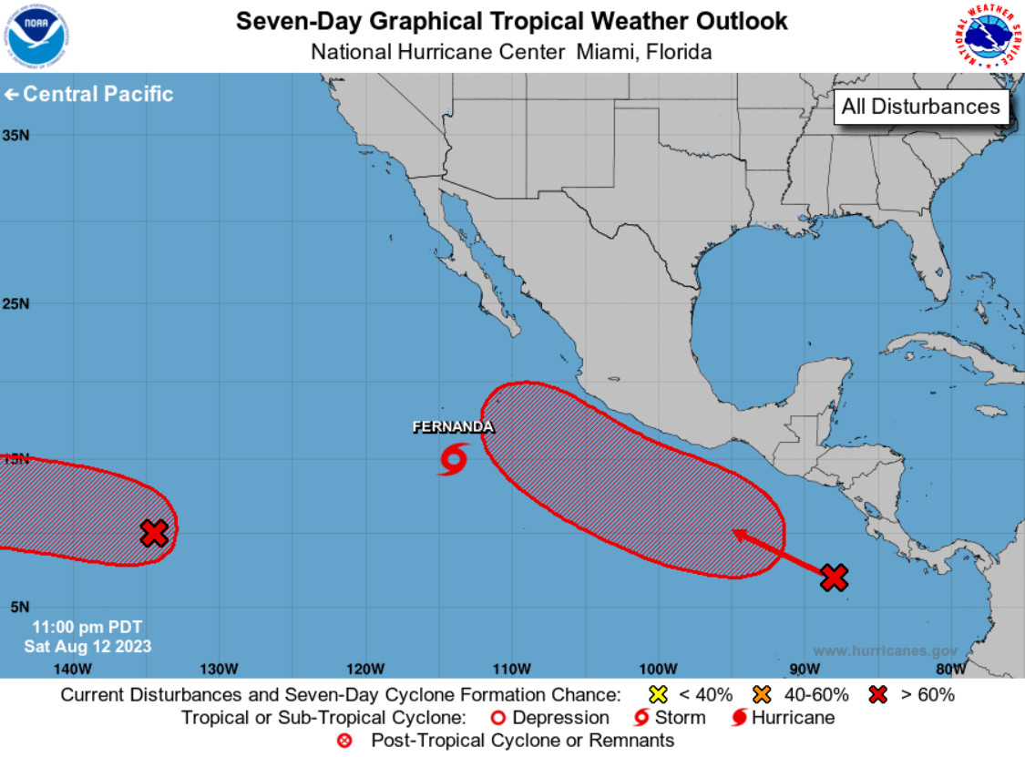
Fernanda is the first storm to form out of three tropical disturbances in the Pacific that are being monitored by forecasters.
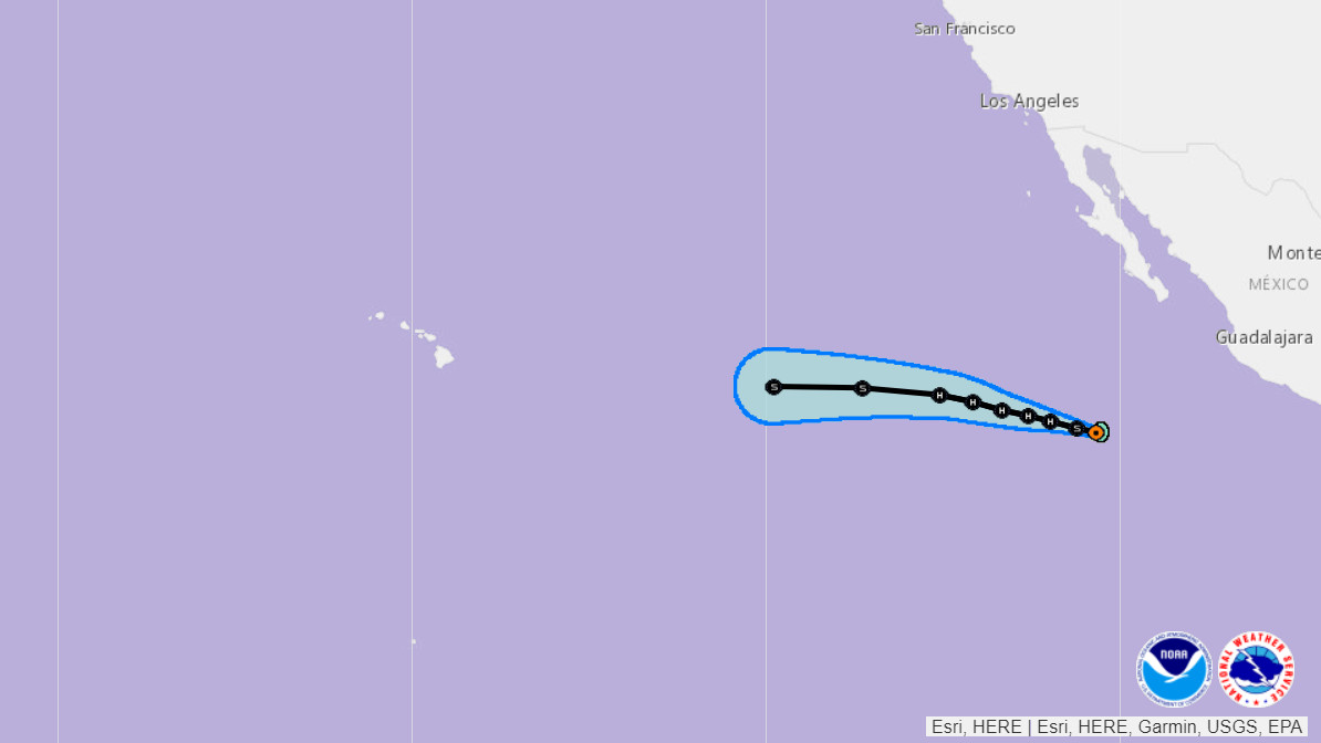
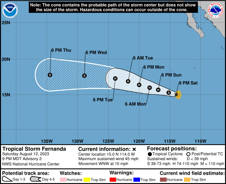
As of Saturday evening, Tropical Storm Fernanda was 610 miles south southwest of the southern tip of Baja California, and heading west-northwest near 10 mph. Maximum sustained winds have increased to near 45 mph, and Fernanda is expected to become a hurricane by Monday.
A closer system was located about 1,500 miles east-southeast of Hilo as of Saturday afternoon. The “broad area of low pressure associated with a tropical wave is producing a large area of disorganized showers and thunderstorms well to the east-southeast of the Hawaiian Islands,” the Central Pacific Hurricane Center reported. “Conditions appear conducive for development of this system, and a tropical depression is likely to form during the next few days while moving toward the west or west-northwest at about 10 mph across the far East Pacific basin, crossing into the Central Pacific basin late Sunday.”
A third tropical disturbance is located off the Coast of Southern Mexico, and is expected to develop into a tropical depression during the early or middle part of next week.
Concerning the closest tropical disturbance, the National Weather Service in Honolulu said the potential tropical cyclone “would be significantly different than what was experienced during Dora,” because the winds are not expected to be nearly as strong.
Over 2,000 structures were damaged or destroyed in Maui’s fast moving fire. The number of confirmed deaths on the island continues to rise, and was reported to be 89 on Saturday afternoon.
Concerning Tropical Storm Fernanda, the National Hurricane Center wrote on Saturday evening:
Satellite imagery indicates that the storm is producing more organized convection and curved bands now wrap about half way around the center. The system appears to be on a strengthening trend with visible satellite images showing a compact structure. The initial intensity has increased up to 40 kt, which is slightly above the latest Dvorak estimates, making it a tropical storm.
Fernanda is moving to the west-northwest at about 9 kt. This general motion is expected to continue through the next few days at a slower pace as it moves towards a weakness in the subtropical ridge. Around mid-week, the system is anticipated to move more westward at a faster forward speed due to a strengthening ridge to its north. There is some spread in the models, especially at days 4 and 5, but they generally agree on the future track. No significant changes were made from the previous forecast.
Steady to rapid intensification is possible during the next 36 hours as Fernanda remains over warm 29C waters in low wind shear conditions. Fernanda could reach a peak intensity around 80 kt Monday and Tuesday, and some models suggest a slightly higher strength. By late Tuesday, the system is expected to move over cooler waters and into a drier environment which should lead to a weakening trend. The new NHC forecast shows the intensity increase at a faster rate during the next 24 to 36 hours.


by Big Island Video News8:03 pm
on at
STORY SUMMARY
HAWAIʻI - Three tropical disturbances are developing in the Pacific, less than a week after winds associated with passing Hurricane Dora devastated Maui.