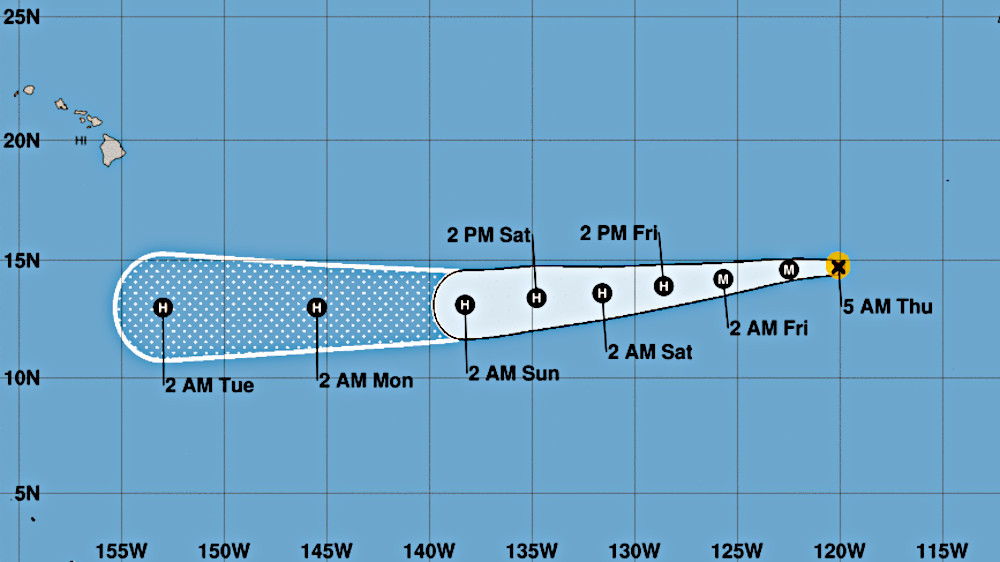
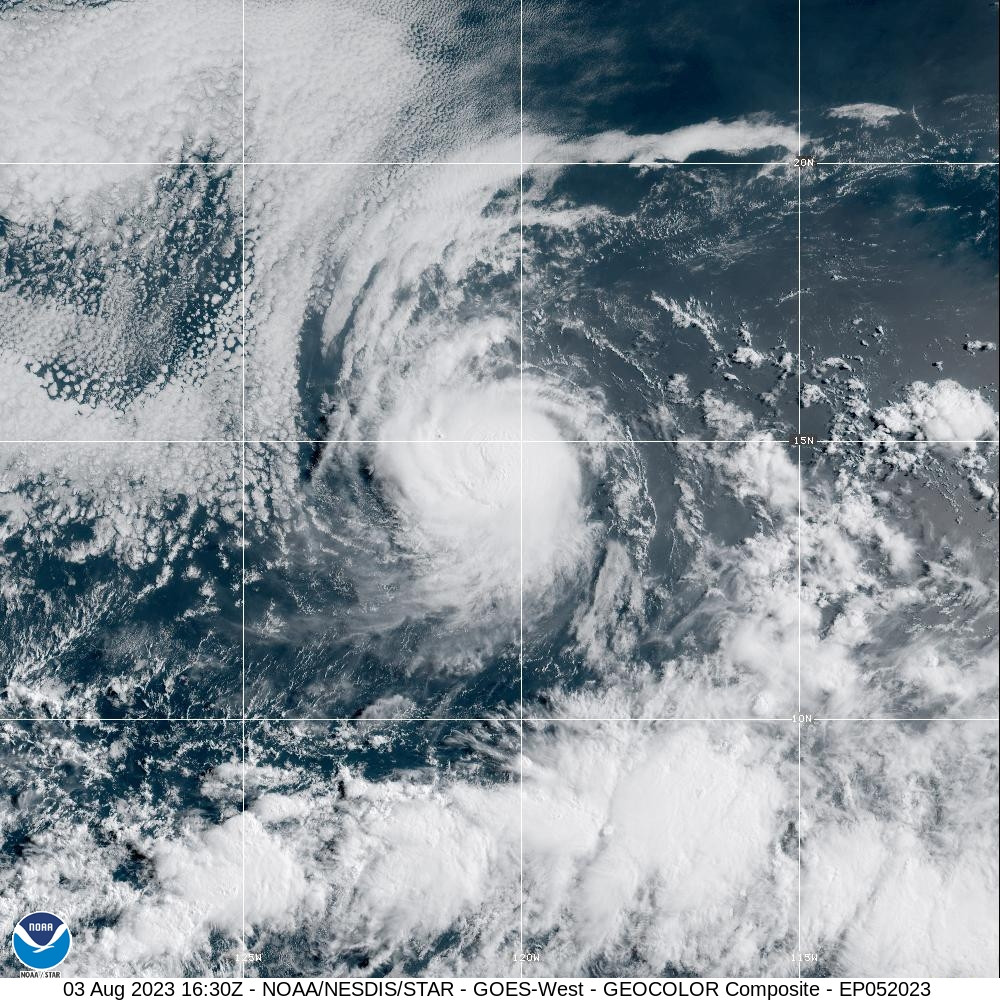
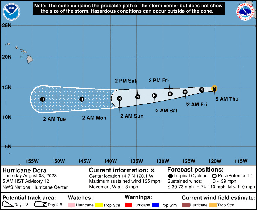
(BIVN) – Hurricane Dora, now a category 3 on the Saffir-Simpson Hurricane Wind Scale and a major hurricane in the Eastern Pacific, continues to move toward the west near 18 mph.
As of 5 a.m. HST, Dora was 2,325 miles east southeast of Hilo, with maximum sustained winds near 125 mph with higher gusts. Forecasters say Dora has likely peaked in intensity, and expect to see gradual weakening during the next couple of days.
Hurricane Dora is expected to track to the south of Hawaiʻi next week. From the National Weather Service in Honolulu:
A transition period is anticipated Sunday through early next week as the ridge strengthens to the north and Hurricane Dora enters the central Pacific on a westward track. Some moisture is forecast to pool northward into the area as an upper disturbance settles southward over the region Sunday night into Monday. This moisture combined with trades potentially becoming strong as the gradient tightens will support a brief period with higher rainfall chances. Thereafter, very dry and windy conditions (low inversion w/ 50 kt winds at 850 mb) are expected across the state as upper heights rise and Dora passes well to the south.
From the National Hurricane Center discussion at 5 a.m. HST:
Dora’s rapid intensification has ended during the past several hours. While the eyewall cloud tops remain quite cold, the eye has become cloud-filled and indistinct. The various subjective and objective satellite intensity estimates have decreased a little, so based on this the initial intensity is set at 110 kt.
The initial motion is now 265/16. As mentioned in the previous forecast discussion, a well-established low- to mid-level ridge north of Dora is expected to maintain this general motion for the next several days. The track guidance remains tightly clustered in both speed and direction, and the new forecast track, which is close to the consensus models, has only minor adjustments from the previous forecast.
Dora has likely peaked in intensity. While the storm is currently over sea surface temperatures near 28C, the global model forecasts indicate that increasing upper-level easterly winds should produce shear during the next 36-48 h, and this is likely to cause problems for the small inner core. Thus, the intensity forecast follows the trend of the guidance in showing weakening during this time. After 48 h, the shear is forecast to decrease while Dora is over water temperatures of 26-27C. The intensity guidance during this time shows a more gradual weakening than what is expected earlier in the forecast period, and this part of the intensity forecast is near or a little below the intensity consensus. Uncertainty remains high with the intensity forecast since this compact system could be more prone than normal to rapid intensity fluctuations.


by Big Island Video News7:24 am
on at
STORY SUMMARY
HONOLULU, Hawaiʻi - Hurricane Dora has likely peaked in intensity, and is expected to gradually weaken during the next couple of days.