August 1st Tropical Briefing from the NHC in Miami, FL. (August 1, 2023)
(BIVN) – The next tropical storm has formed in the Eastern Pacific, and is expected to intensify into a major hurricane as it moves west.
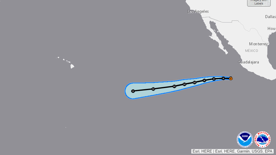
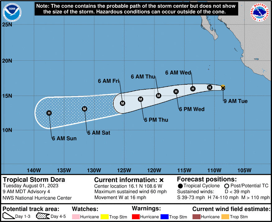
Tropical Storm Dora is about 345 miles southwest of Manzanillo, Mexico, and moving toward the west near 16 mph. “Rapid intensification is forecast during the next 24-36 hours and Dora could become a major hurricane towards the latter half of this week,” the National Hurricane Center in Miami reported, adding that “a gradual turn towards the west-southwest is expected over the next few days.”
Dora appears to be tracking towards the Central Pacific, well to the south of Hawaiʻi.
From the National Hurricane Center at 5 a.m. HST:
Dora is wasting no time getting better organized this morning and may be in the initial stages of rapid intensification. The storm’s structure has improved, with a prominent cold curved band seen on its northern semicircle rotating into a developing central dense overcast near the estimated center is. An earlier F-18 SSMIS pass at 1058 UTC also suggested a formative inner core was taking shape. Subjective intensity estimates from TAFB and SAB were T3.5/55 kt and T3.0/45 kt respectively. The objective intensity estimates currently have a large spread from 36-56 kt, depending on exactly where the center is. Dora’s initial intensity for this advisory is on the higher side of those estimates at 50 kt.
Dora is moving just north of due west this morning at 280/14 kt. The track philosophy has not changed much this cycle, with a large mid-level ridge expected to build westward to the north and ahead of Dora. This evolution should result in Dora maintaining its forward motion as it begins a gradual turn to the west-southwest over the next 2-3 days. The track guidance is ever so slightly faster than the previous cycle, and the official forecast is a bit faster than before, following a blend of the latest HCCA and TVCE consensus aids.
All systems appear go for Dora to intensify a substantial amount over the next several days. GFS SHIPS-derived shear is under 10 kt for the entire forecast period, and sea-surface temperatures (SSTs) also remain above 28 C for at least the next 48 h. Dora is a small tropical cyclone, which can be prone to rapid intensity changes. The only factor that could prevent robust intensification in the short term is dry air entrainment disrupting the formative inner core. With that said, rapid intensification (RI) indices have sharply increased, with DTOPS now indicating a 70 percent chance of RI over the next 24 hours. Given this guidance, the official forecast will now explicitly show RI over the next 24-36 h, with a higher peak intensity, taking Dora to major hurricane intensity in the next 48 hours. This part of the intensity forecast is in best agreement with the latest HCCA intensity aid, but remains lower than the latest HAFS-A/B runs. Towards the end of the forecast period, Dora will begin exploring cooler 26-27 C SSTs along its track, which may initiate some gradual weakening.


by Big Island Video News7:30 am
on at
STORY SUMMARY
HONOLULU - Tropical Storm Dora appears to be tracking towards the Central Pacific, well to the south of Hawaiʻi.