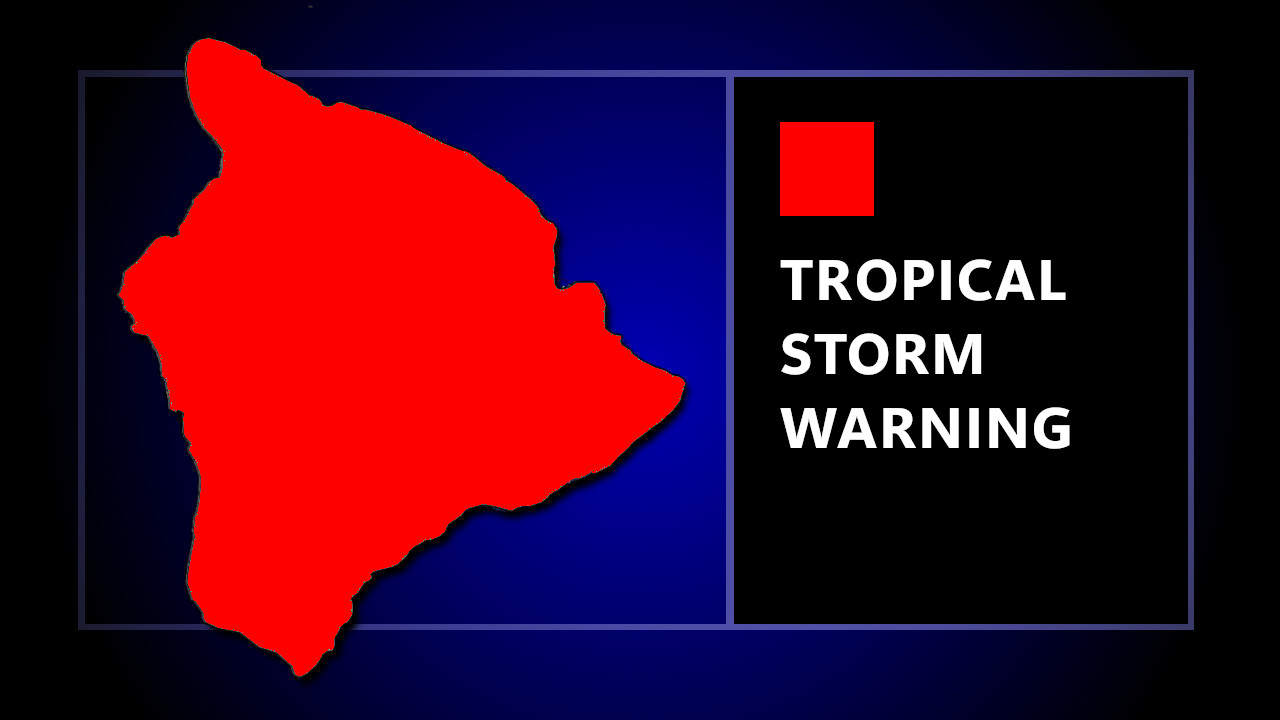
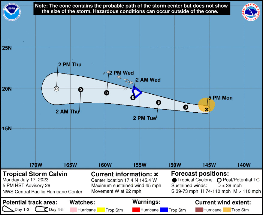
(BIVN) – A Tropical Storm Warning has been issued for Hawaiʻi County, as Tropical Storm Calvin is forecast to pass over or very close to the Big Island on Tuesday night.
Along with the Tropical Storm Warning, a Flood Watch will also be in effect for the entire island starting Tuesday evening, and a High Surf Warning will be in place for east and south-facing shores from Tuesday at 6 p.m. to Wednesday at 6 p.m.
Calvin’s maximum sustained winds are near 45 mph with higher gusts. These high winds extend outward up to 105 miles from the center of the storm. Calvin is forecast to gradually weaken during the next several days.
Forecasters say the primary threat posed by Calvin will be flash flooding, especially over the Big Island. “From Tuesday night into Thursday, storm total rainfall amounts of 4-8 inches, with maximum amounts of 10 inches are possible, mainly along the windward areas of the Big Island of Hawaii,” the Central Pacific Hurricane Center says. “Storm total rainfall amounts of 1-4 inches are expected elsewhere in the state. This rainfall could lead to localized flash flooding and mudslides.”
Details on the potential rainfall were provided by the National Weather Service in Honolulu:
It should be noted that flash flood potential will be heavily track- dependent. In particular, a slightly more southerly track will re- focus the heaviest rain over the eastern and southeast-facing slopes of the Big Island while a reduced orographic contribution likely results in a reduced coverage of deep convection and high- end rain rates. A slightly more northerly track, however, results in an ideal superposition of strong cyclonic onshore flow, deep tropical moisture, and orographic support over Windward Big Island and probably Windward Maui. In this case, strong terrain-induced ascent would have the greatest potential to penetrate the mid- level stable layer (around 20kft AGL) that is otherwise providing a cap on Calvin’s rainfall potential. Thus, despite the fast forward motion, there still exists a window of several hours overnight Tuesday during which rain rates may reach 2″/hr (higher in thunderstorms) with storm totals approaching 10″ in spots. The peak period of concern at this time is approximately 6pm Tuesday through 6am Wednesday with the greatest potential for higher end rain rates occurring after midnight Tuesday night. The flash flood threat diminishes with westward extent as the moisture plume works up the island chain during Wednesday.
With tropical storm conditions expected within the warning area starting Tuesday night, there is a “potential for wind 39 to 57 mph” which could bring limited damage such as broken tree limbs, and damage to awnings and carports. Also, the “situation is somewhat favorable for tornadoes”, forecasters say.
Along the shore, a rapid increase in surf is expected Tuesday and Wednesday. Dangerously large and disorganized waves of 10 to 15 feet in height are possible. Waves breaking in channel entrances may make navigating the channels dangerous, officials say. “Surf heights will quickly decrease on Wednesday as Calvin moves further west and away from the Big Island,” the National Weather Service says.
From the Central Pacific Hurricane Center discussion at 5 p.m. HST:
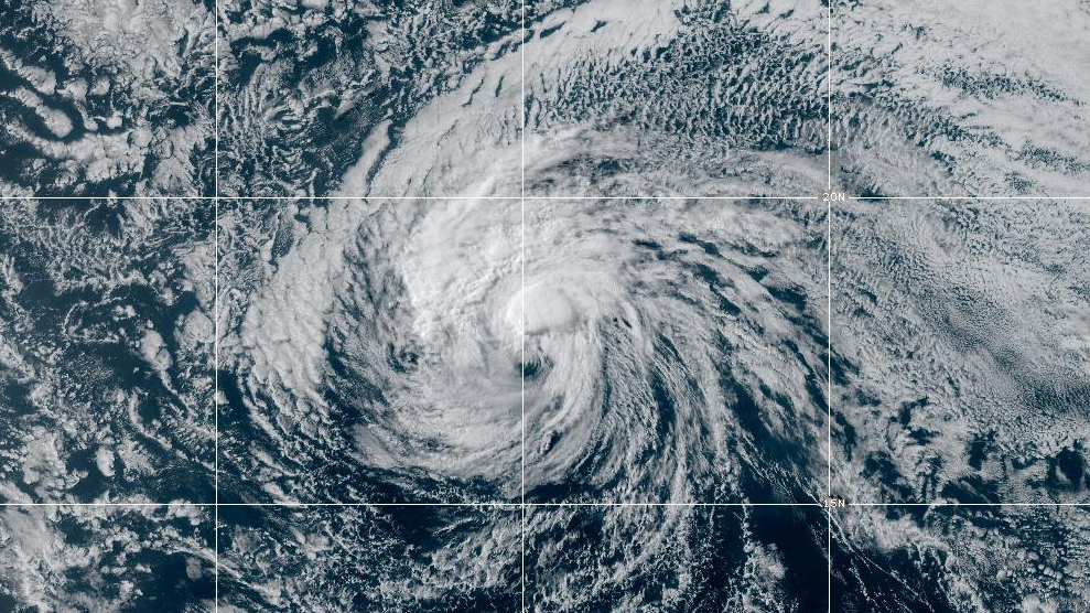
Satellite data showed an exposed low-level circulation all day. Although most of the deep convection today remained in the outer circulation in the northern semicircle, recent images showed some deep convection developing closer to the center. A US Air Force Reserve WC-130J completed its recon mission this morning. The next mission will be flown to support tonight’s forecast packages. Subjective Dvorak intensity estimates came in at 35 kt for PHFO and JTWC. The latest CIMSS SATCON showed 43 kt. The initial intensity for this advisory is 40 kt based on a blend of these estimates.
The initial motion for this advisory is 275/19 kt as Calvin moves quickly westward to the south of a subtropical ridge. This speed is a slight increase from the previous package. This steering is expected to continue over the next several days. The dynamical guidance indicates that the center of Calvin will pass over or just south of the Big Island on Tuesday night. The track forecast is close to the previous forecast, but is a bit faster. It is also close to the HCCA guidance.
The surrounding environment around Calvin continues to be dry and stable with SSTs around 24-25C. As Calvin moves westward, the SSTs will gradually increase, with values of 26-27C around the main Hawaiian Islands. The higher SSTs may result in deep convection becoming better developed, which is suggested by model-simulated satellite imagery from some of the dynamical models. This is should keep Calvin at tropical storm intensity by the time it reaches the Big Island. As a result, Hawaii County has been put in a Tropical Storm Warning starting with this advisory. Calvin will also be affected by an upper tropospheric trough in about 36-48 hrs. The trough will increase the vertical shear over the tropical cyclone and result post-tropical/remnant low status Wednesday night or more likely Thursday.
KEY MESSAGES:
1. Calvin is forecast to pass over or very close to Hawaii County Tuesday night, bringing a period of heavy rain, high surf and locally strong winds. Calvin is expected to weaken as it moves westward to the south of the other Hawaiian Islands Wednesday and Wednesday night, bringing the potential for some peripheral impacts.
2. It is important to not focus on the exact forecast track and intensity when preparing for Calvin. Persons in Hawaii County should prepare now through Tuesday for impacts prior to the onset of tropical storm force winds. These impacts could include flash flooding, damaging winds, and large and dangerous surf.


by Big Island Video News5:49 pm
on at
STORY SUMMARY
HAWAIʻI ISLAND - Tropical storm conditions are expected to impact Hawaiʻi island within 36 hours, as Tropical Storm Calvin approaches the islands.