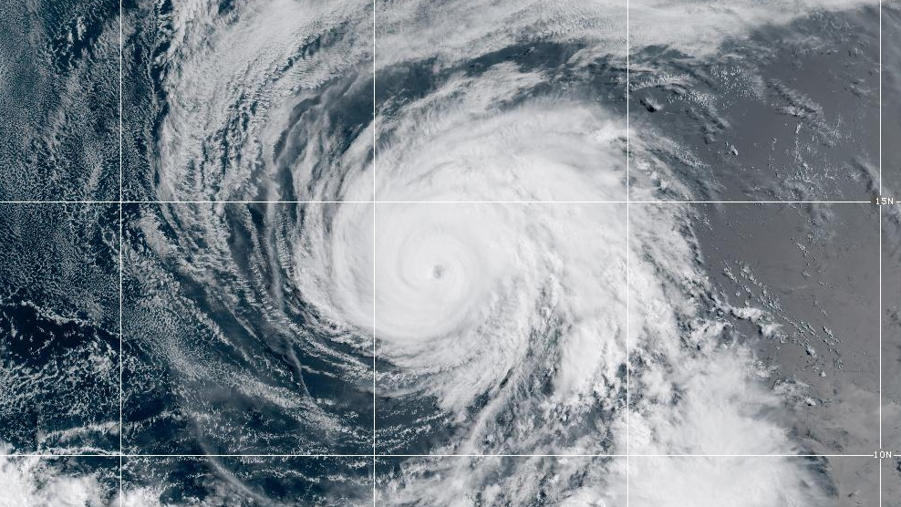
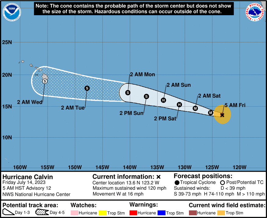
(BIVN) – Calvin has rapidly intensified into a major hurricane, with maximum sustained winds are near 120 mph (195 km/h) with higher gusts.
As of 5 a.m. HST on Friday morning, Hurricane Calvin was 2,140 miles east-southeast of Hilo.
Forecasters say some additional strengthening is possible today, as Calvin heads west in the Eastern Pacific. Then, weakening is expected to begin on Saturday, and continue through early next week as Calvin nears Hawaiʻi.
Calvin – or its remnants – will likely impact Hawaiʻi beginning next Tuesday, but forecasters say it is still too early for details.
The National Weather Service in Honolulu says impacts could begin as early as Tuesday into Wednesday of next week. “Impacts to the state could include high surf, heavy rain, strong winds, or all of the above,” the local forecasters said.
From the 5 a.m. discussion by the National Hurricane Center:
Calvin has rapidly intensified since yesterday morning. The latest geostationary satellite imagery shows the hurricane has a warm and well-defined 15 n-mi-wide eye, with a pronounced ring of deep convection surrounding it in recent passive microwave imagery. The latest subjective Dvorak estimates are a consensus T5.5/102 kt from TAFB and SAB, and the various objective estimates have continued to rise this morning and range from 96-110 kt. The initial intensity is raised to 105 kt for this advisory, making Calvin the first major hurricane of the 2023 eastern Pacific season.
Some additional strengthening is possible today as Calvin remains embedded within a moist, low-shear environment over sufficiently warm sea-surface temperatures (SST). The hurricane is expected to cross the 26C SST isotherm by tomorrow, which should cause its intensity to level off and eventually induce some weakening as it moves over cooler waters. Early next week, Calvin is likely to continue weakening as it encounters less favorable environmental conditions with increased deep-layer shear and a drier mid-level environment along its track. Based on recent intensity trends, the updated NHC forecast lies above the multi-model consensus aids through 48 h, then more closely agrees with HCCA and IVCN through the rest of the period.
Calvin’s long-term motion is still westward, or 280/14 kt. A well-established subtropical ridge over the eastern Pacific will steer Calvin generally westward to west-northwestward through early next week. The track models remain in very good agreement with little cross-track spread noted throughout the forecast period, and the latest NHC forecast is essentially an update of the previous one. This brings Calvin across 140W and into the central Pacific basin by early Monday morning, then toward the Hawaiian Islands thereafter. Given uncertainties about the status and intensity of Calvin near the end of the 5-day period, interests in Hawaii should closely monitor the latest forecast updates.


by Big Island Video News7:58 am
on at
STORY SUMMARY
HONOLULU, Hawaiʻi - Calvin is a category 3 hurricane on the Saffir-Simpson Hurricane Wind Scale, with some additional strengthening possible as it churns in the Eastern Pacific.