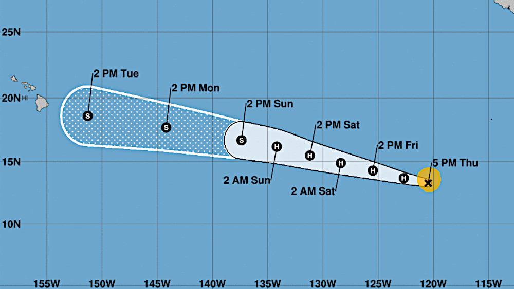
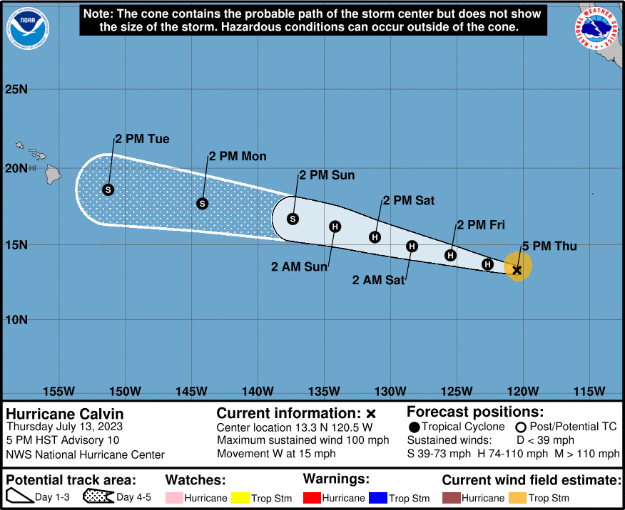
(BIVN) – Hurricane Calvin, located 2,325 miles east southeast of Hilo as of 5 p.m. HST, gained strength as it moved east through the Eastern Pacific on Thursday. The National Hurricane Center reports maximum sustained winds have increased to near 100 mph (155 km/h) with higher gusts, with some additional strengthening expected during the next day or so.
Calvin is expected to move into the Central Pacific Basin late Sunday, and is likely to impact Hawaiʻi beginning next Tuesday, but forecasters say it is too early to know the details.
“It is too early to specify details regarding impacts to the main Hawaiian Islands from Calvin, however, the likelihood of impacts could begin as early as Tuesday into Wednesday of next week,” the National Weather Service wrote in a Thursday afternoon discussion. “Impacts to the state could include but not limited to high surf, heavy rain, strong winds, or all of the above.”
While the National Hurricane Center’s forecast cone for Calvin has the storm tracking towards Hawaiʻi, the hurricane is expected to weaken once it hits colder sea surface temperatures. It should be a tropical storm by the time it crosses into the Central Pacific Basin, forecasters say.
From the 5 p.m. discussion by the National Hurricane Center:
Hurricane Calvin has been quickly improving in organization today. Infrared satellite imagery shows a small ragged eye that is surrounded by deep convection with cloud-top temperatures down to -80 degrees C. Subjective and objective satellite intensity estimates have increased as well. SAB and TAFB estimates were T5.0/90 kt and T4.5/77 kt and University of Wisconsin-CIMSS AiDT is up to 82 kt. Based on a blend of these estimates, the initial intensity is set to 85 kt for this advisory.
Atmospheric and oceanic conditions continue to be conducive for additional strengthening, and model guidance suggests these conditions will persist for the next day or so. Based on Calvin’s recent intensification, the forecast peak has been shifted up to 95 kt at 12-24 h, which is at the upper-end of the model guidance. The cyclone should then begin to move over cooler sea surface temperatures, and the deep-layer vertical wind shear is expected to gradually increase which should induce a weakening trend. The official forecast shows Calvin weakening beyond 24 h and, aside from a higher peak intensity, is very similar to the previous advisory.
Calvin is moving westward at about 13 kt. The strong mid-level ridge centered over the southwestern United States is expected to steer the storm westward to west-northwestward through the forecast period. Model guidance remains generally well-clustered and the official track forecast is nudged slightly north of the previous advisory and lies a little south of the model consensus aids.


by Big Island Video News5:19 pm
on at
STORY SUMMARY
HONOLULU, Hawaiʻi - Hurricane Calvin is expected to weaken once it reaches colder water, and is expected to cross into the Central Pacific Basin late Sunday as a tropical storm.