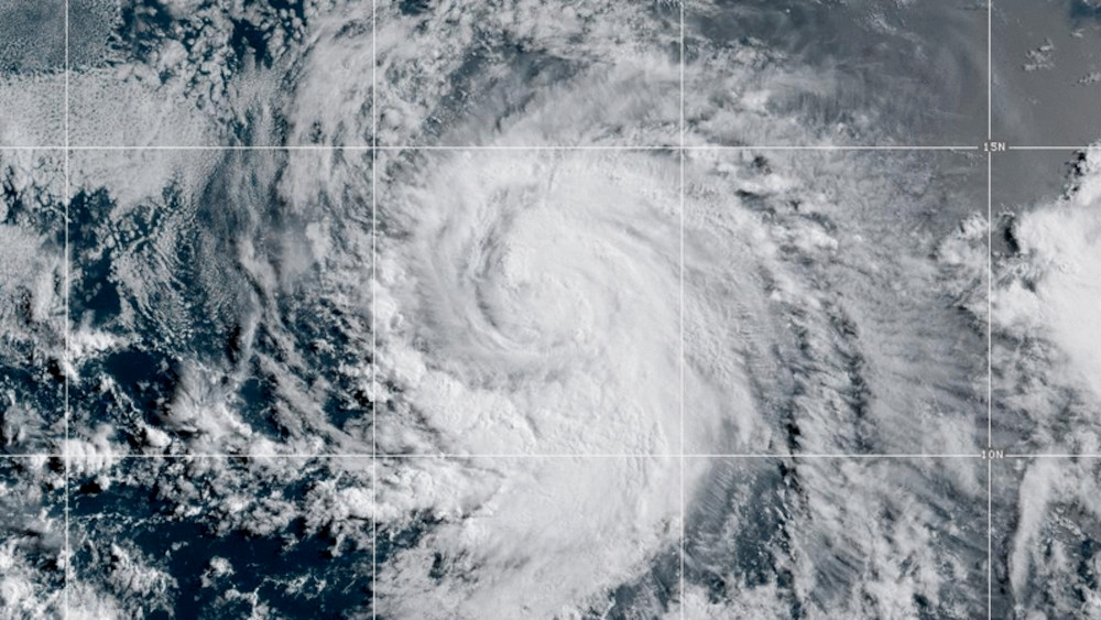
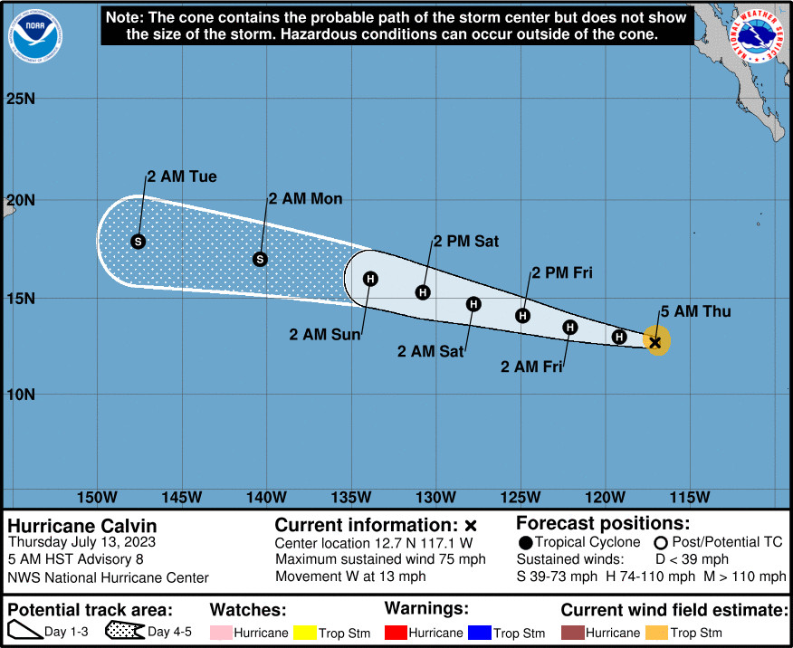
(BIVN) – Calvin has become the third hurricane of the Eastern Pacific this season, as the storm moves west at 13 mph.
Hurricane Calvin was 2,555 miles east southeast of Hilo as of 5 a.m. HST.
The National Hurricane Center says Calvin’s maximum sustained winds are near 75 mph with higher gusts. Forecasters expect Calvin to become stronger before it moves over cooler water and begins to weaken.
Calvin is expected to move into the central Pacific basin late Sunday. The storm will likely impact the state beginning next Tuesday, forecasters say.
From the National Weather Service in Honolulu:
We continue to monitor the development of Tropical Storm Calvin in the eastern Pacific, which is expected to intensify to a hurricane later this morning. It is too early to specify details regarding Calvin impacts on the Hawaiian Islands, but the latest forecast from the National Hurricane Center has Calvin moving into the Central Pacific basin late Sunday as a weakening tropical storm. Calvin will likely impact the state in some sort of way, whether it is high surf, heavy rain, strong winds, or all of the above, it is yet to be determined. Although details are uncertain, we could begin to see impacts from Calvin as early as Tuesday, but more likely around Wednesday of next week.
The National Hurricane Center in Miami provided this discussion at 5 a.m. HST:
Infrared and proxy-visible satellite imagery shows deep and wide convective bands wrapping around Calvin’s center this morning. Recent AMSR and SSMIS microwave passes show that the system has a well-defined inner core, and an eyewall is forming but is not completely closed. The upper-level outflow wind pattern on the eastern side of the system has improved as well. Dvorak estimates for this advisory were T4.0/65 kt from both SAB and TAFB. Given these estimates and improved satellite trends, the initial intensity is set to 65 kt for this advisory. This makes Calvin the third hurricane of the Eastern Pacific hurricane season.
The hurricane remains within a conducive environment for additional strengthening to occur with low vertical wind shear and warm SSTs. The peak intensity of 85 kt in 36 hours remains unchanged from the previous NHC forecast. After 36 hours, sea surface temperatures along the track of Calvin will gradually begin to cool, and this will likely induce gradual weakening through the remainder of the forecast period. The latest NHC intensity forecast lies near the upper-end of the guidance in the near-term, closest to HCCA, and then shows gradual weakening commensurate with the model consensus towards the end of the period.
Calvin continues to move westward but at a slightly slower forward speed of around 11 kt. A strong mid-level ridge to the north of Calvin will continue to move the system westward to west-northwestward. The cross-track spread continues to be fairly low, with the main difference in the models being Calvin’s future forward speed. The NHC track forecast lies between the faster HCCA model and the slower consensus and global model guidance, and is not too different from the previous forecast.


by Big Island Video News7:03 am
on at
STORY SUMMARY
HONOLULU, Hawaiʻi - A weakened Calvin will likely impact Hawaiʻi beginning next Tuesday, forecasters say, but it is too early for details.