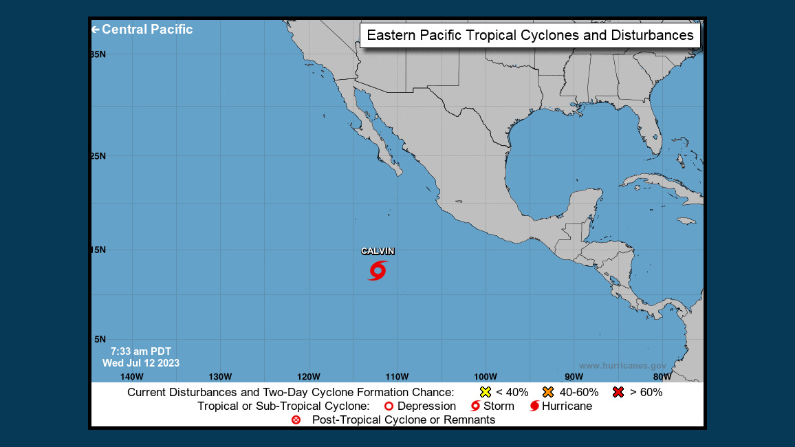
(BIVN) – The tropical depression that formed in the Eastern Pacific on Tuesday has strengthened to become Tropical Storm Calvin overnight.
As of 5 a.m. HST, Calvin was 2,875 miles east southeast of Hilo.
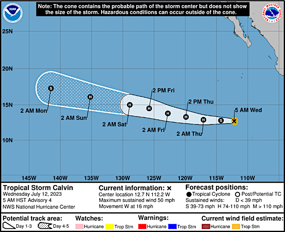
The storm, which is heading west towards the Central Pacific, is forecast to become a hurricane by tomorrow.
The National Weather Service in Honolulu says there is “potential for tropical cyclone Calvin or its remnant low to affect the island weather during the middle part of next week.”
“Tropical Storm Calvin in the far eastern Pacific is forecast to enter the Central Pacific basin Sunday night as a Tropical Storm, then move into the far eastern portion of the offshore waters early next week,” the Hawaiʻi-based forecasters wrote on Wednesday morning. “Although confidence in any details is low being this far out in time, all interests should monitor the latest advisories issued by the National Hurricane Center in Miami, Florida under WMO header WTPZ33 KNHC.”
From the National Hurricane Center discussion posted on Wednesday morning:
Tropical Storm Calvin continues to strengthen this morning with increased curved banding beginning to wrap around the center, as well as cold cloud tops associated with a developing central dense overcast. Microwave satellite from this morning also showed the overall structure of the system is becoming better defined, with a prominent curved band beginning to wrap around the center of Calvin. Subjective satellite Dvorak estimates from TAFB and SAB were T3.0/45 kt and T2.5/35 kt, respectively, while the latest objective estimates from UW-CIMSS are higher than 50 kt. Given the improved structure based on recent satellite trends, the initial intensity is raised to 45 kt for this advisory based on a blend of the various intensity estimates.
The storm is currently in a conducive environment for strengthening, with light-to-moderate vertical wind shear, and warm sea surface temperatures. Given the environment, steady strengthening is predicted, with Calvin now forecast to become a hurricane in 24 hours. There is some guidance showing a roughly 1-in-5 chance for rapid intensification to occur during the next 24 hours, however it is not explicitly forecast at this time. The NHC intensity forecast is near the upper end of the guidance and similar to the previous forecast. By the weekend, Calvin is expected to cross over cooler SSTs which will likely cause gradual weakening through the remainder of the forecast period.
Calvin is moving westward or 280/14 kt. A strong ridge located to the north of Calvin, over Mexico, should steer the cyclone westward to west-northwestward throughout the forecast. Model guidance is in fairly good agreement with the track–the main difference is the forward speed of Calvin with some models moving the storm a little faster (particularly HCCA). The updated NHC track forecast lies near the center of the guidance envelope, close to the various consensus aids to account for those speed differences.


by Big Island Video News7:12 am
on at
STORY SUMMARY
HAWAIʻI - Calvin is forecast to enter the Central Pacific basin Sunday night as a Tropical Storm, forecasters say.