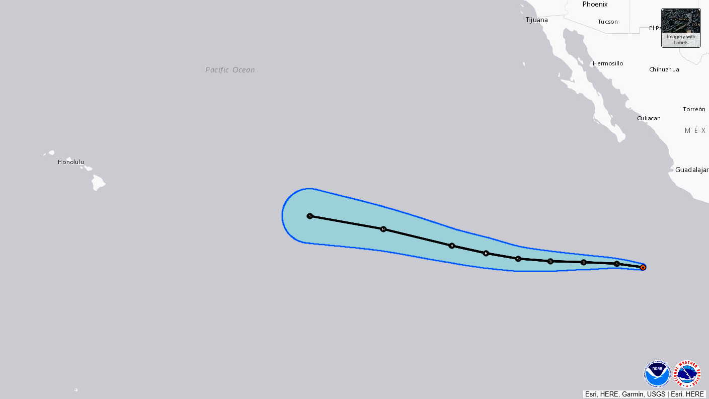
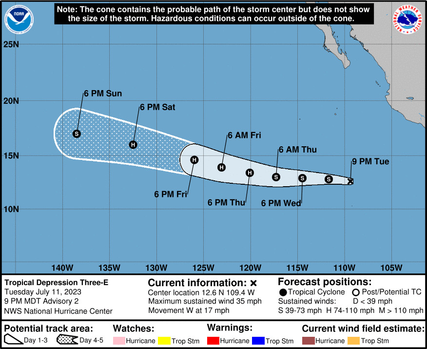
(BIVN) – The National Hurricane Center is keeping an eye on a newly formed tropical depression in the Eatern Pacific that is expected to strengthen as it tracks west.
Forecasters say Tropical Depression Three-E, located about 710 miles south of the tip of Baja California, is expected to become a tropical storm tonight or Wednesday.
From the National Hurricane Center discussion on Tuesday afternoon:
Deep convection associated with Tropical-Depression Three-E has become a bit more concentrated near and west of the center since the last advisory. However, at this time most subjective and objective satellite intensity estimates are near 30 kt, so the system remains a depression.
The initial motion is now westward or 280/15 kt. A strong low- to mid-level ridge to the north of the cyclone is expected to steer it generally westward at a quick forward speed for the next 2-3 days, followed by a west-northwestward motion from 72-120 h. The track guidance is fairly tightly clustered, and the new forecast track is similar to the previous track and the various consensus models.
The cyclone is in an environment of light to moderate shear, abundant moisture, and warm sea-surface temperatures, and current indications are that these conditions should continue for the next 60-72 h. This should allow steady strengthening, with the system reaching hurricane strength in about 48 h. It should be noted that while this environment may allow rapid strengthening, none of the rapid intensification indices of the SHIPS model are currently bullish on this possibility. After 72 h, the cyclone should move over cooler sea surface temperatures and into a drier air mass, and this combination should cause weakening.


by Big Island Video News6:06 pm
on at
STORY SUMMARY
HONOLULU - The long term forecast shows the storm strengthening into a hurricane as it tracks west towards the Central Pacific before starting to weaken.