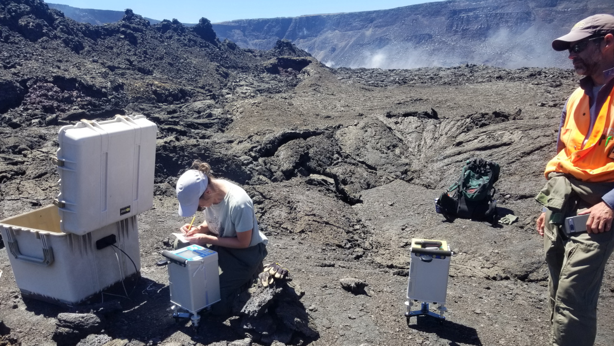
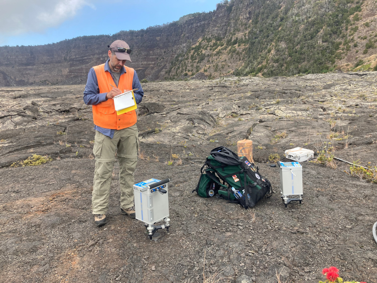
USGS: “USGS scientist, Mike Poland, measures gravity using a gravimeter on the caldera floor of Kīlauea. At Kīlauea, the Hawaiian Volcano Observatory (HVO) performs routine microgravity surveys to monitor volcanic activity and to determine changes in gravity.” (USGS photo by A. Ellis)
(BIVN) – Kīlauea is no longer eruping, and the alert level remains at ADVISORY. Scientists continue to monitor the volcano for any changes.
New photos published by the USGS Hawaiian Volcano Observatory show geophysicists in March performing the annual gravity survey of Kīlauea.
The USGS wrote that the annual microgravity surveys “can be used to determine how mass is distributed beneath a volcano.” They USGS said the surveys are “crucial in confirming whether ongoing uplift or subsidence is caused by magma intrusion or withdrawal.”
“Scientists conduct these surveys using small, shoebox-sized instruments called relative gravimeters that can measure a change in the force of gravity to one-in-one billionth of the force you feel every day,” the USGS HVO explained.
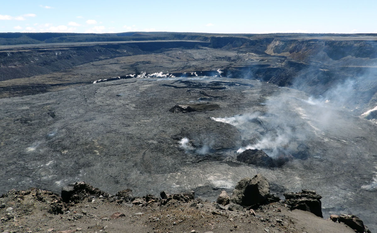
USGS: “During a morning visit to Halema‘uma‘u rim on April 14, Hawaiian Volcano Observatory geologists had clear views across Kīlauea summit caldera. Kīlauea stopped erupting on March 7; currently, only steam and minor gas emissions are being emitted at the summit.” (USGS image by K. Mulliken)
In a recent Volcano Watch article, scientists also wrote about the Kīlauea Seismic Imaging Project, which will help reveal subsurface structures beneath the summit region of Kīlauea volcano.

by Big Island Video News
on at
STORY SUMMARY
HAWAIʻI VOLCANOES NATIONAL PARK - Measurements of gravity can be used to confirm whether ongoing uplift or subsidence is caused by magma intrusion or withdrawal.