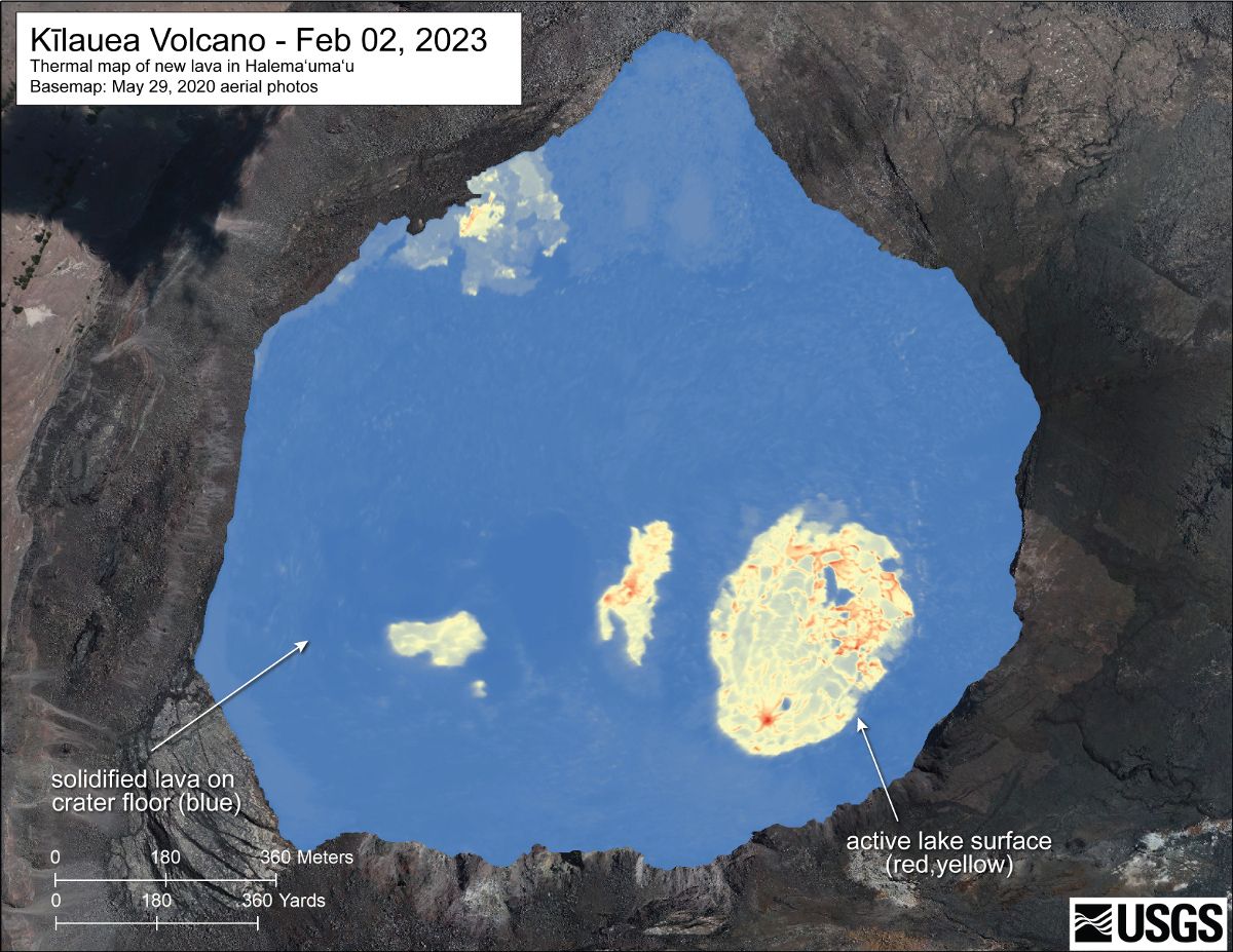
USGS February 2, 2023 thermal map. “The largest lava lake is located in the eastern portion of the crater, though lava has also filled the areas previously active in the western portion of the crater,” USGS wrote. “The scale of the thermal map ranges from blue to red, with blue colors indicative of cooler temperatures and red colors indicative of warmer temperatures.”
(BIVN) – The USGS Hawaiian Volcano Observatory recently published new maps showing the ongoing changes at the summit of Kilauea.
Scientists say a helicopter overflight on February 2, 2023, allowed for aerial visual and thermal imagery to be collected of Halema‘uma‘u crater inside Hawaiʻi Volcanoes National Park.
“Recent HVO helicopter overflights have been unable to produce accurate structure-from-motion models of the Halema‘uma‘u crater floor due to the thick volcanic gas plume,” noted scientists. “For this reason, no updated statistics can be provided for the average crater floor elevation or the erupted lava volume. Since thermal images can see through the plume, updated eruptive features were digitized from thermal images captured during the HVO overflight on February 2.”
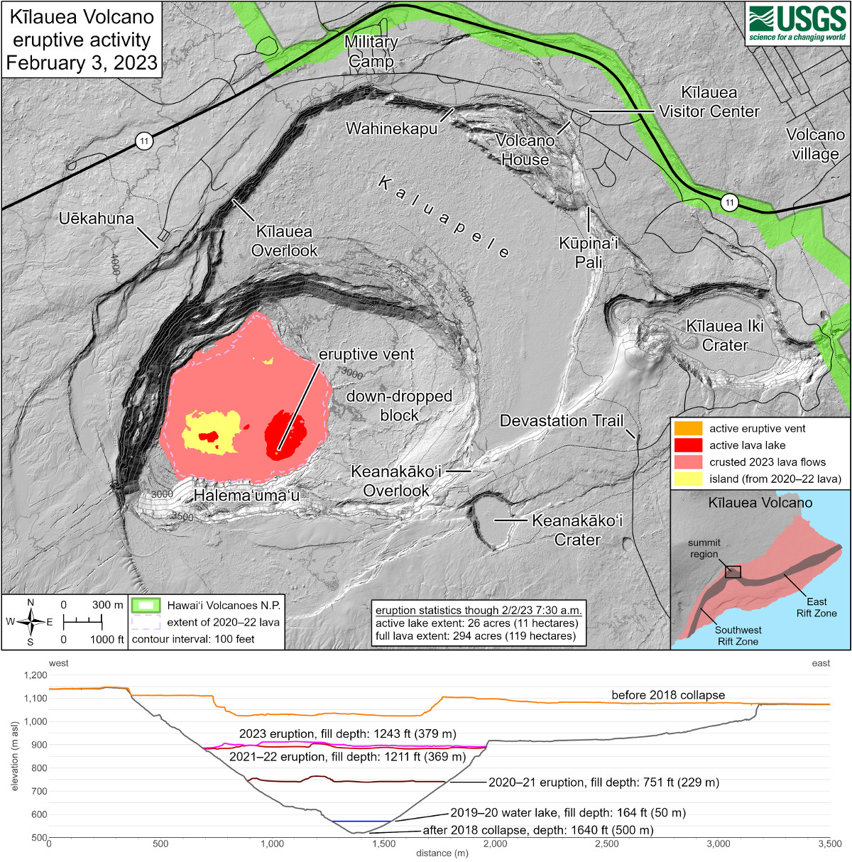
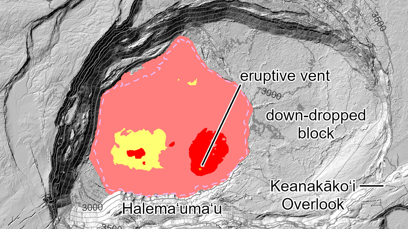
USGS: “The extent of the active lava lake—the area in red—is 26 acres (11 hectares). The full extent of new lava from this eruption, totaling both the active lava lake (red) and flows that have crusted over (pink), is 294 acres (119 hectares). Also included here are west to east topographic profiles across the caldera. Profiles are provided for the periods before the 2018 caldera collapse (orange), shortly after the 2018 collapse (gray), the December 2020–May 2021 eruption (brown), the September 2021–December 2022 eruption (red), and the current eruption (pink) as last modelled from the HVO overflight on January 17. Also shown is the maximum depth of the 2019–20 Halema‘uma‘u water lake (blue).”
No significant changes have been observed at the summit or in either rift zone, scientists say, and the current Volcano Alert Level remains at WATCH.

by Big Island Video News
on at
STORY SUMMARY
HAWAIʻI VOLCANOES NATIONAL PARK - The USGS recently published a few new maps produced using data gathered during Kilauea summit overflights.