UPDATE – (8:45 a.m. HST on Saturday, December 3)
- Fissure 3 remains active. “As of 7:00 a.m. this morning, December 3, the flow front was about 2.5 mi (4 km) from the Daniel K. Inouye Highway (Saddle Road). During the past 24 hours, the lava flow advanced at an average rate of about 40 feet per hour (13 meters per hour). Though the advance rate has slowed over the past 24 hours, the lava flow remains active.” (USGS)
- “Fissure 4 is no longer active; HVO geologists observed only glowing cracks in the area of fissure 4 during the eruption monitoring overflight this morning.” (USGS)
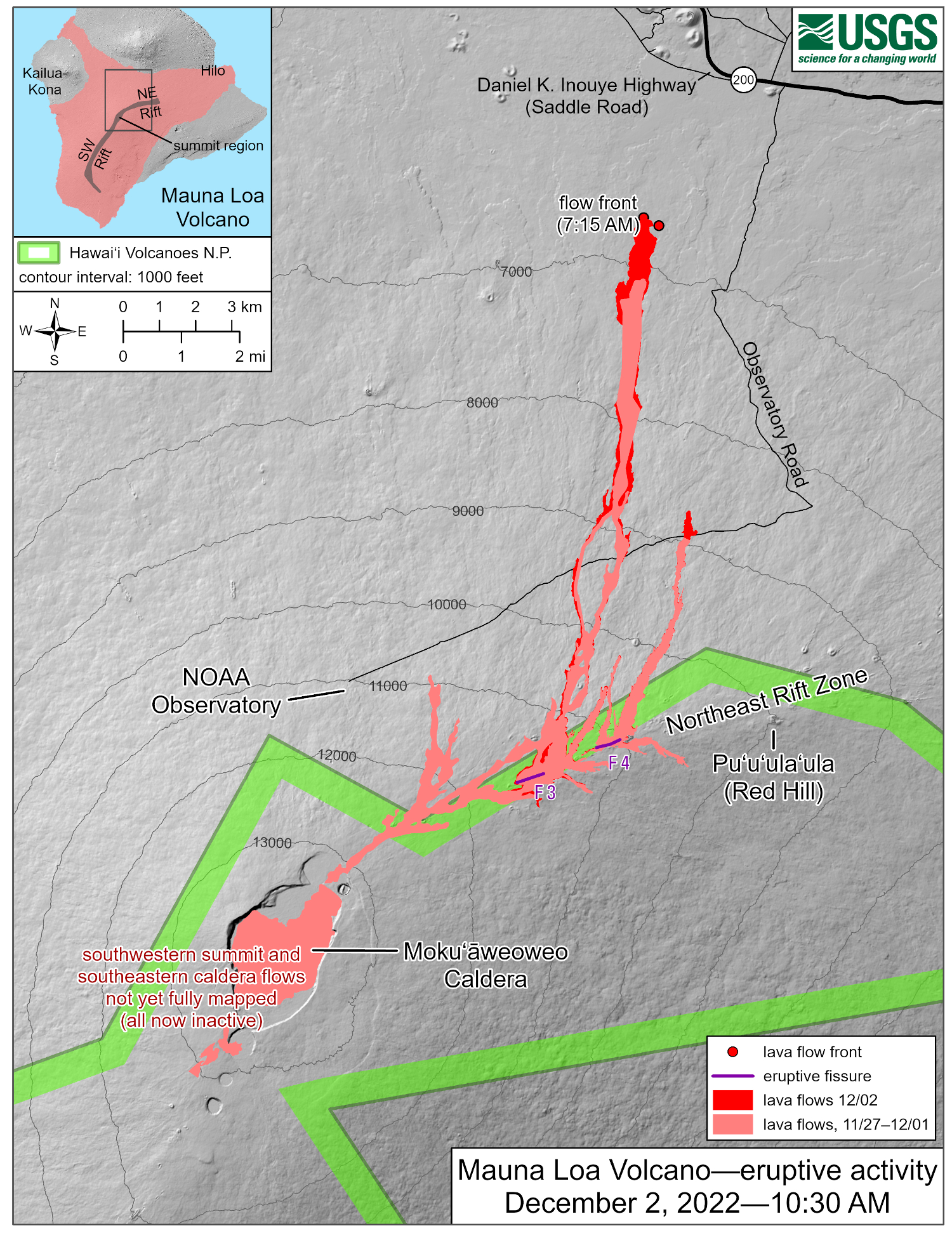
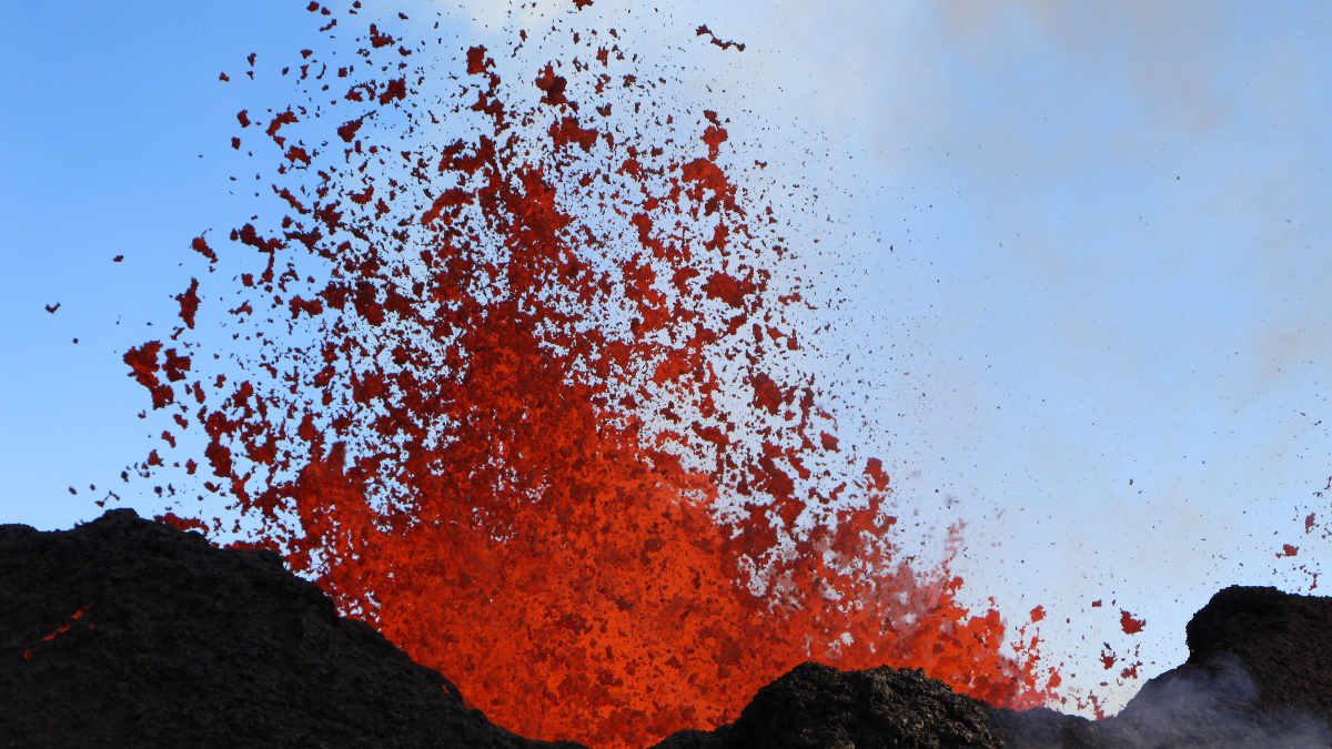
USGS: “The Northeast Rift Zone eruption of Mauna Loa has continued into its fifth full day. Fissure 3 is generating lava flows primarily to the north; fissure 4 continues to be active, but with very little eruptive activity observed this morning. Webcam and satellite views overnight allowed USGS analysts to accurately map some of the most active flows, displayed in red here, along with older flows further uprift, in part of Mokuʻāweoweo Caldera, and in the upper summit region southwest of the caldera. Elsewhere the progression of the flows is marked by points for the flow fronts, mapped by HVO field crews.”
(BIVN) – The eruption on the Northeast Rift Zone on Mauna Loa continued overnight. USGS webcams stationed around the giant Hawaiʻi island volcano show lava flowing down the mountain towards the north.
The Daniel K. Inouye Highway is open in both directions and no communities are threatened at this time.
“For your safety, the speed limit has been reduced to 35 miles per hour in the vicinity of Mauna Kea Access Road,” stated the Hawaii County Civil Defense on Friday evening. “A Lava Parking area has been opened across the Kahele Recreation Area. Please pay attention to the road and be considerate of others on the roadway.”
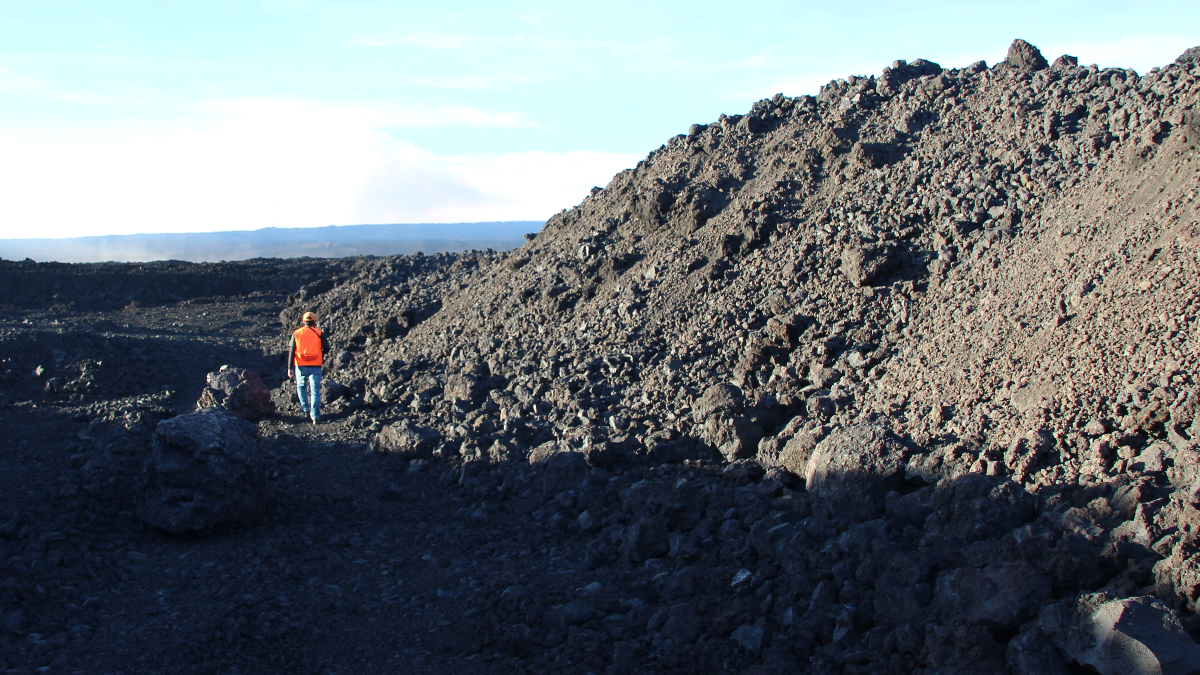
USGS: “A USGS scientist maps the eastern margin of the 2022 Mauna Loa eruption lava flow on December 1, 2022. In this area, the flow height is between 3 and 5 meters (10 to 16 feet) tall. The large block immediately to the right of the scientist likely rolled off from the lava flow a few hours before this photograph was taken, as the block was slightly above ambient temperatures. USGS scientists returned to this area on December 2 and observed that the lava flow margin in this area had not advanced between the two visits.” (USGS photo by N. Deligne)
From the USGS Hawaiian Volcano Observatory on Friday evening:
The Northeast Rift Zone eruption of Mauna Loa continues, with little change since this morning. One active fissure, fissure 3, is feeding a lava flow downslope. Fissure 4 is sluggish, and fissures 1 and 2 are no longer active.
Fissure 3 is generating a lava flow traveling to the north toward the Daniel K. Inouye Highway (Saddle Road) that has reached relatively flatter ground and slowed down significantly over the past couple of days, as expected. As of 7:00 a.m. this morning, the flow front was about 2.7 mi (4.3 km) from the Daniel K. Inouye Highway (Saddle Road). During the previous 24-hour period, the lava flow advanced at an average rate of 150 feet per hour (45 meters per hour). The lava flow remains active. Around fissure 3, a cone is developing; it was measured as approximately 157 (48 m) high today. Fissure 4 continues to be active, but with very little eruptive activity observed this morning.
Advance rates may be highly variable over the coming days and weeks due to the way lava is emplaced on flat ground. On flat ground, lava flows spread out and inflate. Individual lobes may advance quickly, and then stall. Additional breakouts may occur if lava channels get clogged upslope. There are many variables at play and both the direction and timing of flow advance are expected to change over periods of hours to days, making it difficult to estimate when or if the flow will impact Daniel K. Inouye Highway.
Volcanic gas plumes are lofting high and vertically into the atmosphere before being blown to the west at high altitude, generating vog in areas downwind. Vog information can be found at https://vog.ivhhn.org/. Pele’s hair (strands of volcanic glass) fragments are being wafted great distances and have been reported as far the Mauna Kea Visitor Information Station.
Sulfur dioxide (SO2) emission rates of approximately 180,000 tonnes per day (t/d) were measured on December 1, 2022.
Tremor (a signal associated with subsurface fluid movement) continues in the location of the currently active fissures. This indicates that magma is still being supplied to the fissure, and activity is likely to continue as long as we see this signal.
There is no active lava within Moku’āweoweo caldera, and the Southwest Rift Zone is not erupting. We do not expect any eruptive activity outside the Northeast Rift Zone. No property is at risk currently.
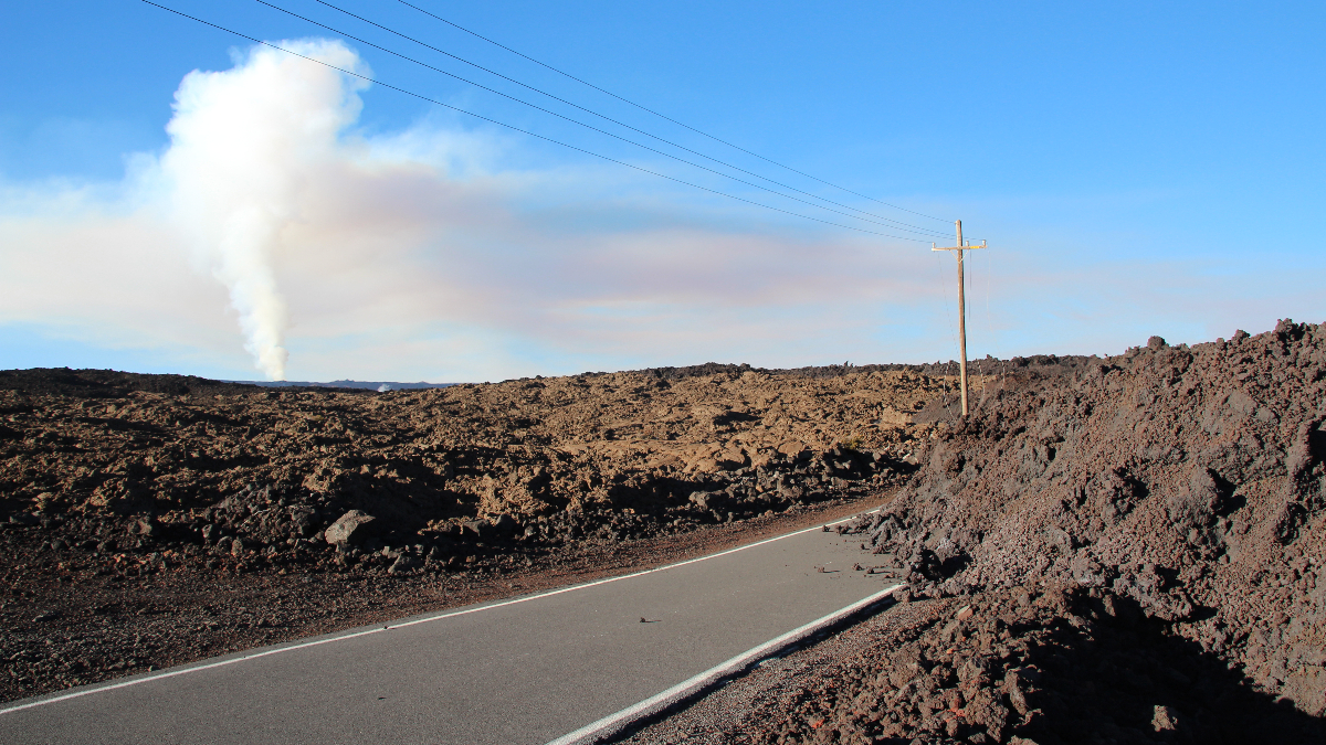
USGS: “The 2022 Mauna Loa lava flow crossed the road leading to the Mauna Loa Observatory within the first 24 hours of the start of the eruption. On December 2, USGS monitoring field crews visited the eastern margin where the lava flow covered the road. The plume from fissure 3 is visible in the background.” (USGS photo by N. Deligne)

by Big Island Video News
on at
STORY SUMMARY
HAWAIʻI ISLAND - The Daniel K. Inouye Highway is open in both directions and no communities are threatened at this time, as the eruption of Mauna Loa continues on the Northeast Rift Zone.