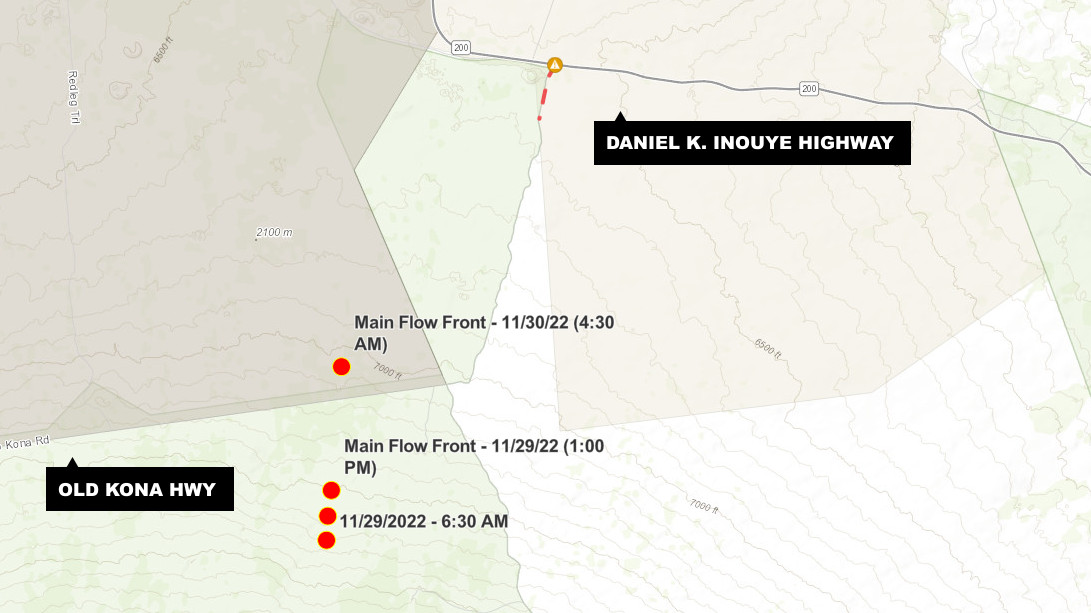
UPDATE – (8 a.m. on Wednesday, November 30) – The leading edge of the lava flow on Mauna Loa’s northeast flank is more than 3 miles from Daniel K. Inouye Highway. The highway is currently open in both directions. The lava is above the 7,000 foot elevation, according to the USGS Hawaiian Volcano Observatory.
(BIVN) – At approximately 11 p.m. on Tuesday night, the leading edge of the Mauna Loa lava flow crossed Old Kona Highway, a dirt road that crosses the Mauna Loa Forest Reserve. These images show the leading edge of the eruption.
All this lava is coming from fissures erupting high on the Hawaiʻi island volcano on the Northeast Rift Zone. The flows were active all night, making their way down the mountain, and could be seen from many miles away.
The lava could soon claim the cross-island Daniel K. Inouye highway, but scientists expect the lava flow will slow down as it reaches the base of Mauna Loa.
Residents can track the progress of the lava flow from a new US Geological Survey webcam, providing a view of the eruption while stationed on neighboring Mauna Kea.
There is a visible gas plume from the erupting fissure fountains and lava flows. Scientists say the plume is primarily being blown to the North. Sulfur dioxide emission rates of approximately 250,000 tonnes per day were measured on November 28, 2022. This number dwarfs the emissions recorded at Kilauea when it began erupting last year.


by Big Island Video News7:07 am
on at
STORY SUMMARY
HAWAIʻI ISLAND - Last night, the leading edge of the Mauna Loa lava flow crossed Old Kona Highway, a dirt road that crosses the Mauna Loa Forest Reserve.