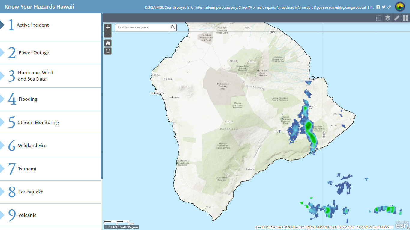
(BIVN) – There is a new, online tool to help track potential hazards in Hawaiʻi.
From the Hawaiʻi Emergency Management Agency:
The Hawaiʻi Emergency Management Agency (HI-EMA) has launched a new interactive tool to provide the public with updated information on potential hazards statewide, the “Know Your Hazards” map, now posted on the HI-EMA website. Using “Know Your Hazards,” Hawaiʻi residents and visitors can get current information on power outages, hurricane wind and sea data, flooding risk, stream levels, wildfires, tsunamis, earthquakes, volcanic activity, and more.
This tool was developed by Jonathan Levy, HI-EMA’s Geographic Information Systems (GIS) specialist, as part of the Agency’s continuing effort to ensure the most accurate reporting of hazards and threats that may affect residents and visitors.
“Our Agency’s mission is to help the Hawaiʻi ʻohana prepare for, mitigate against, respond to, and recover from disasters and emergencies,” said Levy. “This tool helps our whole community be more aware of the current hazards in Hawaiʻi where they live, work, and play. It gives them the ability to make informed decisions on disaster preparedness and planning.”
The later part of November brings an end to hurricane season in Hawaiʻi, but also begins the time of year frequently marked by heavy precipitation, typically known as “wet season.” During heavy precipitation, Hawaiʻi may experience our most common hazard – flooding and related impacts. Typically dry areas can become flooded, disrupting many daily aspects of how we live. The “Know Your Hazards” interactive map tool will help residents and visitors stay abreast of any incoming storm systems and display potential dangers.
The detailed mapping system taps into a wide array of data tools available to the state, from stream gauges to low-orbit satellites. All information is regularly updated by compiling data feeds from the United States Geological Survey, Federal Emergency Management Agency, National Aeronautics and Space Administration, Hawaiian Electric Company, County Offices of Emergency Management, and other partners.
The interactive tool can be used on both desktop and mobile devices and can be shared on Twitter and Facebook. To access the tool please follow this link.


by Big Island Video News4:24 pm
on at
STORY SUMMARY
HONOLULU, Hawaiʻi - The Hawaiʻi Emergency Management Agency has issued a new, visual tool for public use as the wet season begins.