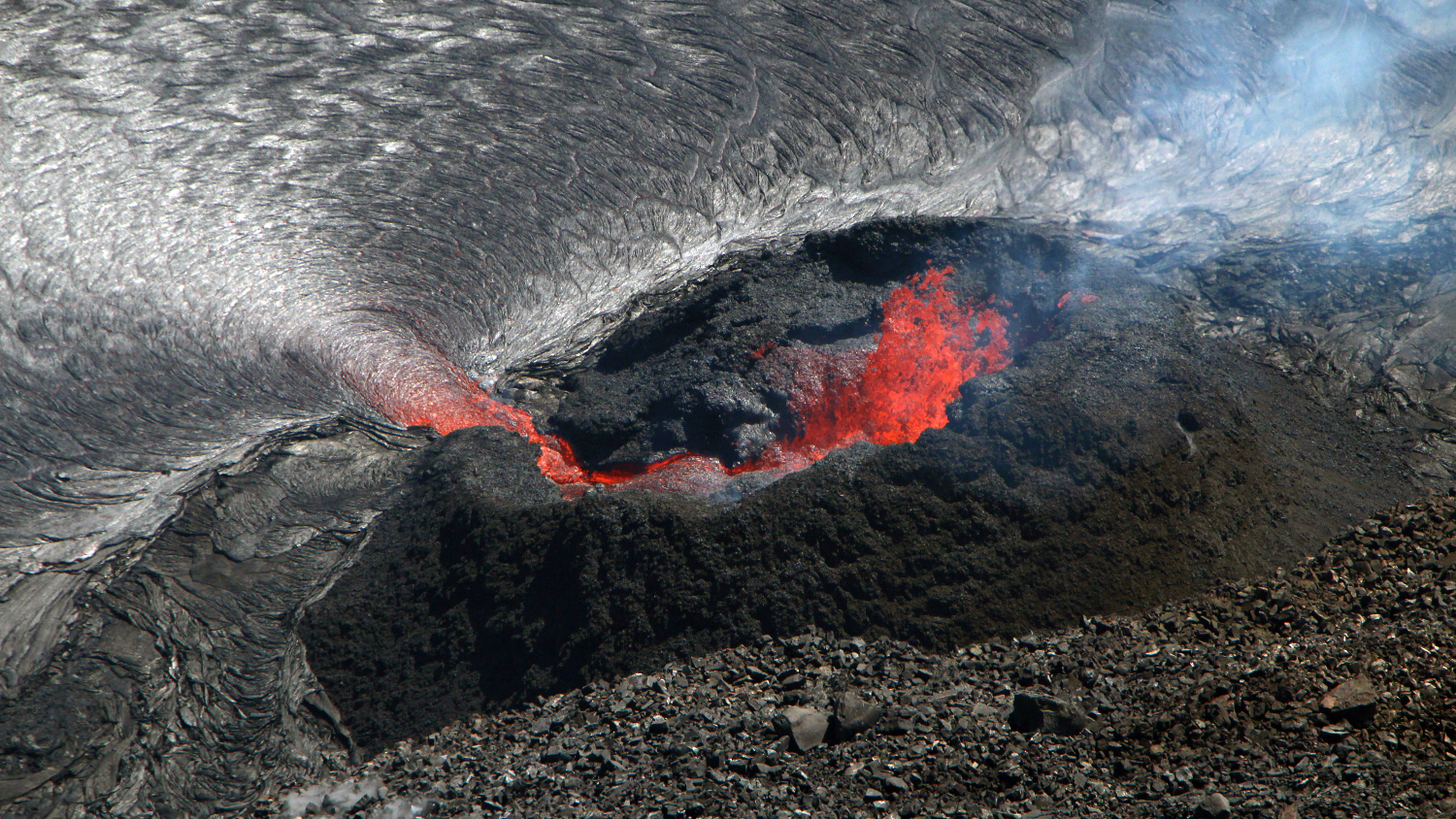
USGS: “Photo from the western rim of Kīlauea caldera looking down on the west vent feeding the lava lake in Halema‘uma‘u. Spatter is being thrown 5-10 m (16-33 ft) high out of the west vent onto the walls of the cone that has formed around the lava fountain. The small pond inside the cone is about 2 m (7 ft) higher and forms a small cascade down to the larger lava lake.” (USGS photo by D. Downs)
(BIVN) – Kīlauea continues to erupt at the summit, with all lava activity is confined within Halemaʻumaʻu crater in Hawai‘i Volcanoes National Park.
“No significant changes seen in summit tilt or GPS observations; summit tilt was flat over the past 24 hours,” the USGS Hawaiian Volcano Observatory reported on Wednesday. “Earthquake activity remains below background and volcanic tremor remains elevated since the beginning of the eruption.” Sulfur dioxide emission rates remain high, and were last measured at approximately 2,700 tonnes per day.
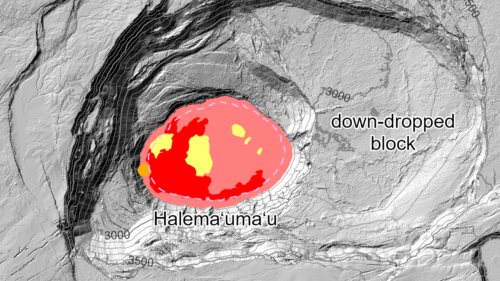
Geologists recently posted some new maps to the HVO website, tracking the changes that are occurring at the summit lava lake.
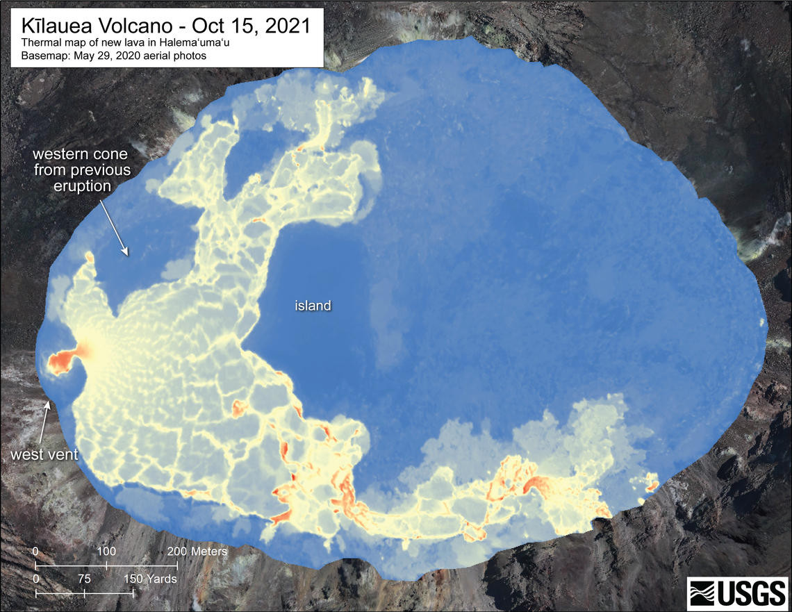
USGS: “This detailed thermal map of the Halema‘uma‘u lava lake is a zoomed-in version of the broader map above, constructed from imagery collected during a helicopter overflight on October 15, 2021, at approximately 7:30 a.m. HST. The scale of the thermal map ranges from blue to red, with blue colors indicative of cooler temperatures and red colors indicative of warmer temperatures. The only remaining active eruptive vent at this time is the west vent; several hotspots in the southern part of the lava lake correspond with short lava cascades between the higher western half and lower eastern half of the lake.” (USGS map by M. Patrick)
From today’s Halemaʻumaʻu lava lake observations, as reported by the USGS:
Lava continues to erupt from a single vent in the western wall of Halemaʻumaʻu crater. The western end of the lake showed a maximum elevation of approximately 790 meters (2592 ft) above sea level when measured by field crews on October 19, which is a 1 meter (3 ft) increase relative to the October 17, 2021, measurement and a total increase of about 46 meters (151 ft) since lava emerged on September 29. The total erupted volume since the beginning of the eruption was estimated to be about 19.9 million cubic meters (5.3 billion gallons) on October 15. The western vent had consistent fountain heights up to 9 m (30 ft) with occasional bursts up to 14 m (46 ft) observed by field crews on October 19. The lava lake is not level across its surface due to the location of the vent in the western end. The western lake quadrant is approximately 2 meters (6.6 feet) higher than the active southern lobe, 3 meters (9.8 feet) higher than the active northern lobe and there is about 7 meters (23 feet) elevation difference between the active west and stagnant east part of the lake.
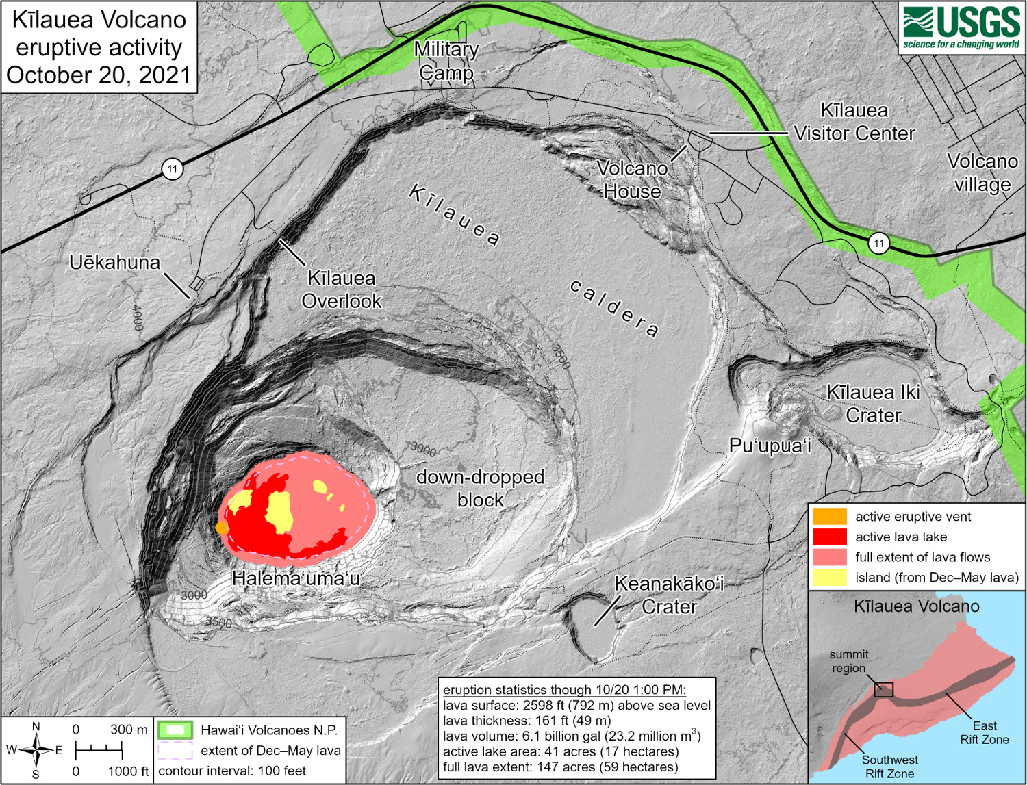
USGS: “This reference map depicts the ongoing Kīlauea summit eruption on October 20, 2021. Only one eruptive vent is active within Halema‘uma‘u at this time, along the western edge of the rising lava lake. Similar to the last eruption—from December 2020 until May 2021—the eastern end of the lava lake has stagnated and solidified, and sits several yards (meters) lower than the still-active western end. Note that this map depicts contour elevations in feet, with the surface of the active lava lake now at approximately 2,598 ft (792 m) above sea level. At this time, active lava is visible from two public visitor overlooks in Hawai‘i Volcanoes National Park: a site along the trail between Kīlauea Overlook and Uēkahuna can see the southeastern edge of the lava lake, and a section of the Keanakāko‘i Overlook can see fountains at the eruptive vent.” (USGS map)
No unusual activity has been noted in the Kīlauea East Rift Zone. The Hawaiian Volcano Observatory says it will continue to closely monitor Kīlauea Volcano, and will continue to issue daily Kīlauea Volcano updates until further notice.
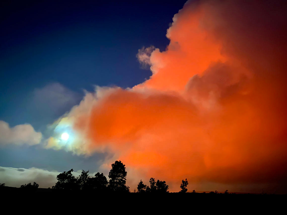
USGS: “At 7 p.m. HST on October 19, 2021, the glow from Halema‘uma‘u lava lake colored the gas plume from the erupting west vent red. Meanwhile, the moon was rising in the east, further illuminating the scene above the summit of Kīlauea. The photo was taken from the old crater rim drive on the west side of the crater.” (USGS photo by J. Schmith)

by Big Island Video News8:26 pm
on at
STORY SUMMARY
HAWAIʻI VOLCANOES NATIONAL PARK - Hawaiian Volcano Observatory scientists have produced some new maps of the ongoing summit eruption.