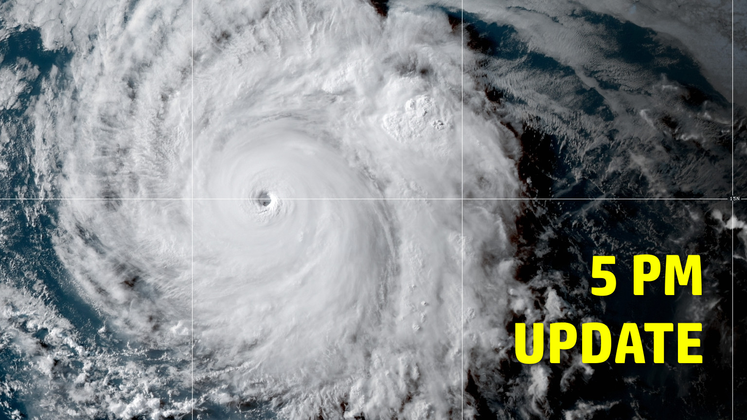
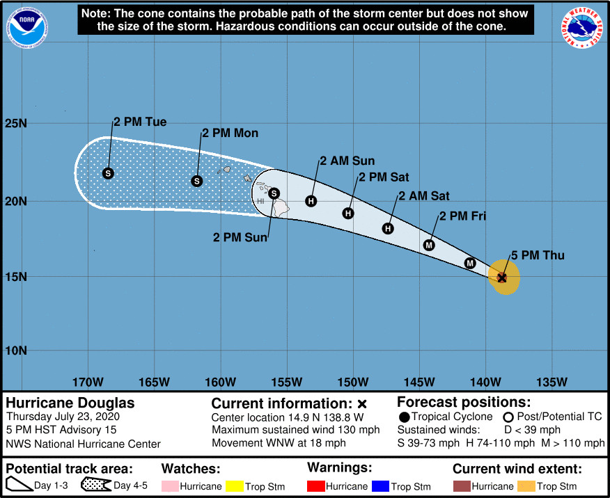
(BIVN) – Douglas is now a category 4 hurricane on the Saffir-Simpson Hurricane Wind Scale, 1,125 miles east southeast of Hilo. The storm is heading west northwest at 18 mph, with sustained winds at 130 mph with higher gusts.
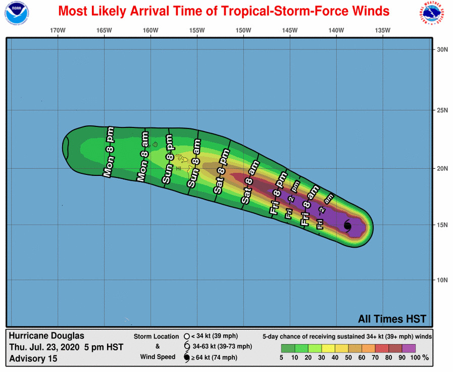
On the forecast track, the National Hurricane Center says Douglas will approach the Hawaiian Islands Saturday night, and be near those Islands on Sunday. Along the shore, swells generated by Douglas are expected to begin affecting portions of the Hawaiian Islands on Saturday.
Gradual weakening expected to begin on Friday and continue through the weekend. Douglas is forecast to be near hurricane strength when it approaches the Hawaiian Islands.
At 4 p.m., the National Weather Service in Honolulu issued this Special Weather Statement on Douglas:
The latest forecast from the National Hurricane Center indicates that Hurricane Douglas will move near, or over, portions of the main Hawaiian Islands this weekend. The potentially close passage of this hurricane brings a triple threat of hazards to the state, including but not limited to damaging winds, flooding rainfall, and dangerously rough seas that could result in damaging surf, especially along east facing shores. Watches could be required for portions of the state Friday, with impacts potentially beginning as early as Saturday night.
It is still too early to determine where impacts may be greatest, so everyone in the state of Hawaii needs to take time to prepare now. Review and execute your family emergency preparedness plan and remember that the Hawaii Emergency Management Agency recommends that you have a 14 day supply of food, water, and medicine for you and your ohana.
Keep up to date with the latest forecast information through the internet (hurricanes.gov), local media, social media, or NOAA Weather Radio broadcasts.
From the National Hurricane Center discussion posted at 5 p.m. HST:
Douglas remains a well organized hurricane in visible and infrared satellite imagery. The 15-nmi-wide eye remains very distinct and the surrounding cloud tops have cooled since the previous advisory. Although not evident in conventional satellite imagery, a recent AMSR-2 microwave satellite image showed evidence of concentric eyewalls. Subjective Dvorak T-numbers from TAFB and SAB are 6.0 (115 kt) and recent UW/CIMSS ADT estimates have been creeping upward, and now also close to T6.0. Based on these estimates, the initial wind speed has been raised to 115 kt, making Douglas a category 4 hurricane on the Saffir-Simpson Hurricane Wind Scale.
Douglas has likely reached its peak intensity as it will be moving over cooler SSTs during the next day or so. Although the predicted track of the hurricane will bring it over warmer waters when Douglas approaches the Hawaiian Islands, vertical shear is forecast to increase at that time. This is expected to result in continued gradual weakening, however Douglas is forecast to be near hurricane strength when it moves close to Hawaii. Despite the slight increase in the initial intensity, the updated NHC wind speed forecast is unchanged from the previous advisory through 36 hours, and then follows the intensity consensus guidance thereafter.
Douglas continues moving quickly west-northwestward or 295/16 kt. The hurricane is forecast to remain on this heading with some slight reduction in forward speed during the next day or so as it remains to the south of a large mid-level ridge. After that time, Douglas is forecast to turn westward to the south of another strong mid-level ridge the is predicted to build well north of the Hawaiian Islands later in the weekend. The new NHC track forecast is very similar to the previous advisory and lies just south of the various consensus aids out of respect of the ECMWF and its ensemble mean which lie along the southern edge of the track envelope.


by Big Island Video News5:14 pm
on at
STORY SUMMARY
HAWAIʻI - Hurricane Douglas has gotten slightly stronger over the course of the day, forecasters say, as the storm nears the Central Pacific on a track towards Hawaiʻi.