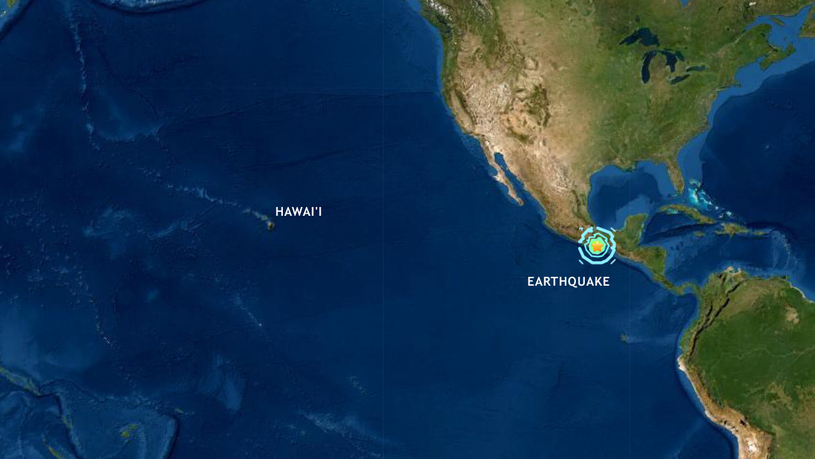
(BIVN) – A Magnitude 7.4 earthquake that occurred on Tuesday morning near Oaxaca, Mexico triggered a tsunami threat for parts of the Pacific Ocean, but not for Hawaiʻi, according to the local emergency officials.
The Hawaiʻi County Civil Defense issued an alert after the quake occurred, reporting that the Pacific Tsunami Warning Center “confirmed there is NO TSUNAMI THREAT to the Island and State of Hawaii”.
The earthquake was first measured at a Magnitude 7.7, but was later revised to a Magnitude 7.4.
Tsunami waves have been observed, the Pacific Tsunami Warning Center said. Waves reaching 0.3 to 1 meter above the tide level are possible for some coasts of Mexico, the PTWC said in its most recent message. “Tsunami waves are forecast to be less than 0.3 meters above the tide level for the coasts of Costa Rica, Ecuador, El Salvador, Guatemala, Hawaiʻi, Honduras, Nicaragua, Panama and Peru,” the center added.
The USGS wrote this about the event:
The June 23, 2020, M 7.4 earthquake near Oaxaca, Mexico occurred as the result of reverse faulting on or near the plate boundary between the Cocos and North American plates. Focal mechanism solutions for the event indicate rupture occurred on either a shallowly dipping thrust fault striking towards the west or on a steeply dipping reverse fault striking towards the ESE. The depth and focal mechanism solutions of the event are consistent with its occurrence on the subduction zone interface between these plates, approximately 100 km northeast of the Middle America Trench, where the Cocos plate begins its descent into the mantle beneath Mexico. In the region of this earthquake, the Cocos plate moves approximately northeastward at a rate of 60 mm/yr.
While commonly plotted as points on maps, earthquakes of this size are more appropriately described as slip over a larger fault area. Reverse faulting events of the size of the June 23, 2020 earthquake are typically about 70 x 35 km in size (length x width).
Historically, several significant earthquakes have occurred along the southern coast of Mexico. In 1932, a M 8.4 thrust earthquake struck in the region of Jalisco, several hundred kilometers to the northwest of the June 23rd event. On October 9, 1995, a M 8.0 earthquake struck in the Colima-Jalisco region, resulting in at least 49 fatalities and leaving 1,000 people homeless. The deadliest nearby earthquake occurred on September 19, 1985, in the Michoacan region ~700 km to the northwest of the June 23rd event. This M 8.0 earthquake resulted in at least 9,500 fatalities, injured about 30,000 people, and left 100,000 people homeless. In 2003, a M 7.6 earthquake in Colima, Mexico, resulted in 29 fatalities, destroyed more than 2,000 homes and left more than 10,000 people homeless. In March 2012, a M 7.4 earthquake 250 km to the northwest of the June 23rd, 2020 event killed 2 and injured 11 in the Oaxaca region. The hypocenter of the September 8th, 2017, M 8.2 earthquake offshore Chiapas is located 240 km southwest of today’s earthquake. That event caused at least 78 fatalities and 250 injuries in Oaxaca, and a further 16 deaths in Chiapas. Eleven days later, a M 7.1 earthquake struck closer to Mexico City, 390 km northwest of today’s earthquake, resulting in over 300 fatalities and significant damage in Mexico City and the surrounding region. In February 2018, a M 7.2 struck 225 km to the northwest of this event that injured four people and damaged 1,000 homes in Oaxaca. In addition, a military helicopter surveying the damage crashed at Jamiltepec, killing 14 people on the ground and injuring 15 others.


by Big Island Video News7:51 am
on at
STORY SUMMARY
HAWAIʻI - Hawaiʻi County Civil Defense issued an alert after the quake, reporting that the Pacific Tsunami Warning Center "confirmed there is NO TSUNAMI THREAT to the Island and State of Hawaii".