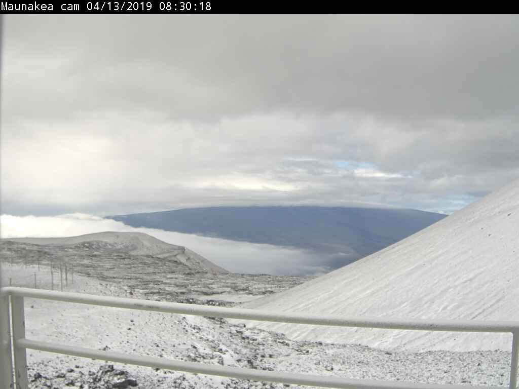
Webcam image from Mauna Kea on Saturday morning, looking at south sky and Mauna Loa. Camera is located in the Smithsonian Astrophysical Observatory’s Submillimeter Array, via NOAA.
UPDATE (Saturday morning) – A Flood Advisory remains in effect until 9:45 a.m. this morning for parts of Hilo, Hamakua, and Puna. Snowfall is also occurring on Mauna Kea.
(BIVN) – The Flash Flood Watch is no longer in effect for Hawaiʻi Island, but there are still a number of weather advisories to report.
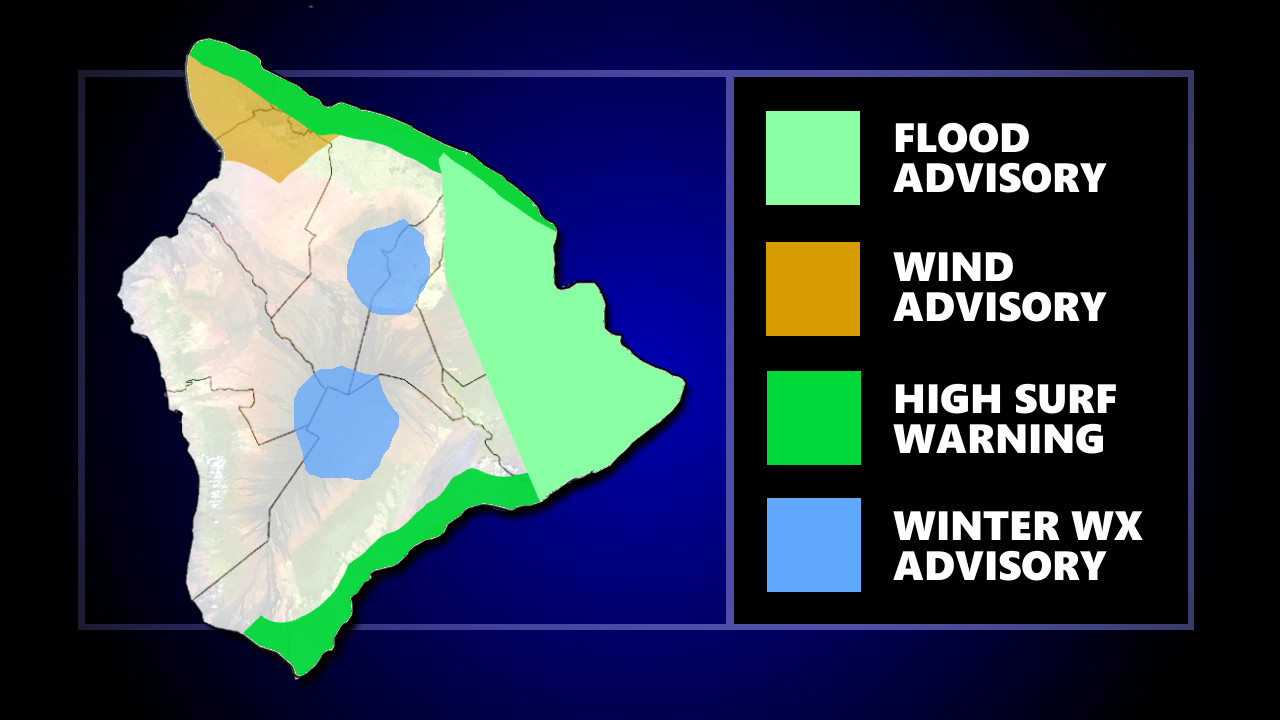
On Friday evening, the National Weather Service issued a Flood Advisory for Hilo and Puna and a High Surf Warning for east-facing shores, in addition to the Wind Advisory for Kohala and the Winter Weather Advisory for the summits, already in effect.
At 8:55 p.m. HST, forecasters said radar and rain gages were showing heavy rain fall, with rates between 1 and 2 inches per hour, over the South Hilo and Puna districts. A Flood Advisory was issued to include Hilo, Hawaiian Acres, Orchidlands Estates, Glenwood, Keaʻau, Papaikou, Volcano, Hawaiian Paradise Park, Pahoa, Mountain View, Oʻokala and Pepeʻekeo.
An updated message reported that the Flood Advisory had been extended to 1:15 a.m.
Meanwhile, the surf has picked up along east-facing shores.
The National Weather Service issued a High Surf Warning, which is in effect until 6 p.m. HST Saturday, replacing the High Surf Advisory issued previously.
Surf heights of 14 to 20 feet are expected along east facing of the Big Island through the weekend. It will likely peak tonight through Saturday and steadily decrease Sunday into Monday.
For Kohala, a Wind Advisory is in effect until Saturday evening. Northeast winds of 20 to 30 mph with localized gusts over 50 mph can be expected.
Also, the Winter Weather Advisory for the summits of Mauna Kea and Mauna Loa remains in effect, with additional snow accumulations of up to 1 inch expected. The advisory will be in place until Saturday morning.


by Big Island Video News10:12 pm
on at
STORY SUMMARY
HAWAIʻI ISLAND - A Flood Advisory was issued Friday evening and a High Surf Warning was also put into place for the Big Island.