(BIVN) – Kīlauea Volcano remains queit. On the lower East Rift Zone, scientists say there has been no significant incandescence visible overnight in the collapse pit within the fissure 8 cone. Minor fuming has been visible during the day. At the summit, seismicity and ground deformation remain low.
Rates of tilting throughout both the summit and the ERZ are much lower than those observed during the recent period of major eruptive activity, the USGS Hawaiian Volcano Observatory reported over the weekend.
The USGS has started to publish some retrospective products on the eruptive activity that began in May 2018. That includes a chronology of the activity from April 30 through September 22, 2018, and a timeline of the events of 2018.
The USGS has also published a series of “before and after” satellite images of the changes in the Leilani Estates subdivision, Lanipuna Gardens, and Kapoho. Over 700 homes were lost to lava in the summer eruption.
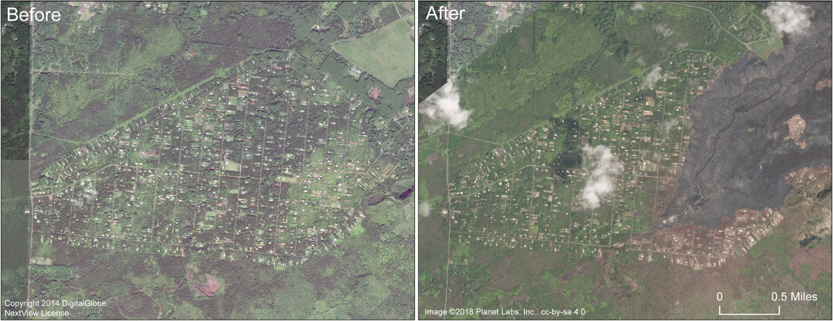
(USGS) This comparison shows satellite images of Leilani Estates subdivision before and after. The image on the right, collected in early September 2018, shows that the eastern portion of the subdivision has been covered by lava. The fissure 8 lava channel runs northeast from the fissure 8 cone at the start of the channel. Note also the brown areas of dead vegetation south of the lava flow. Highway 130 runs north-south along the left side of the images.
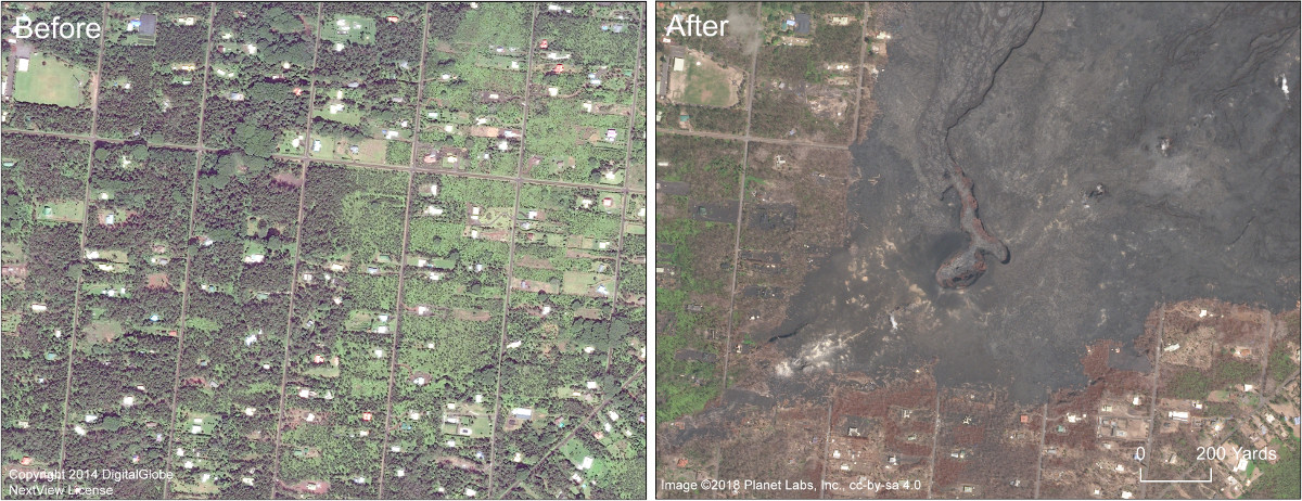
(USGS) A close up comparison of the fissure 8 area in Leilani Estates subdivision. Leilani Avenue runs right-left (east-west) through the center of the images. On the right side, the crater within the fissure 8 cone is visible. The fissure 8 lava channel extends north from the cone.
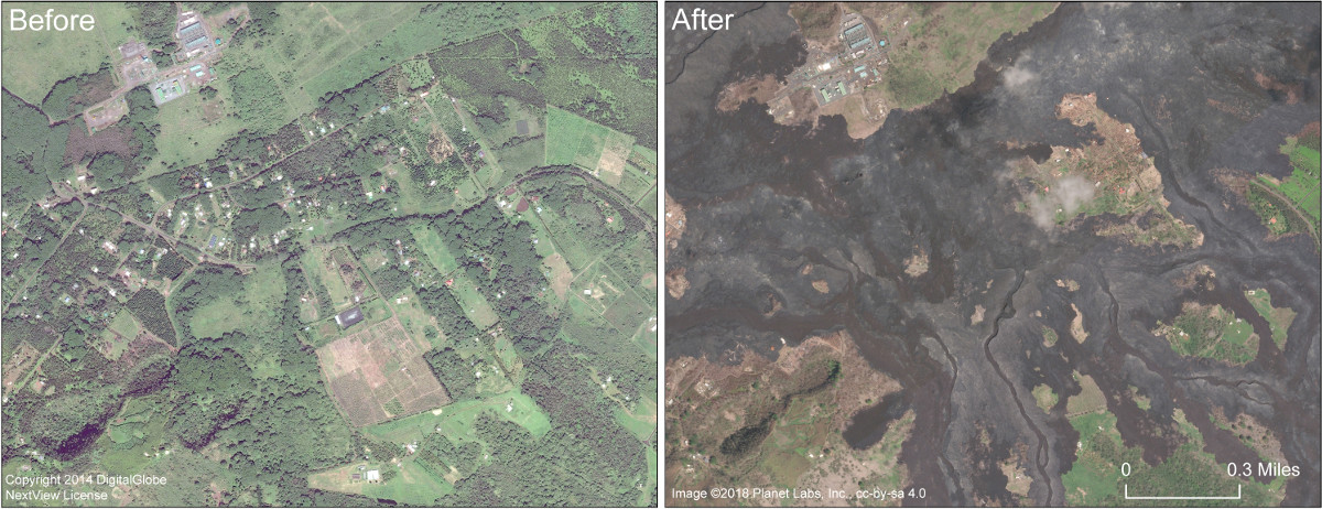
(USGS) This comparison shows before and after images in the area of Lanipuna Gardens subdivision. Pohoiki Road runs left to right through the center of the image. The Puna Geothermal Ventures site is in the upper left portion of the image.
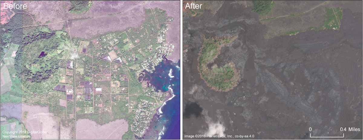
(USGS) This comparison shows the area of Kapoho before and after. Kapoho Crater is in the left portion of the image. Lava filled much of the crater, including the small nested crater that contained Green Lake. The Kapoho Beach Lots subdivision is in the right side of the image, north of Kapoho Bay, and was completely covered by the fissure 8 lava flow. Vacationland Hawai‘i, in the lower right corner of the image, was also completely covered, along with the adjacent tide pools. Kapoho Farm Lots, near the center of the image, is also beneath the flow.

by Big Island Video News
on at
STORY SUMMARY
PUNA, Hawaiʻi - The dramatic changes following the eruption on the lower East Rift Zone are shown in comparison images released by the USGS Hawaiian Volcano Observatory.