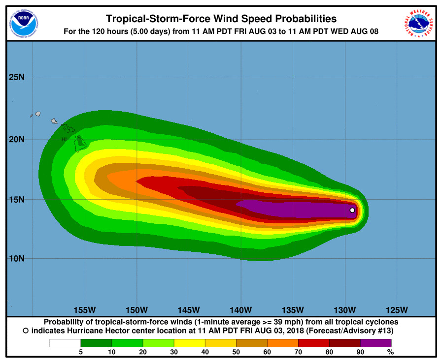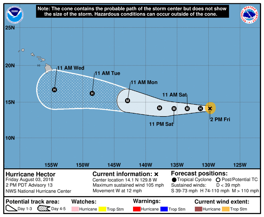
(BIVN) – Hector is again a Category Two hurricane, after the storm’s maximum sustained winds have increased to near 105 mph (165 km/h) with higher gusts. Hector is forecast to strengthen into a major hurricane tomorrow and continue at that intensity for a couple of days, as it enters the Central Pacific and heads along a path that will take it near Hawai‘i waters. Right now, Hector’s hurricane-force winds extend outward up to 15 miles (30 km) from the center and tropical-storm-force winds extend outward up to 70 miles (110 km).
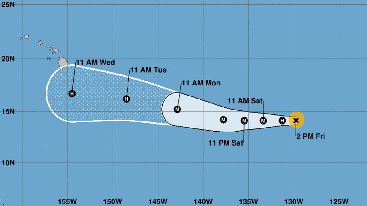
The latest five-day forecast shows Hector making a possible pass to the south of Hawai‘i Island as a hurricane, with a part of the Big Island inside the cone of uncertainty.
“A large subtropical ridge should push the hurricane westward for the next couple of days,” the National Hurricane Center stated in a discussion posted at 11 a.m. Friday. “Due to a weakness in the ridge in 2 or 3 days, Hector is forecast to gain some latitude in the long range. Model guidance has been oscillating northward and southward with the forecast in the Central Pacific, with the latest guidance a little faster and farther south. The NHC forecast is shifted in that direction, but not as far south as the new model consensus.”
“There is the potential for Hector to bring some impacts to portions of the Hawaiian Islands by the middle of next week, but it is too soon to specify the magnitude of the impacts or where they could occur,” the National Hurricane Center wrote. “This is a good time for everyone in the Hawaiian Islands to ensure they have their hurricane plan in place.”

“Hector is our first hurricane this year. We want to remind the public we are in the middle of the hurricane season and we urge people to take the weekend to prepare their homes and families for impacts that could be felt statewide,” said Tom Travis, Administrator of Emergency Management, in a media release.
HI-EMA recommends residents and visitors take the following actions to prepare for any possible hurricane or tropical cyclone:
- Prepare an “emergency kit” of a minimum of 14 days of food, water and other supplies.
- Talk with family members and develop a clear understanding what you will do if a hurricane or tropical storm threatens. Prepare an action plan that includes details such as whether your family plans to shelter in place or evacuate.
- Know if your home is in an inundation zone, flood zone, or susceptible to high winds and other hazards. Know if your home is retrofitted with hurricane resistant clips or straps.
- Stay tuned to local media and their websites/applications regarding weather updates.
- Sign up for local notification systems (i.e., HNL.Info).
- Get to know your neighbors and community so you can help each other.
- Walk your property and check for potential flood threats. Clear your gutters and other drainage systems. Remove and secure loose items. Keep your car gas tanks filled.
- Prepare your pets by checking or purchasing a carrier and other preparedness items. A pet carrier is necessary for your pet’s safety if you plan to evacuate to a pet-friendly shelter. Don’t forget 14 days of food and water for your furry family members.
- Set aside an emergency supply of any needed medication and keep a copy of your prescriptions in case you run out of medication after a disaster.
- Secure your important documents in protective containers.
- Visitors should download GoHawaii App and read the Hawaii Tourism Authority’s Travel Safety Brochure at http://www.travelsmarthawaii.com.
- Build an emergency kit – now.
The next NWS update on Hurricane Hector is expected at 5 p.m. HST.


by Big Island Video News11:42 am
on at
STORY SUMMARY
HAWAII ISLAND - The latest 5-day forecast projects Hector will pass to the south, but the Big Island is still within the cone of uncertainty.