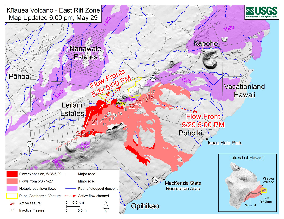
USGS: Map as of 6:00 p.m. HST, May 29, 2018. Given the dynamic nature of Kīlauea’s lower East Rift Zone eruption, with changing vent locations, fissures starting and stopping, and varying rates of lava effusion, map details shown here are accurate as of the date/time noted—and could have changed rapidly since that time. Shaded purple areas indicate lava flows erupted in 1840, 1955, 1960, and 2014-2015.
(BIVN) – The community was given an important update on lower Puna access and emergency routes during a public meeting in Pahoa Tuesday evening.
Just hours before the meeting, lava from Fissure 8 in Leilani Estates covered Highway 132, leaving Kapoho with only Beach Road to get in and out of Vacationland and Beach Lots. As of the posting of this video, Beach Road appears to be threatened by the same fast moving lava flow.
On the western side of lower Puna, the State Department of Transportation has maintained Highway 130, and hopes to get to work on Chain of Craters Road on Wednesday, after an agreement is finalized with the National Park Service.
Don Smith, the Hawaii Island district engineer for DOT, says they are also working on a deal that could open up an alternative north-south route through Ala’ili Road off Highway 130. Hawaii DOT already transported heavy equipment through Waikoloa Rd. to Kalapana for use on the evacuation routes.

by Big Island Video News
on at
STORY SUMMARY
PUNA, Hawaii - State and local officials gave an update on the routes in and out of lower Puna during a community meeting in Pahoa Tuesday night.