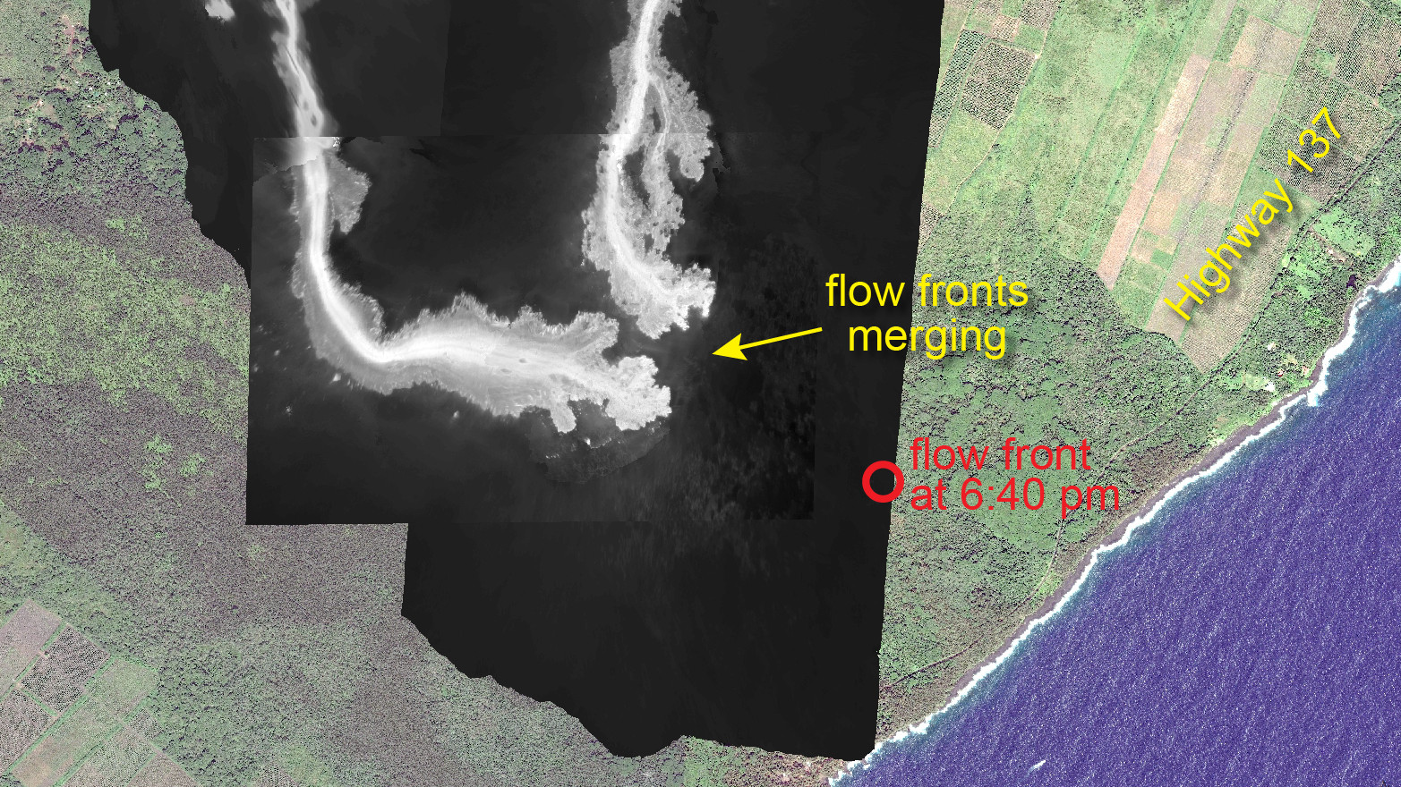
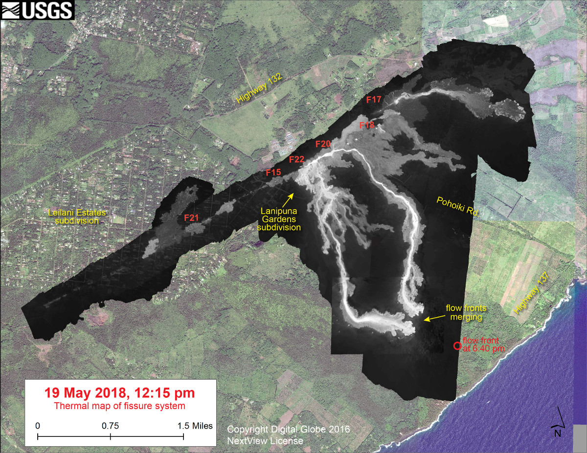
(USGS) This thermal map shows the fissure system and lava flows as of 12:15 pm on Saturday, May 19. The two primary lava flows originate from the Fissure 20-22 area, and crossed Pohoiki Road over the past day. The flow front position based on a 6:40 pm update is shown by the red circle. The black and white area is the extent of the thermal map. Temperature in the thermal image is displayed as gray-scale values, with the brightest pixels indicating the hottest areas. The thermal map was constructed by stitching many overlapping oblique thermal images collected by a handheld thermal camera during a helicopter overflight of the flow field. The base is a copyrighted color satellite image (used with permission) provided by Digital Globe
(BIVN) – Lava has crossed Highway 137 and is now entering the ocean in Puna.
Hawaii County Civil Defense says flow front #1 has crossed Highway 137 at the 13-mile marker and has entered the ocean.
Flow front #2 is approximately 400 meters from Highway 137.
Highway 137 is closed between Kamaili Road and Pohoiki Road. Kamaili Road is closed between Highway 130 and Highway 137. Residents in the area have been evacuated. Civil defense says all persons are asked to stay out of the area.
Civil defense is still warning of the effects of laze where the lava meets the sea. Accoring to officials:
- Laze is formed when hot lava hits the ocean sending hydrochloric acid and steam with fine glass particles into the air.
- Health hazards of laze include lung, eye and skin irritation.
- Be aware that the laze plume travels with the wind and can change direction without warning.
NOTE: The article was first published with a typo in the headline misidentifying the highway as 132, although the article and associated media referenced Highway 137. We regret this error.

by Big Island Video News
on at
STORY SUMMARY
PUNA, Hawaii - Hawaii County Civil Defense says flow front #1 has crossed Highway 137 at the 13-mile marker and has entered the ocean. Front #2 is close behind.