KALAPANA, Hawaii – The forward progress of the active 61g lava flow slowed significantly between Thursday and Friday as it moved across the coastal plain on Kīlauea’s south flank.
When the USGS Hawaiian Volcano Observatory mapped the lava flow on Friday afternoon, the flow front had advanced only 98 yards since Thursday’s measurements. The flow front remains 0.7 miles from the ocean.
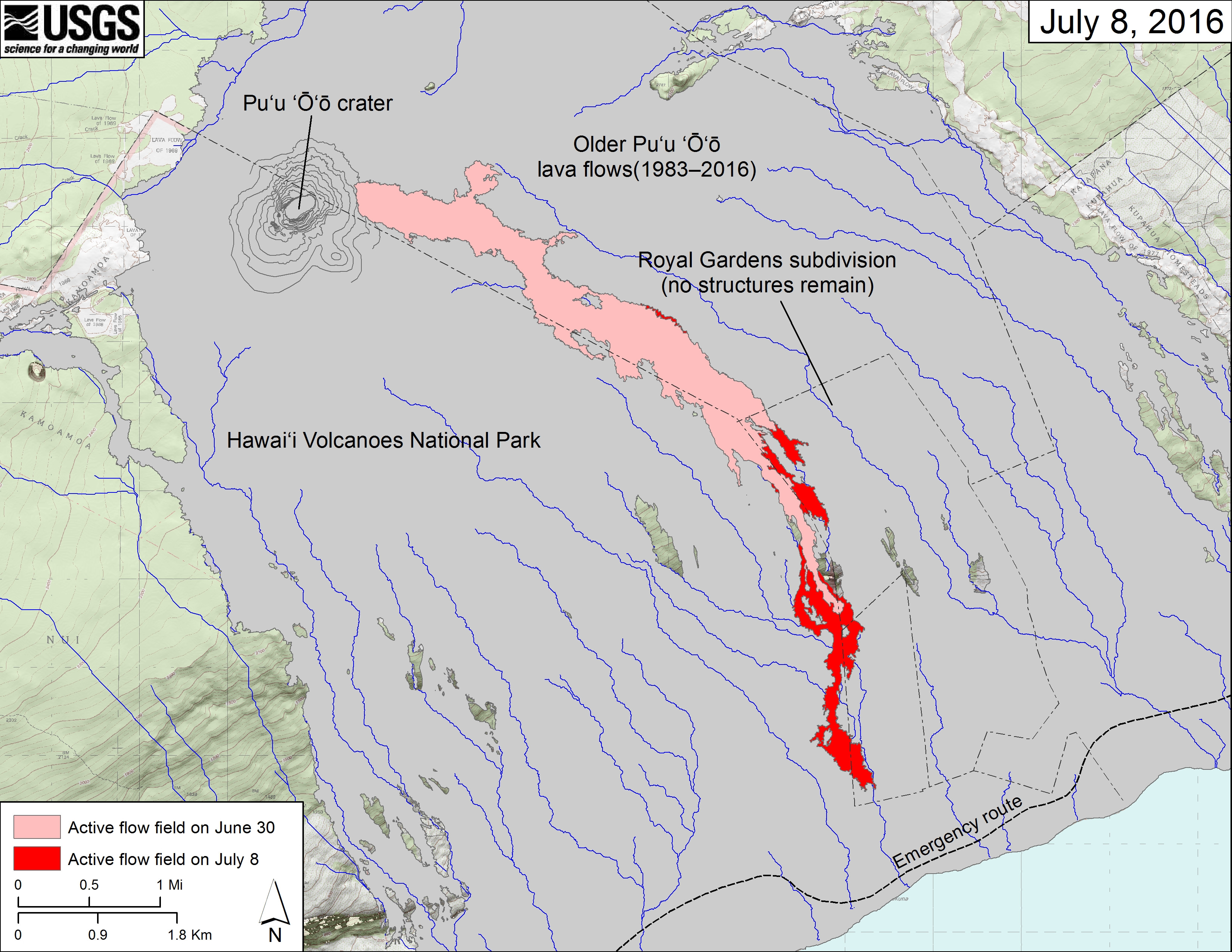
(USGS map) The area of the active flow field as of June 30 is shown in pink, while widening and advancement of the active flow as mapped on July 8 is shown in red. Older Puʻu ʻŌʻō lava flows (1983–2016) are shown in gray.
Scientists say the activity at the leading tip of the flow was fairly weak Friday.
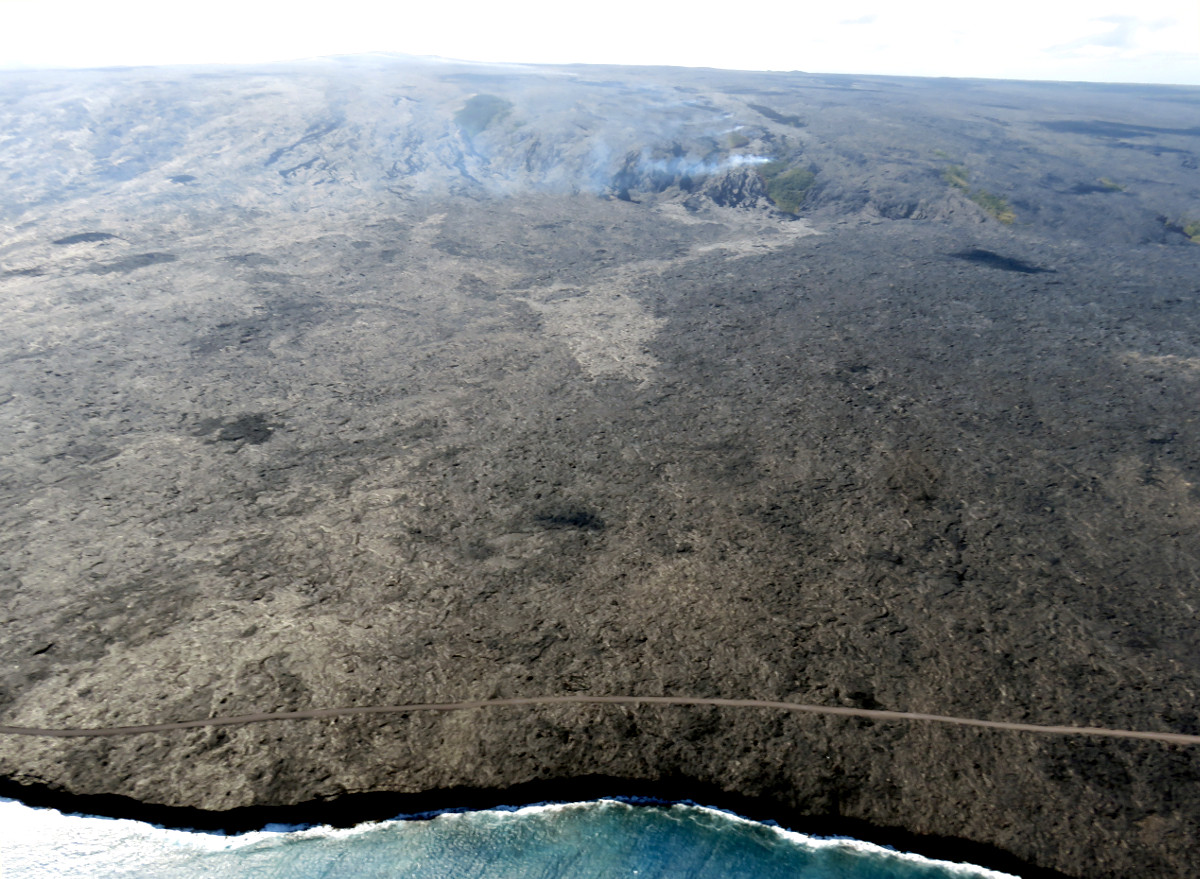
(USGS photo) The position of the lava flow front relative to the shoreline can be seen in this aerial photograph. The leading edge of the flow, which was 1.1 km (0.7 miles) from the ocean today, is the light-colored area near the center of the image. More vigorous breakouts were active upslope, near the base of the pali. Fume from the lava tubes and smoke from burning vegetation are visible on the pali in the upper part of the photo. Puʻu ʻŌʻō is visible on the upper left skyline.
There is still some dramatic activity closer to the Pulama pali, where channelized ʻaʻā lava flows were still active on the steep slopes.
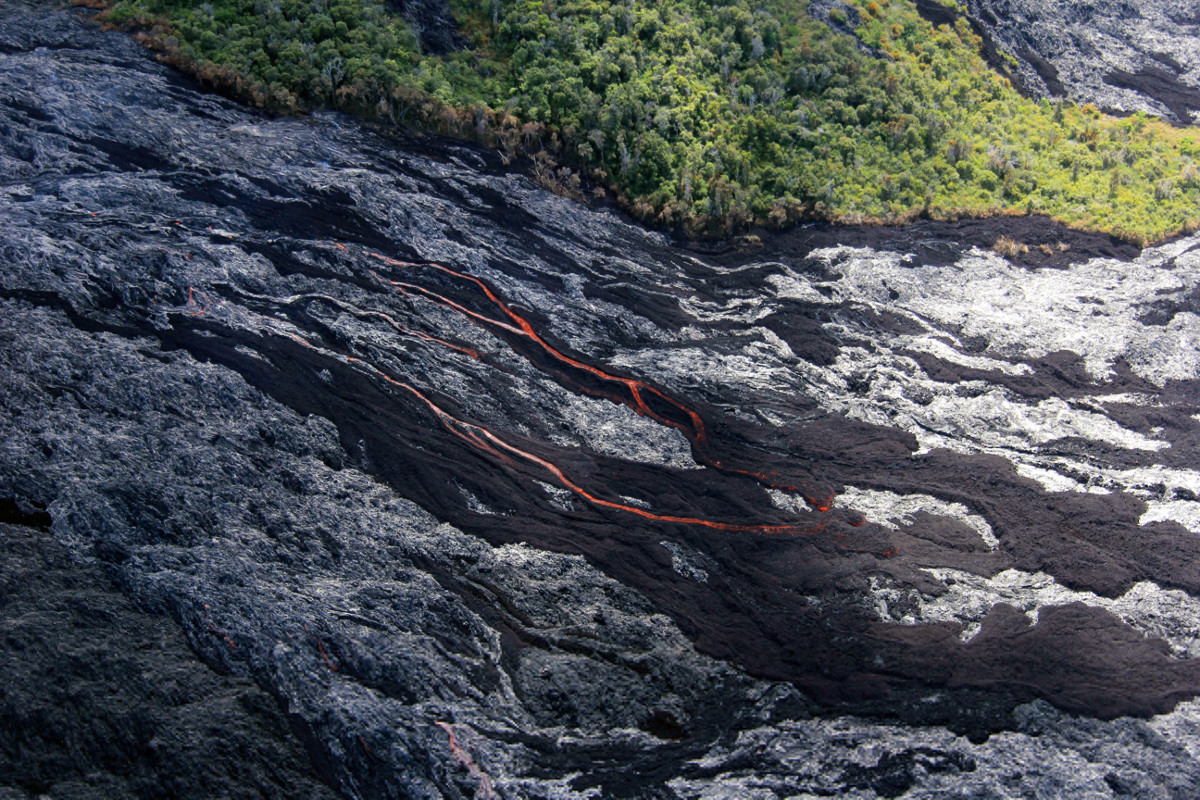
(USGS photo) On the pali: dark brown areas are recently active ʻaʻā, and the shiny gray areas are pāhoehoe lava.
Bright incandescence is visible in the overnight webcam views of the active lava flow field, marking lava tube skylights above the pali.

by Big Island Video News
on at
STORY SUMMARY
KALAPANA (BIVN) - USGS Hawaiian Volcano Observatory scientists observed weak activity at the leading tip of the 61g lava flow, which remains 0.7 miles from the ocean.