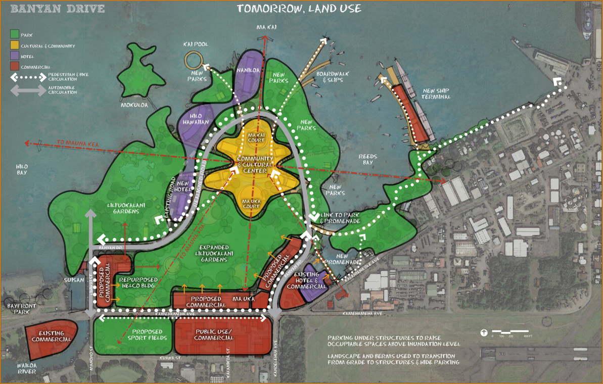
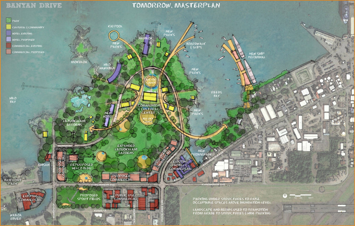
HILO, Hawaii – Two conceptual Banyan Drive redevelopment maps, “Tomorrow, Land Use” (above) and “Tomorrow, Master Plan” (below), have been drawn up and will be presented to the public next week.
The maps are part of the ongoing work of the Banyan Drive Hawai‘i Redevelopment Agency, created in April 2016 “to bring about a revitalization and redevelopment of properties along Banyan Drive on the Waiakea peninsula where hotel, resort, commercial and public uses may coexist compatibly.”
The maps offer a glimpse into the agency’s and administration’s thinking about the future of the resort area. Most obvious is the transformation of the Naniloa golf course into an expansion of Lili’uokalani Gardens, to include a “community & cultural center”.
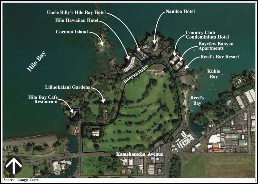
It appears as if the Naniloa and the Hilo Hawaiian hotels will have a home at the future Banyan Drive, as will a new hotel located on current Lili’uokalani Gardens grounds. But other existing hotels and condos are absent from the “tomorrow” maps, replaced by new parks along the shore.
The maps also envision a “kai pool”, boardwalk and boat slips, a new ship terminal, and more of a walkable link to Hilo Harbor in Keaukaha.
Proposed commercial uses line Kamehameha Highway as well as the Manono Street entrance to Banyana Drive.
Two meetings will be held in the coming weeks, one on Tuesday, June 28, and another on Tuesday, July 5, both at 4:30 p.m. at the County of Hawai‘i Aupuni Center Conference Room in Hilo (101 Pauahi Street).
At the meeting the Planning Department will “give a brief presentation of the conceptual maps, answer questions and listen to suggestions and concerns you may have.”


by Big Island Video News3:34 pm
on at
STORY SUMMARY
HILO (BIVN) - Two months after creating a special agency to redevelop Banyan Drive, two conceptual maps envisioning the future of the Hilo resort area have already been produced. The public will now have a chance to talk about it.