HAWAII VOLCANOES NATIONAL PARK – Scientists with the USGS Hawaiian Volcano Observatory took a helicopter flight over two new lava breakouts on the flanks of Puʻu ʻŌʻō this morning, and have returned with video and maps plotting the path traveled by of the flows.
The two new breakouts began erupting just before 7:00 a.m. HST on May 24. The first lava flow is on the northeast flank, approximately 0.15 miles from the rim of the cone, heading toward the northwest. The other flow is on the east flank of the cone, approximately 0.3 miles from the rim of the cone, heading toward the southeast. Neither flow is currently threatening any nearby communities, scientists say.
This new USGS map shows the extent of the new lava flows, based on aerial photos that were taken at 8:30 a.m.
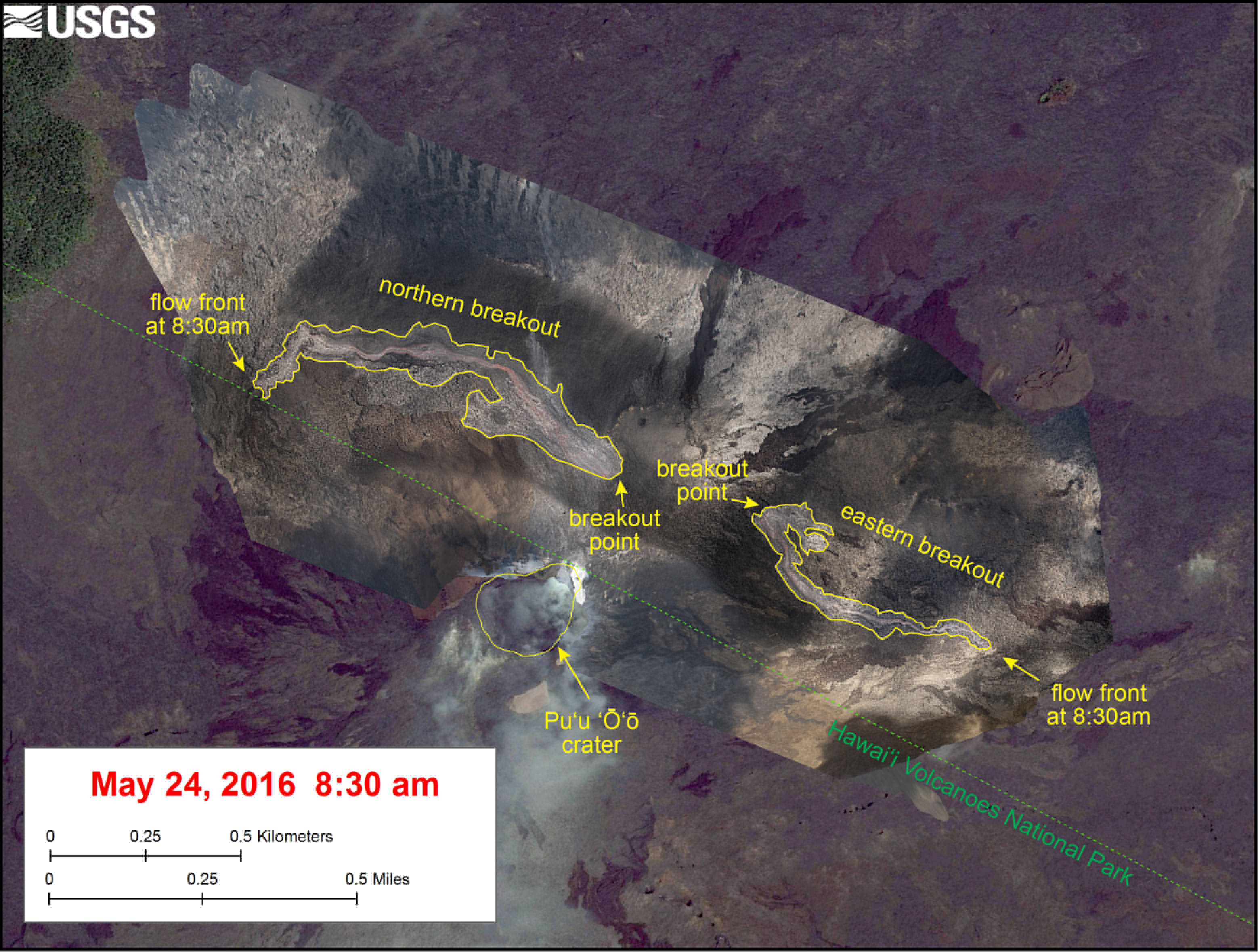
USGS map: The new breakouts had not extended beyond the boundary of the Puʻu ʻŌʻō flow field at the time the photos were taken, and neither lava flow currently poses an immediate threat to nearby communities, scientists say.
“At the time,” scientists wrote on the USGS HVO website, “the larger flow from the northern breakout was traveling down the north flank of Puʻu ʻŌʻō, towards the northwest, and was about 1 km (0.6 miles) long, and the flow from the eastern breakout was about 700 meters (0.4 miles) long. The aerial photos used to map the flows are shown over an older satellite image.”
Meanwhile, for a live look at the breakout on the east flank, USGS adjusted their PWcam to point northeast in order to follow one of the two new lava flows.
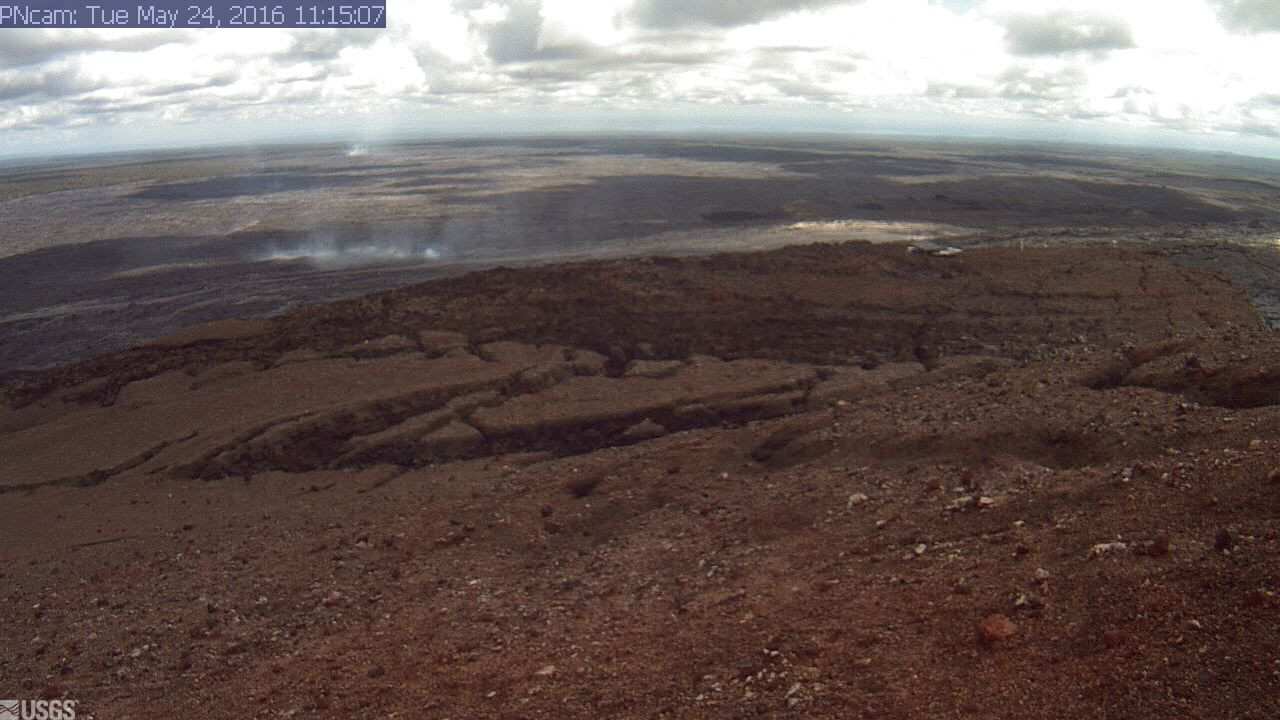
courtesy USGS webcam

by Big Island Video News
on at
STORY SUMMARY
KILAUEA VOLCANO (BIVN) - USGS Hawaiian Volcano Observatory scientists flew over two new lava breakouts on Tuesday, and return with new maps and dramatic video footage.