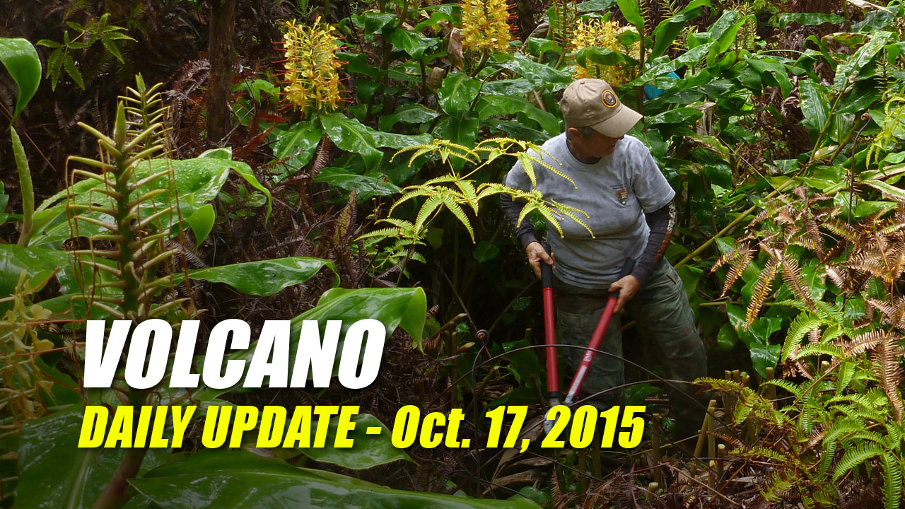
(ABOVE) A NPS photo shows volunteer and stewardship project leader Jane Field taking on invasive Himalayan ginger, one of the world’s top 100 invasive species according to the International Union for the Conservation of Nature. The Stewardship at the Summit program continues today.
TOP STORY | Earthquake Swarm

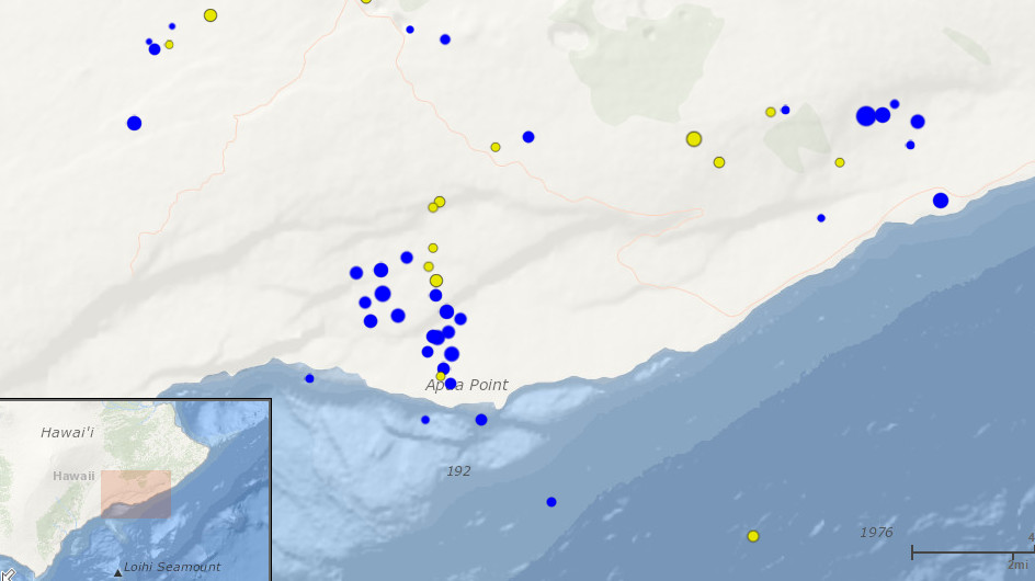
HAWAII VOLCANOES NATIONAL PARK – A number of earthquakes have been recorded in the last two days, especially around Apua Point south of the Kilauea summit. The screenshot of the interactive USGS map above shows quakes (almost all below magnitude 3.0) that occurred in the last two days in blue. These south flank earthquakes are associated with a “slow slip event”, or SSE, according to the USGS Hawaiian Volcano Observatory.

“SSEs are episodes of fault slip occurring over the course of 1–2 days beneath Kīlauea’s south flank. If all that slip took place abruptly, it would generate the equivalent of a M6 earthquake. Because the slip occurs over days, however, the SSE motion is detectable only with sensitive geodetic or deformation monitoring instruments.”USGS Hawaiian Volcano Observatory on April 12, 2012
MORE ON SSE: Waiting and listening for Kīlauea to Chatter
9:40 a.m. | Eruption Update
KILAUEA VOLCANO – Eruptions continue at Kilauea Volcano’s summit and in its east rift zone at Pu’u ‘O’o, reports the USGS Hawaiian Volcano Observatory.

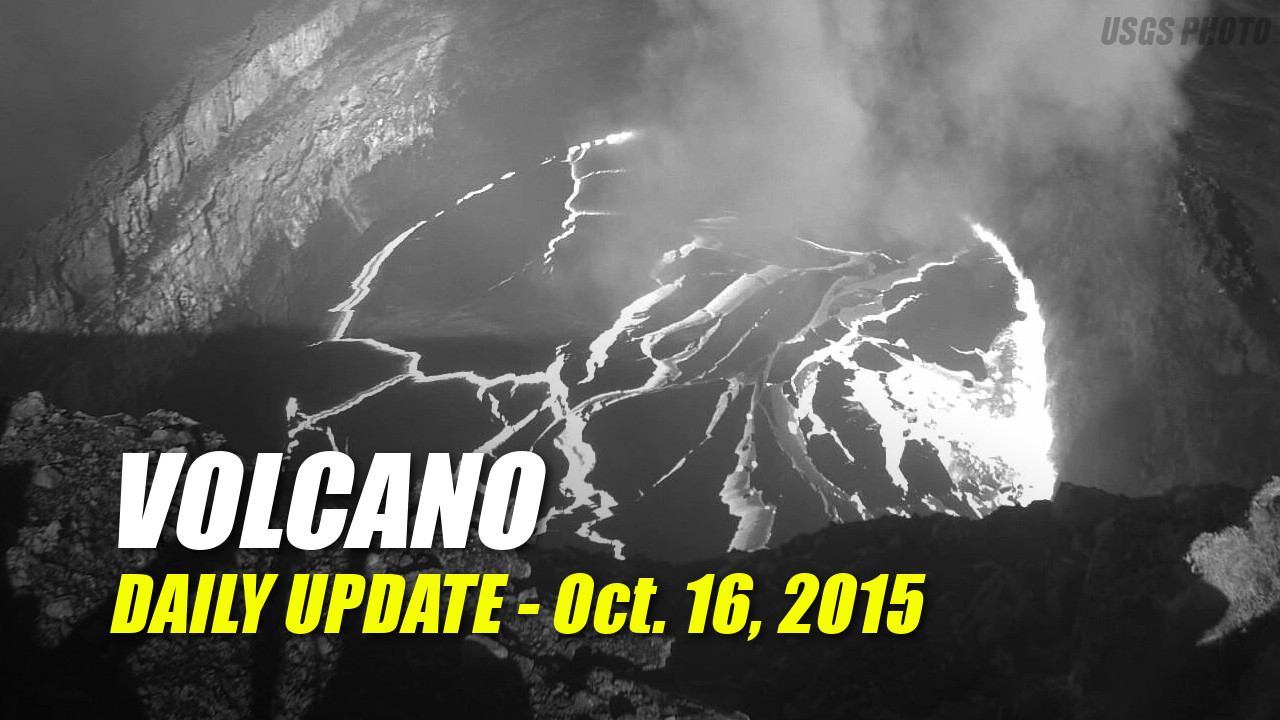
Summit Observations: Summit inflation continued over the past day, and the lava lake level has risen slightly. This morning the lake was roughly 60 m (200 ft) below the Overlook crater rim. Summit sulfur dioxide emission rates ranged from 780 to 6000 metric tons per day during the 2-week period ending October 13.
Puʻu ʻŌʻō Observations: Webcams show no significant change in eruptive activity at Puʻu ʻŌʻō. Tilt over the past day was affected by heavy rain. The sulfur dioxide emission rate from all East Rift Zone vents was about 300 metric tons per day when measurements were last possible on October 2, 2015. A swarm of small earthquakes continues on Kīlauea’s south flank, west of Kaʻena Point, near Apua Point. These south flank earthquakes are associated with a “slow slip event” – more information on slow slip events can be found in this Volcano Watch article from 2012: http://hvo.wr.usgs.gov/volcanowatch/view.php?id=119
June 27th Lava Flow Observations: Webcam images show that the ‘June 27th’ lava flow continues to be active. Satellite imagery from this week showed scattered breakouts between 2.2 and 6.3 km (1.4 and 3.9 mi) northeast of Puʻu ʻŌʻō. The lava flow is not currently threatening any communities. USGS Hawaiian Volcano Observatory on Oct. 17, 2015
SOURCE: Recent Kilauea Status Reports
10/15 | Mauna Loa Update
MAUNA LOA VOLCANO – Mauna Loa is not erupting. On September 17, the USGS Hawaiian Volcano Observatory elevated the Volcano Alert Level and Aviation Color Code for Mauna Loa to ADVISORY/YELLOW based on long-term trends in both earthquake and deformation monitoring data. A new update was posted on October 15.

“The seismicity rate is elevated above background, though at a lower weekly rate than reported in mid- to late-summer. Earthquakes occurred beneath Mauna Loa’s upper Southwest Rift Zone at depths less than 13 km (8 miles). Deformation data are still consistent with inflation of magma reservoirs beneath Mauna Loa’s summit and upper Southwest Rift Zone.”USGS Hawaiian Volcano Observatory on Oct. 15, 2015
SOURCE: Recent Mauna Loa Status Reports
10/15 | HVNP Campground Closure
HAWAII VOLCANOES NATIONAL PARK – Due to falling tree hazards, Nāmakanipaio cabins and campground at Hawaii Volcanoes National Park have been closed pending further evaluation. Recent heavy rain and strong winds contributed to the downing of the large eucalyptus trees.

“We are sorry for any inconvenience this may cause for park visitors and the community who enjoy Nāmakanipaio,” said Park Superintendent Cindy Orlando. “Safety is our number one priority in the park, and we do not want anyone to get hurt.”National Park Service
The National Park Service says Kulanaokuaiki Campground remains open on a first-come, first-served basis and is currently free of charge. Reservations are not required for Kulanaokuaiki. The backcountry campgrounds along the coast, at Nāpau Crater Overlook, Pepeiao, and on Mauna Loa remain open and backpackers can obtain a backcountry permit from the backcountry office, located in the Visitor Emergency Operations Center up to 24 hours in advance. The backcountry office is open daily from 8 a.m. to 4 p.m.
10/15 | Cooper Center Repairs
VOLCANO VILLAGE – The Cooper Center in Volcano Village will get some help from the Hawaii County Council once Resolution 308-15 is approved. The resolution will provide $15,000 in funds from District 6 councilwoman Maile David’s Contingency Relief account to go towards needed repairs. The meeting will be on October 20th at the West Hawaii Civic Center.
ABOUT
The Volcano Update on Big Island Video News covers the news and events of Volcano Village, the Hawaii Volcanoes National Park, Kilauea and Mauna Loa volcanoes, and western villages and subdivisions of Puna mauka. If you have news or event information you would like to share, please email us at news@bigislandvideonews.com.


by Big Island Video News9:42 am
on at
STORY SUMMARY
Covering Volcano Village, the Hawaii Volcanoes National Park, Kilauea and Mauna Loa volcanoes, and the Puna mauka subdivisions.